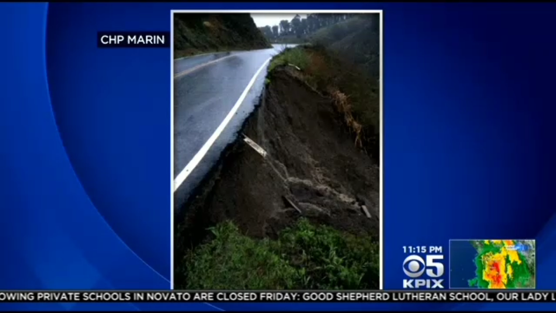
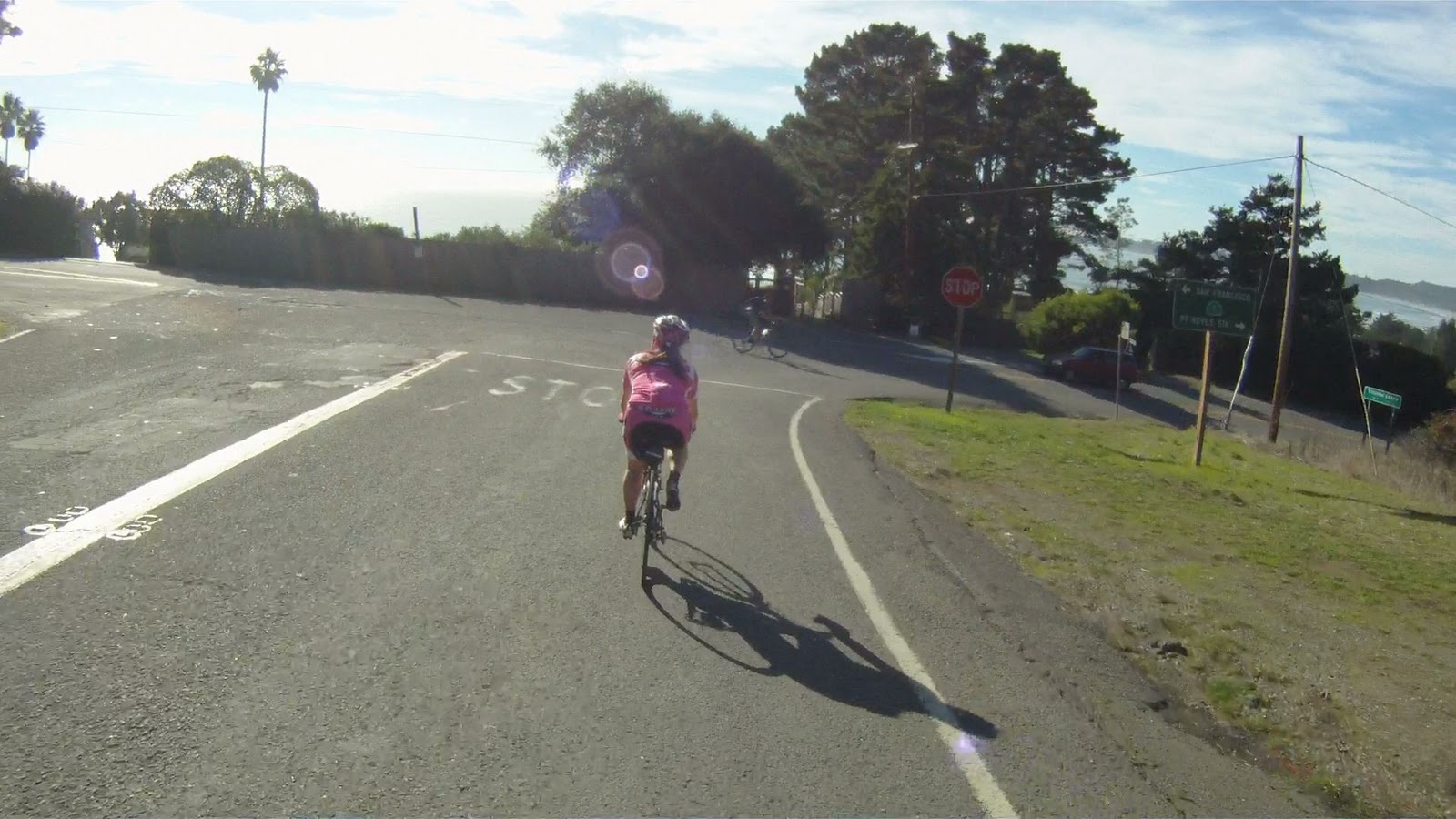
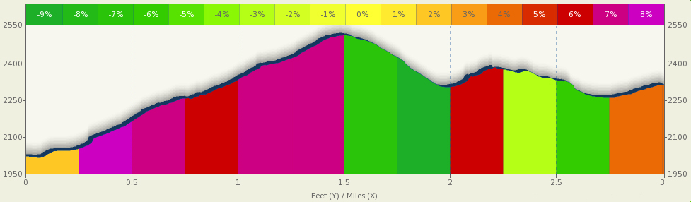
Rainstorms on December 11, 2014 caused a section of CA-1 (SR-1) to collapse between Muir Beach and Panoramic Drive.
This section of road is featured in our trail and video “The Three Amigos“.
As this route of return is no longer available, this closure affects the ride back to Sausalito from Muir Woods and Stinson Beach.
From Muir Woods, you have the option of climbing back up Muir Woods Road or heading to Stinson Beach and climbing back via Panoramic Highway, the opposite direction of our Dog Days trail.
Your other options are to continue North on CA-1 and 1) attempt the climb up Fairfax Bolinas Road to West Ridgecrest and return via the latter half of Alpine Damn Loop
Or 2) go toward Point Reyes and return via Sir Francis Drake Blvd to Fairfax.
Construction is expected to continue through March 2015. See 511.org for the most up-to-date information on the closure and construction.
At this time we do not advise going to Muir Woods or Stinson Beach unless you are a very strong climber or are prepared for a 60+ mile ride.
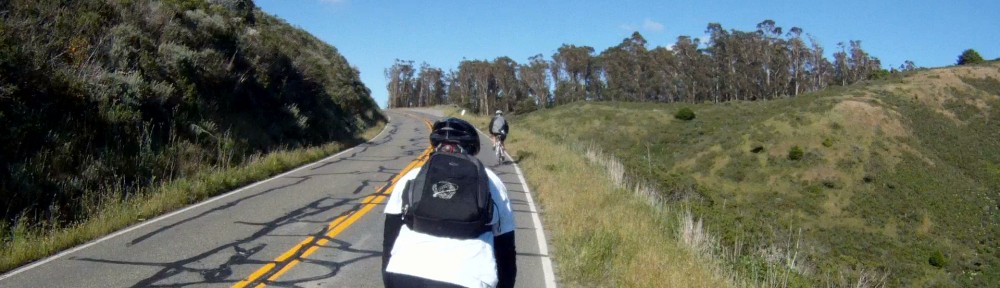
The route from Stinson Beach to Muir Beach takes place along the nicest part of the Pacific Coast Highway where the road is wide and well-paved, and the views are breathtaking. Long climbs followed by gorgeous downhills are the rule. Though the journey to Muir Beach has its share of climbing, it is also filled with picturesque views to distract. This return may not be as challenging as the ride back up Panoramic Highway, but it is definitely more rewarding. After grabbing lunch in Stinson Beach, gear up and enjoy the views of the Pacific Ocean while making your way to Muir Beach and the next stage of the return to Sausalito.
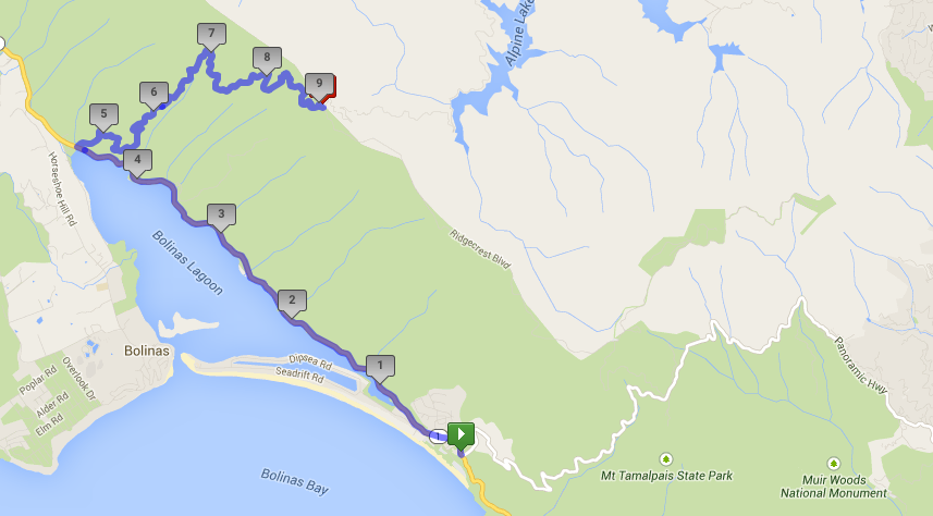
Elevation Map for the Route provided by MapMyRide.com
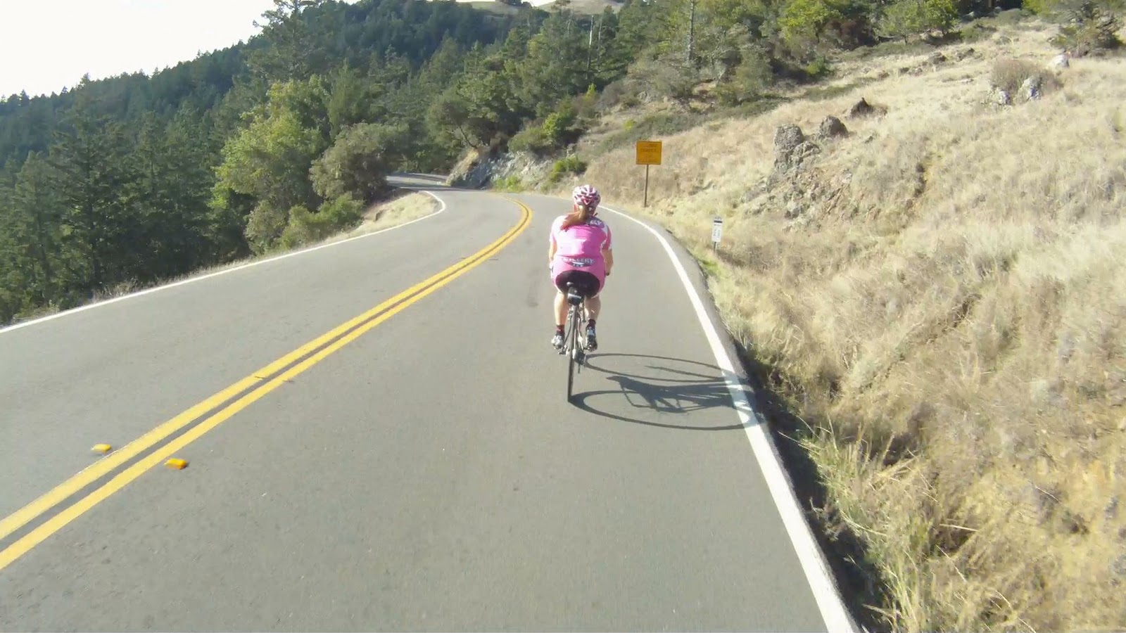
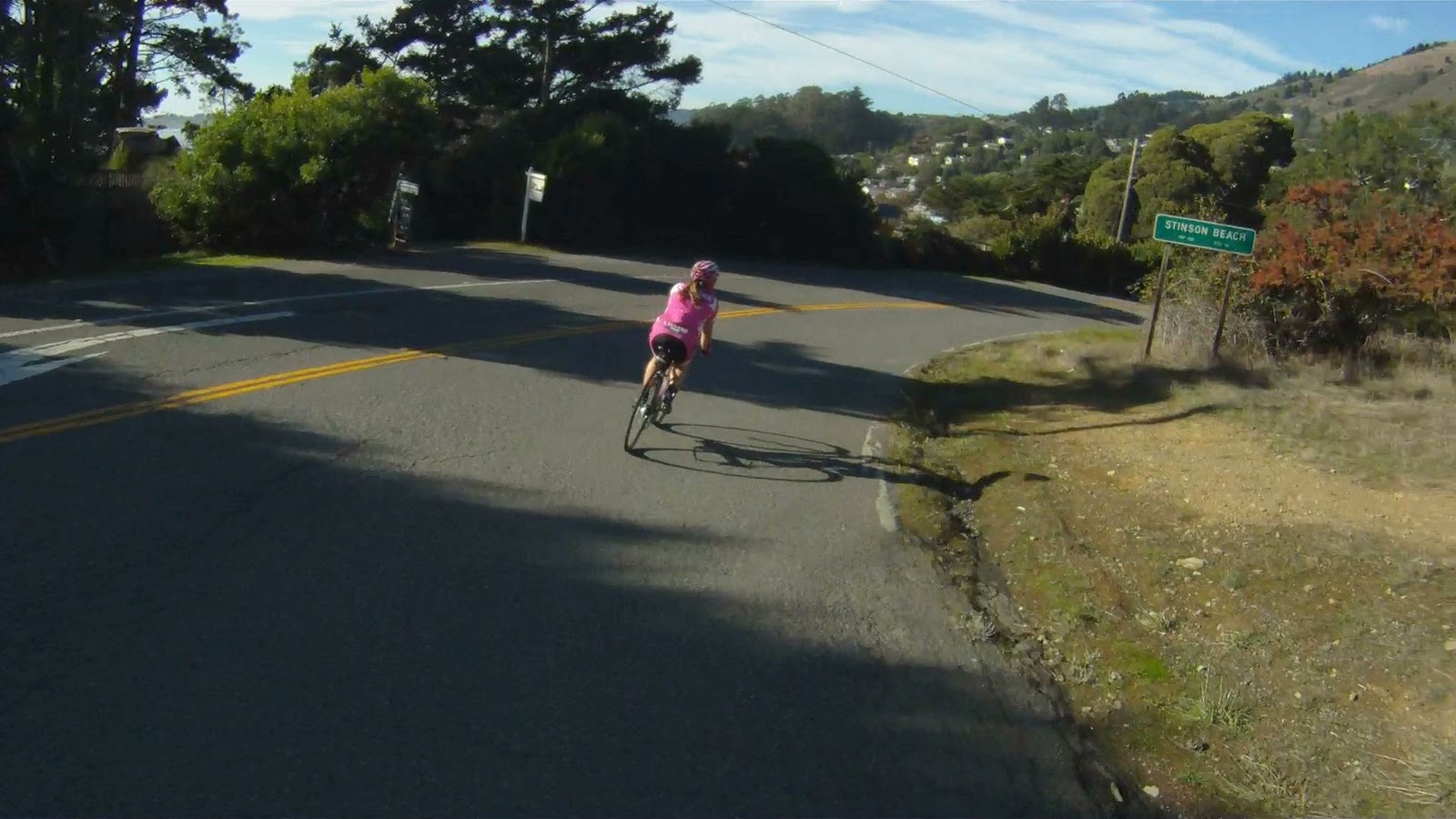
When it’s time to leave Stinson Beach, you have a few options to consider. The first is to continue on to Fairfax-Bolinas Road to the north.
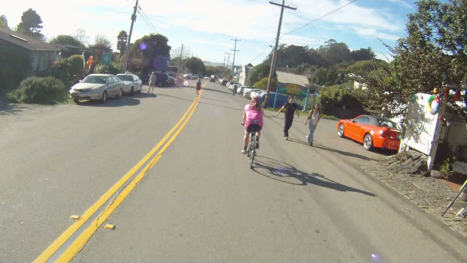
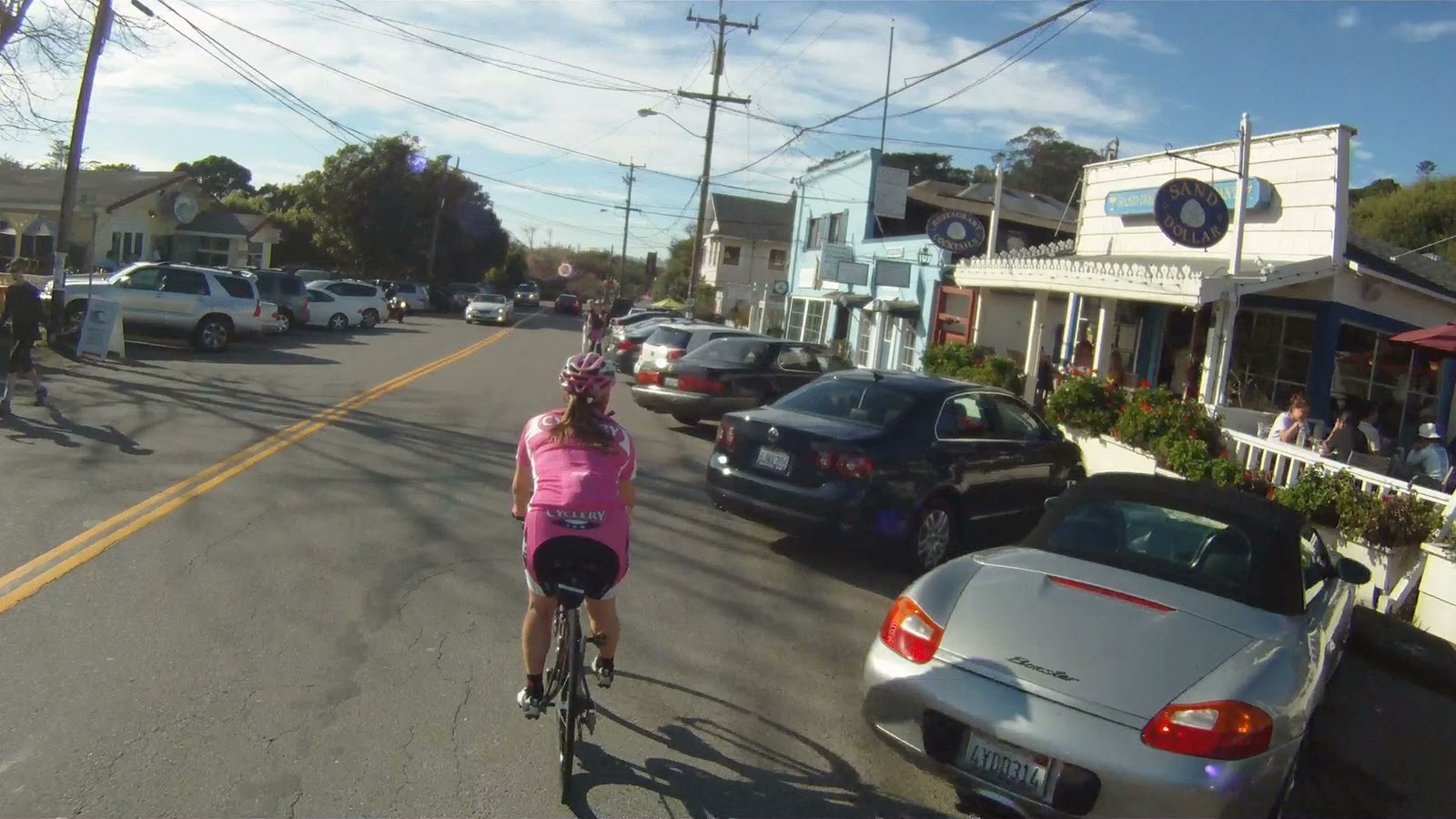
Ride along the main drag of Stinson Beach
You can also return the way you came along Panoramic Highway.
The turn from CA-1 back up Panoramic Highway
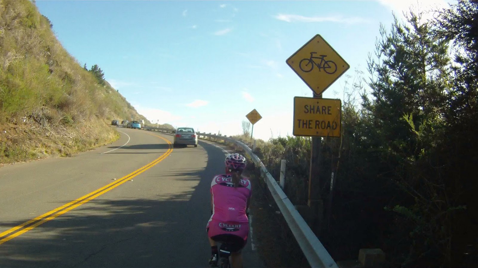
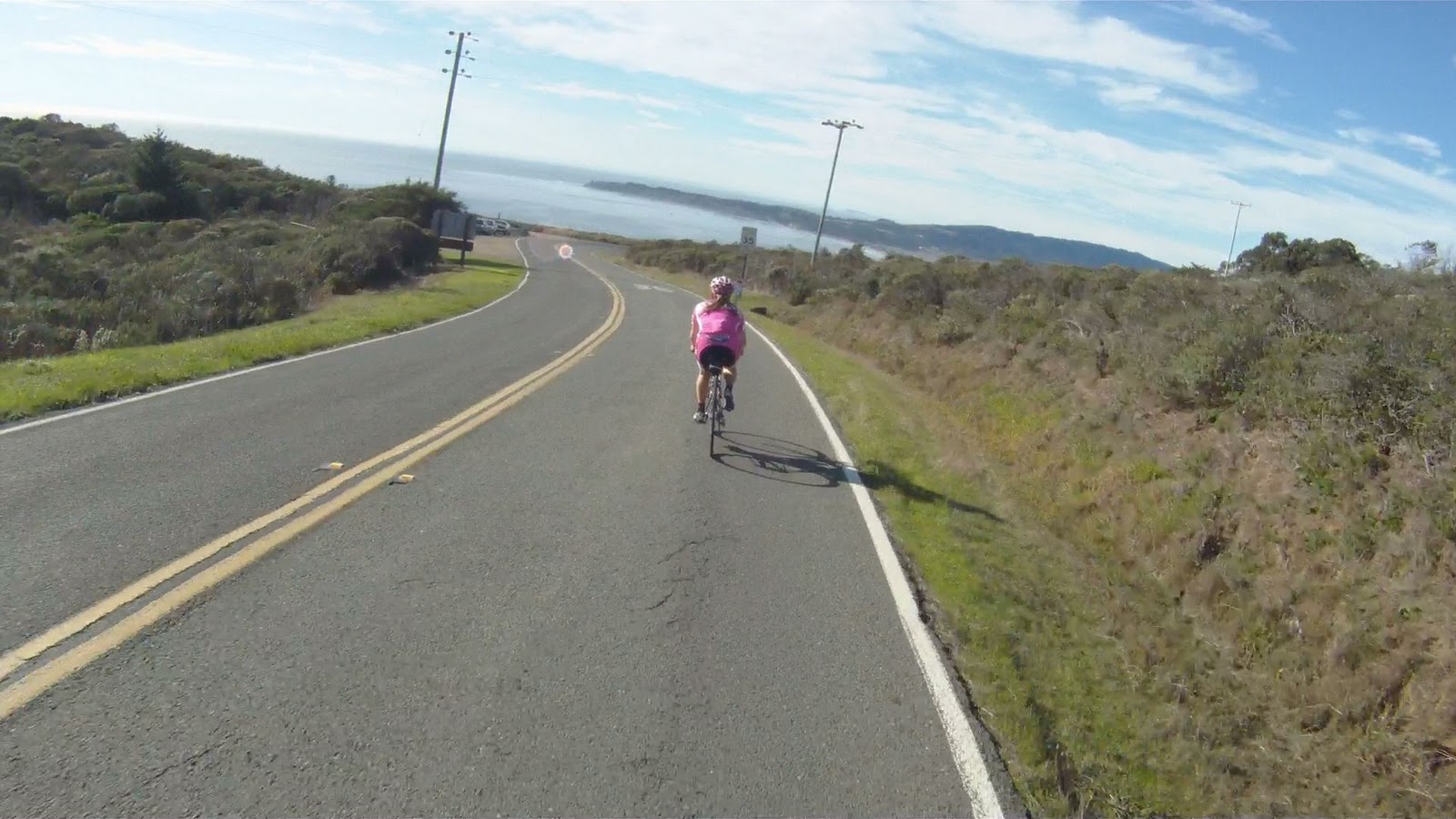
Or you can follow the Pacific Ocean along the scenic Pacific Coast Highway (CA-1) to Muir Beach. If you choose to follow the coast, you are in for a scenic ride.
The beginning of the initial climb along the Pacific Coast Highway
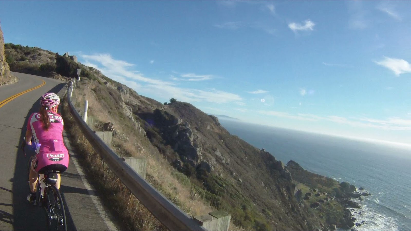
The views of the cliffs, beach and ocean below make the climb much more tolerable.
View along the Pacific Coast Highway
But the views also tempt you to stop and take pictures frequently along the journey.
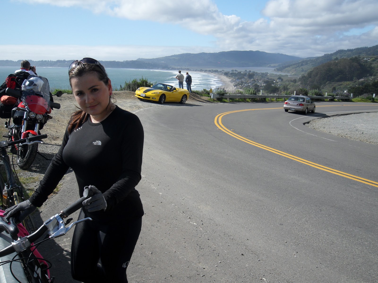
Miko with Vita (our first journey to Stinson Beach was on the hybrids!), a Hertz Corvette and Stinson Beach below
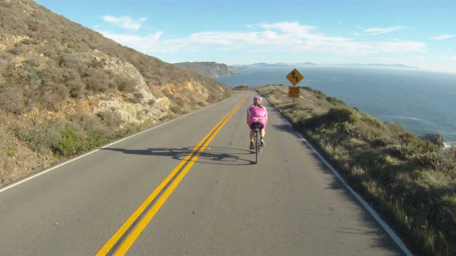
Don’t pause for too long, there’s still a lot of climbing to go.
Along the climb, there are many places to stop, take a break or take pictures. Part of biking in this area is enjoying the natural beauty of your surroundings. Make sure to not miss the incredible views along the ride.
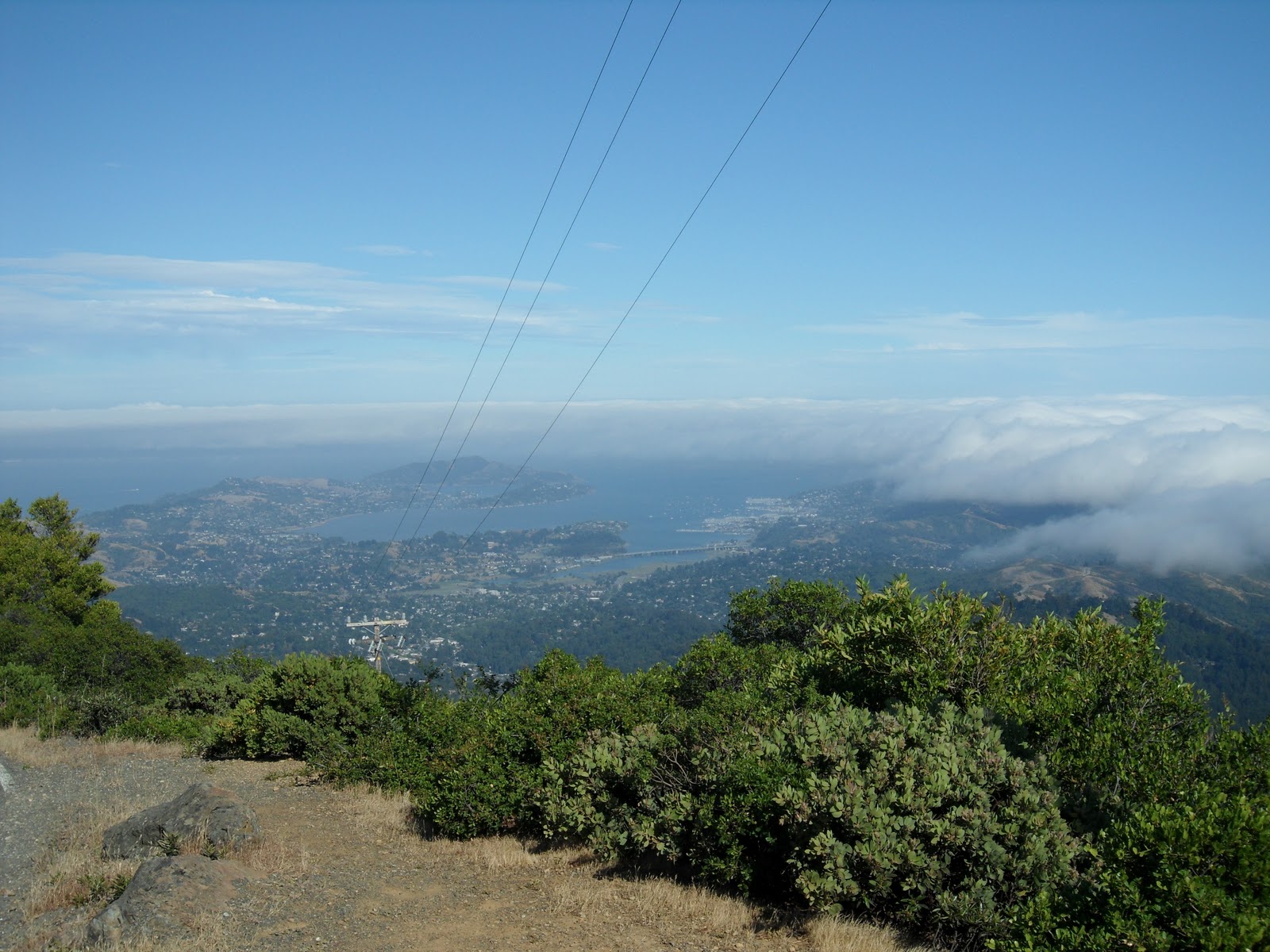
At points along the ride you can see where the coastline juts out into the ocean near Pacifica, more than 15 miles away.
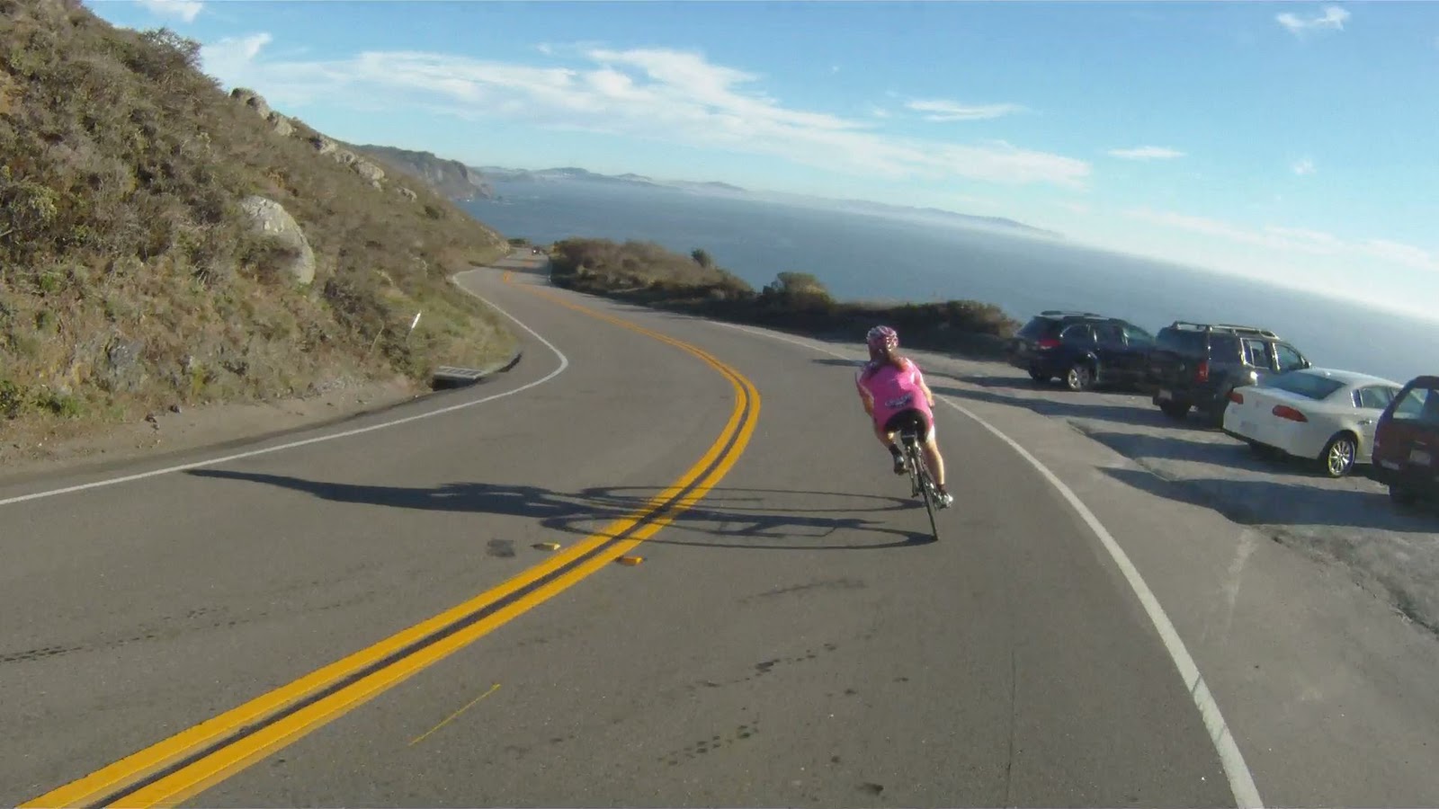
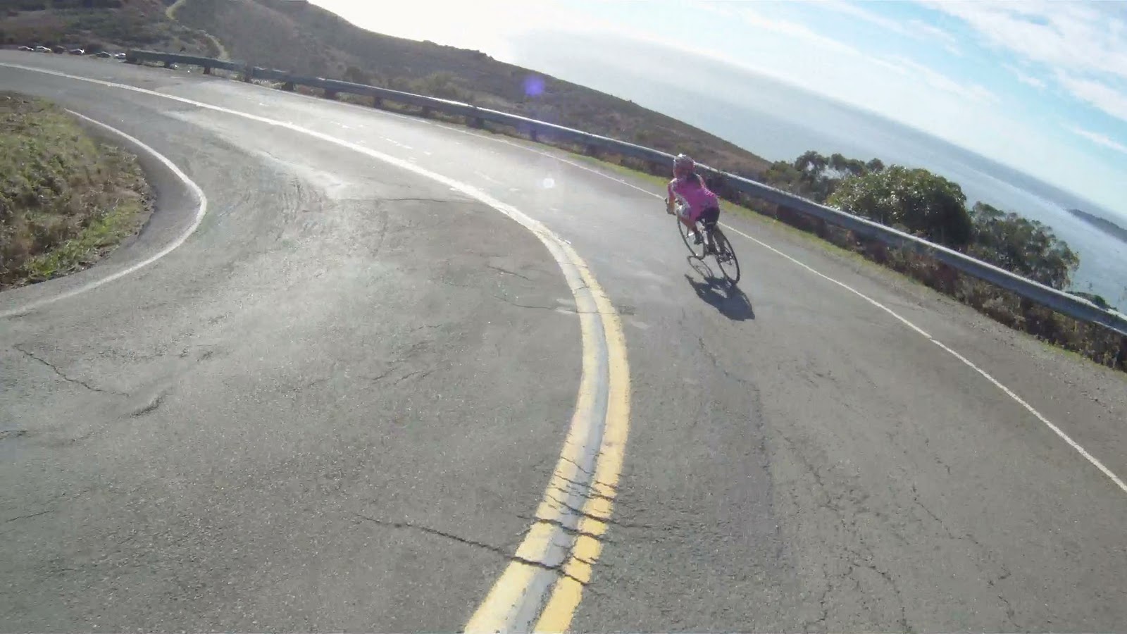
Other points along the journey have the views, but also have the fun of a spectacular downhill.
Though not as technical as the descent to Stinson Beach, these are still fast corners where you can get your tip on.
At the end of this downhill, you have one more climb and a last descent before you reach Muir Beach. The last climb has great views as well, but is a solid 6% grade the entire time with the most difficult section at the end.
On your way back down you will pass the Muir Beach Overlook.
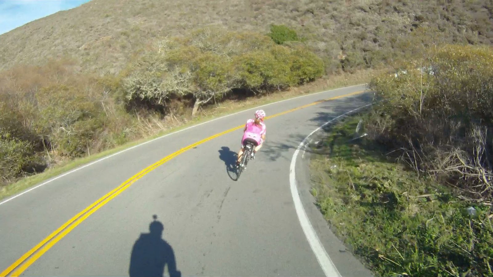
Then it’s game on for the final descent to Muir Beach and more “wee fast fun” corners.
After a curve to the right over a small bridge CA-1 intersects Muir Woods Road. Follow CA-1 to the right towards San Francisco and to Muir Beach.
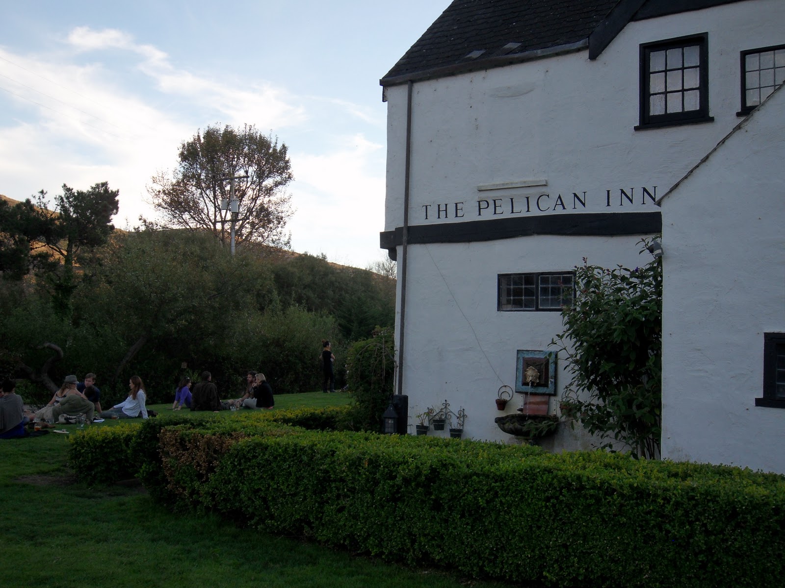
A quarter-mile or so down the road, you will arrive at the Pelican Inn. The entrance is before the sign, so look for the parking lot on your right. If you see the sign with the pelican…
You’ve just passed the entrance.
The Pelican Inn is owned by the same company as the Mountain Home Inn that was along Panoramic Highway on the climb to Mt. Tam. This is a great place to get some more food, use the facilities or just relax and take a breather before the next stage of your journey.
From the Pelican Inn you can follow CA-1 all the way back to Marin Crossroads and the Sausalito Ferry.
For now, check our video Three Amigos and enjoy the ride.
Watch the video of our descent to Stinson Beach, California.
Making the journey to Stinson Beach is one of the most satisfying trails in Marin County. There are no tourists out this way because of the difficulty involved in both the climb and descent. The climb to reach the crest of Panoramic Highway is a long, arduous path, not for the faint of heart or legs. The descent to Stinson Beach is mentally challenging, very fast and highly technical. The switchbacks toward the end are a series of 180 degree turns over rough road which are entered at high speed and long, steep straightaways leading to the next switchback. The work is worth the reward as this descent is one of the most thrilling in the Bay Area!
FOR A MORE DETAILED LOOK click here for the full Geoped Map provided by g-map-pedometer.com.
Elevation Map for the Route provided by MapMyRide.com
At the end of A Panoramic View you have the choice of continuing your assent up Mt. Tam along Paying the Toll, descending back to Sausalito, or taking the plunge and descending to Stinson Beach. If you choose Stinson Beach, you are in for a thrilling, high-speed descent to the Pacific Ocean.
At the crest of Panoramic Highway, you have 4 miles to either the top of Mt. Tam or to Stinson Beach
The descent takes about 10 to 20 minutes, be ready to be in the drops almost that entire time. Cars are a constant factor in slowing you down, but being passed on your way down is pretty unlikely.
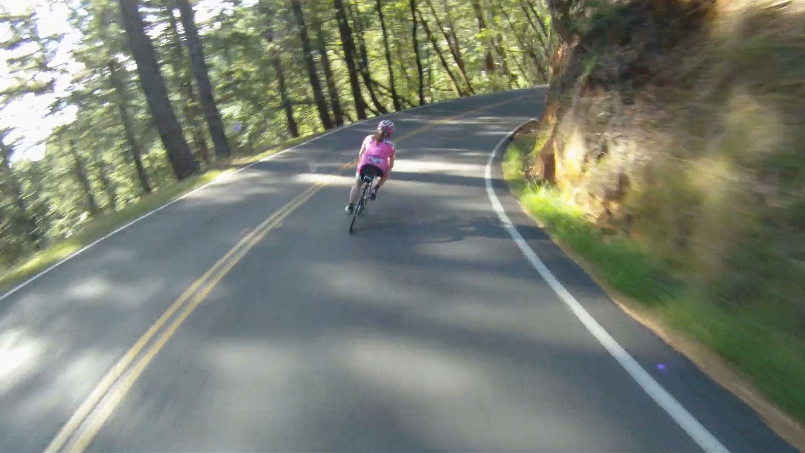
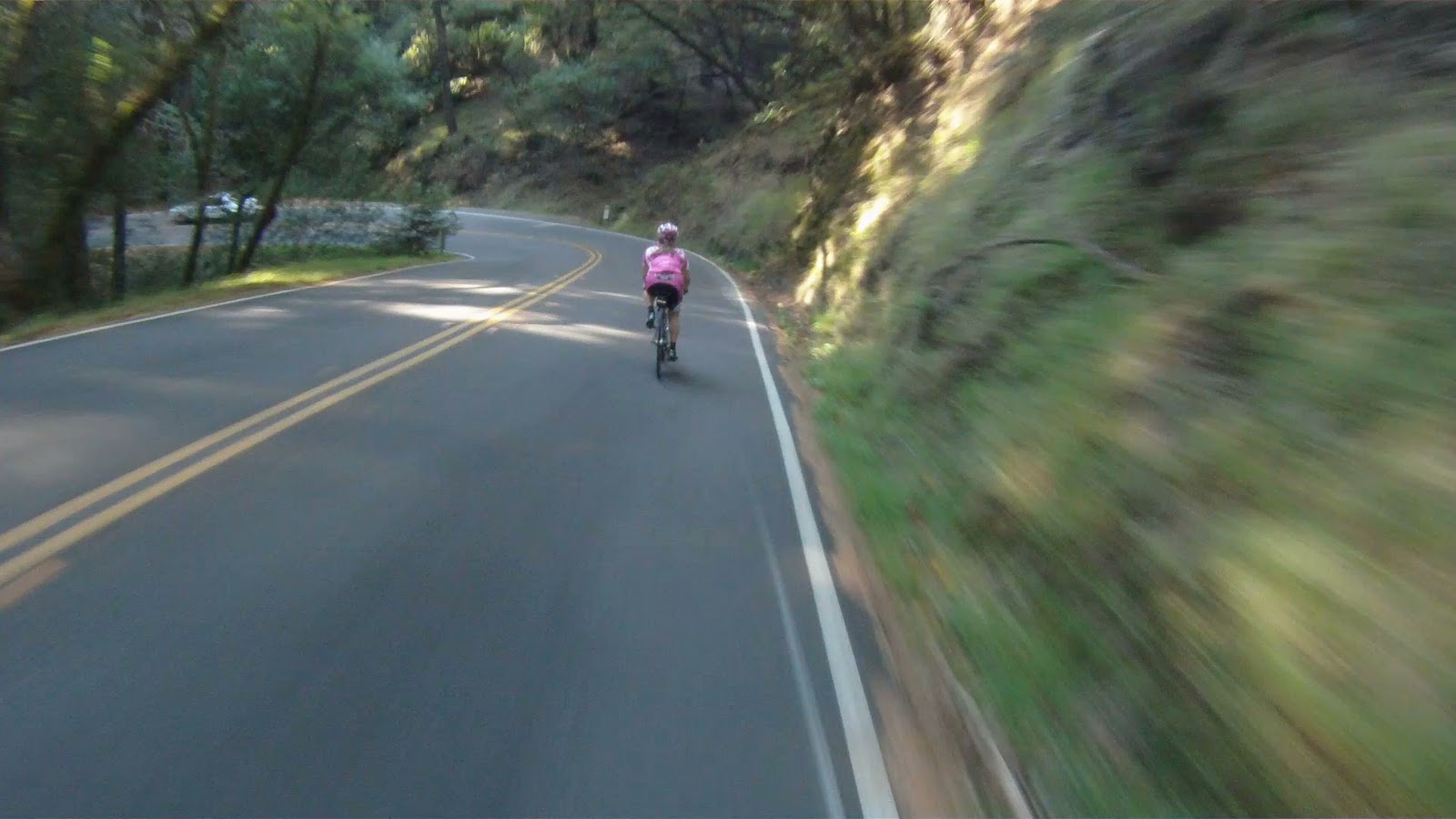
The descent starts in the woods and has some high speed straights that lead to sweeping corners.
The corners along this part of the ride are where you will start to catch up with cars.
Though if necessary, you can take a break at the next corner to allow the car more time to get ahead of you, so as to not ruin your ride or overheat your breaks.
The air is always cool on this part of the descent with the canopy of trees.
After spending the first two mile in the woods, you’ll come to an opening and the beginning of the Alpinesque switchbacks.
The panoramic views from the bike here are just picturesque.
It’s worth taking a break to admire the views and take some pictures at this point.
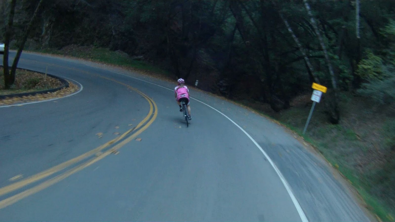
But get ready, the rest of the descent is very tricky. The straights are steep, very fast with smooth roads, but…
The corners at the switchbacks in this area are the roughest part of the road, so pay attention to your entry speed, or you might end up sliding or crashing.
The nature of these turns allow you to tip the bike to extreme angle on this part of the descent, keeping up your speed through the corners.
The last few switchbacks have long straight aways in between where you have to start peddling for the first time since reaching the crest of Panoramic Highway.
A few of the corners toward the end of the descent are a little less technical than those at the top.
Don’t fall asleep though, there are still technical corners lingering at the end of the run. Watch your entry speeds going into these last few corners, the rough roads through the corners make these turns very difficult.
After the last series of swithbacks, the road will level out and end at the Pacific Coast Highway, CA-1.
Make a right to head into Stinson Beach.
When you arrive in Stinson Beach, make sure to stop at the Sand Dollar Restaurant and grab a bite to eat.
Making the journey to Stinson Bach is one of the major achievements for bikers in the Bay Area. It is a ride that can challenge you both mentally and physically. Once you’ve made it, you realize the climb and mentally challenging descent were all worth it. So enjoy a bite to eat before you head back.
Once you are ready to head back to Sausalito, you have two options. The first is to return on Panoramic Highway the way you came. The second option is to return along the Pacific Coast Highway, CA-1 through Muir Beach and make the climb back to Sausalito. Look forward to this article coming soon!
Until then, you can watch video the of return along Highway One in “The Dog Day Are Over” below. Enjoy!
After Paying the Toll, the summit of Mount Tamalpais is almost within reach. The last stage of the Mt. Tam assent is grueling and sometimes just plain cruel! The steepness of the first mile will push you to your limits before you reach the first of three peaks. At the summit, take a breath, enjoy the view and brace yourself for a tough climb back to the first peak before you make the descent back to the Bay.
FOR A MORE DETAILED LOOK click here for the full Geoped Map provided by g-map-pedometer.com.
Elevation Map for the Route provided by MapMyRide.com
From the top of Paying the Toll, make a right onto East Ridgecrest Boulevard and follow it all the way to the third peak which is the summit of Mount Tamalpais.
Make a right onto East Ridgecrest Boulevard to Summit Mt. Tam
The first peak is the hardest to reach. This peak is next to the Doppler Radar station at the top of a 1.25 mile climb. Though less steep than the climbs on Pan Toll Road, this first climb is lengthy and difficult. By the time you finish the first climb, your legs will be Jello!
View from the top of the first peak
Make sure to pause at this first peak and take in the views of Mill Valley below. Get some energy back as you take the first descent and start making the climb toward the next peak.
Stand and push up the second climb and take another break at the top of the second peak.
The view from the second peak gives you better views of Tiburon and Sausalito
From the top of the second peak, the views of Tiburon and Sausalito get closer. One last peak to climb before heading back.
Another short descent and the last peak is all that stands between you and the summit. The last climb is steep. Once you make it to the summit, take in the views and know you’ve climbed over 2,500 feet on your way to this point!
View of Tiburon, Belvedere, Strawberry, Mill Valley and Sausaltio from the summit of Mount Tamalpais
On a clear day, you can see San Francisco, East Bay and all over Marin County from the summit of Mount Tamalpais. At over 2,500 feet in altitude, you can see above the fog as it rolls over San Francisco Bay.
The historic Mt. Tam Fire Lookout and Ranger Station
At the summit, you can lock up your bikes and take a stroll up the stairs to the Fire Lookout and Ranger Station. On a clear day, you can see not only San Francisco and East Bay, but also out to the Farallon Islands (to the west and 25 miles off-shore in the Pacific Ocean) and it’s even been reported that you can see the snow-capped peaks of the Sierra Nevada range 150 miles to the east. At the parking lot, there are bathrooms and a water fountain at the top so you can relieve and refill. Enjoy your time at the summit, because once you are ready to go, you have more hill climbing awaiting.
Elevation Map for the Route provided by MapMyRide.com
Another 300 feet of climbing over two more hills looms once you leave the summit of the third peak. The return to the second peak is a breeze compared to the climb back to the first peak. The climb to the west peak is almost a half-mile long and is very steep. Push through this tough climb and then it’s all down hill from there.
Once you’ve gone there and back again, the summit of Mt. Tam allows you have options of where to go next. You can continue on Ridgecrest Boulevard and head towards Fairfax-Bolinas Road, or you can turn back down Pan Toll Road and go to Mill Valley or Sausalito. If you’re feeling particularly adventerous that day, you can even head to Stinson Beach from where A Panoramic View and Paying the Toll meet. No matter which way you decide to go, after reaching the summit of Mount Tamalpais, you have entered a club with others who have pushed themselves to conquer this beast! Enjoy the journey, but make sure to stop and enjoy the view as well.