After Paying the Toll, the summit of Mount Tamalpais is almost within reach. The last stage of the Mt. Tam assent is grueling and sometimes just plain cruel! The steepness of the first mile will push you to your limits before you reach the first of three peaks. At the summit, take a breath, enjoy the view and brace yourself for a tough climb back to the first peak before you make the descent back to the Bay.
Distance from San Francisco Ferry Building (see Golden Gateway Trail) 27.42 miles; from the Marin Crossroads 12.99 miles; from Somewhere Over the Rainbow 8.91 miles; from A Panoramic View 4.42 miles; from Paying the Toll 2.99 miles
Difficulty: If you’re not prepared for a tough slog back from the summit as well, you might be spending the night on the mountain!
Climbing on Route: 630 feet (192 meters)
Total Elevation Gain from Marin Crossroads: 2641 feet (805 meters)
Download your route sheet here: Directions – Welcome to the Top of the World
Download your route sheet for the entire Mount Tamalpais Route here: Directions – There and Back Again

FOR A MORE DETAILED LOOK click here for the full Geoped Map provided by g-map-pedometer.com.
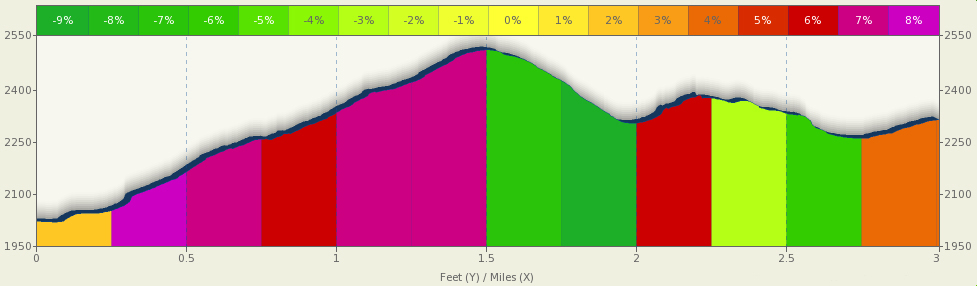
Elevation Map for the Route provided by MapMyRide.com
From the top of Paying the Toll, make a right onto East Ridgecrest Boulevard and follow it all the way to the third peak which is the summit of Mount Tamalpais.

Make a right onto East Ridgecrest Boulevard to Summit Mt. Tam

The first peak is the hardest to reach. This peak is next to the Doppler Radar station at the top of a 1.25 mile climb. Though less steep than the climbs on Pan Toll Road, this first climb is lengthy and difficult. By the time you finish the first climb, your legs will be Jello!

View from the top of the first peak
Make sure to pause at this first peak and take in the views of Mill Valley below. Get some energy back as you take the first descent and start making the climb toward the next peak.
Stand and push up the second climb and take another break at the top of the second peak.

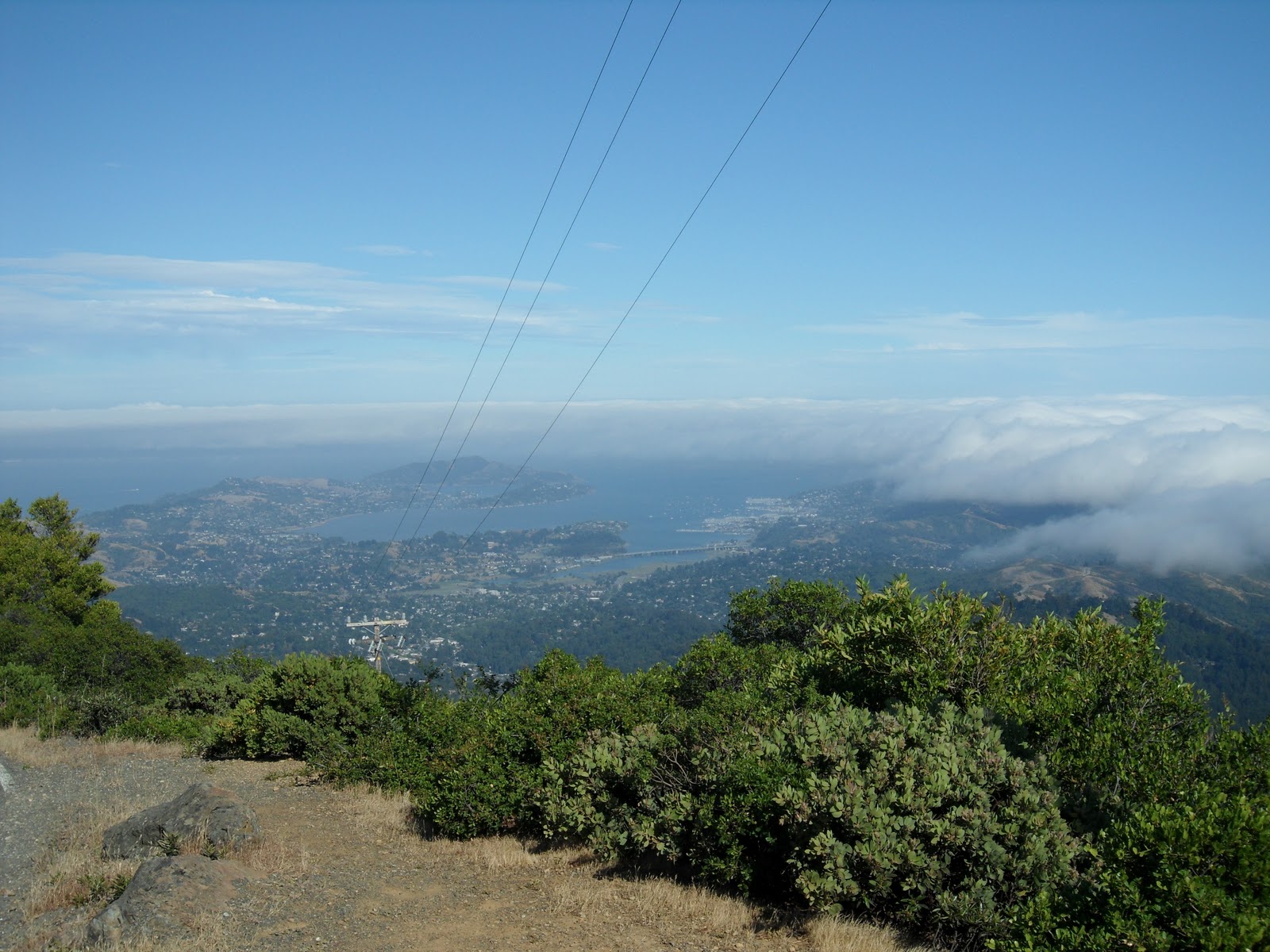
The view from the second peak gives you better views of Tiburon and Sausalito
From the top of the second peak, the views of Tiburon and Sausalito get closer. One last peak to climb before heading back.
Another short descent and the last peak is all that stands between you and the summit. The last climb is steep. Once you make it to the summit, take in the views and know you’ve climbed over 2,500 feet on your way to this point!
View of Tiburon, Belvedere, Strawberry, Mill Valley and Sausaltio from the summit of Mount Tamalpais
On a clear day, you can see San Francisco, East Bay and all over Marin County from the summit of Mount Tamalpais. At over 2,500 feet in altitude, you can see above the fog as it rolls over San Francisco Bay.

The historic Mt. Tam Fire Lookout and Ranger Station
At the summit, you can lock up your bikes and take a stroll up the stairs to the Fire Lookout and Ranger Station. On a clear day, you can see not only San Francisco and East Bay, but also out to the Farallon Islands (to the west and 25 miles off-shore in the Pacific Ocean) and it’s even been reported that you can see the snow-capped peaks of the Sierra Nevada range 150 miles to the east. At the parking lot, there are bathrooms and a water fountain at the top so you can relieve and refill. Enjoy your time at the summit, because once you are ready to go, you have more hill climbing awaiting.

Elevation Map for the Route provided by MapMyRide.com
Another 300 feet of climbing over two more hills looms once you leave the summit of the third peak. The return to the second peak is a breeze compared to the climb back to the first peak. The climb to the west peak is almost a half-mile long and is very steep. Push through this tough climb and then it’s all down hill from there.

Once you’ve gone there and back again, the summit of Mt. Tam allows you have options of where to go next. You can continue on Ridgecrest Boulevard and head towards Fairfax-Bolinas Road, or you can turn back down Pan Toll Road and go to Mill Valley or Sausalito. If you’re feeling particularly adventerous that day, you can even head to Stinson Beach from where A Panoramic View and Paying the Toll meet. No matter which way you decide to go, after reaching the summit of Mount Tamalpais, you have entered a club with others who have pushed themselves to conquer this beast! Enjoy the journey, but make sure to stop and enjoy the view as well.