Are you are looking to go further than just around San Francisco and just don’t know how to get there? From the simple, relatively flat ride to Sausalito, to the climb to Stinson Beach and beyond! These skinny-tire road routes will keep any roadie happy.
THE GOLDEN GATEWAY: San Francisco to Sausalito

The GOLDEN GATEWAY run is just golden and the gateway to all the serene and spectacular runs in Marin. While a spectacular day may merit a brief pause or perhaps a picture or two, it’s not recommended except in areas where there’s wide clearance where you will cause minimal obstruction to the through traffic. Read On…

One of the most recognizable landmarks of San Francisco is the Golden Gate Bridge, especially the perspective from the Marin Headlands. The Marin Headlands themselves are beautiful sea cliffs with sweeping views of San Francisco, the Golden Gate Bridge and the Pacific Ocean. The initial climb is a challenge and great training while the descent is extremely steep with sharp turns. It has the perfect mix of beauty and challenge. All of this excitement is accessible with a short ride just across the Golden Gate Bridge. Try this ride out as a trainer for climbing or just as an introduction to cycling in the Bay Area like Alberto Contador did on October 4, 2011 with some friends from Mike’s Bikes. Read on…
MARIN CROSSROADS – The Source of Great Beginnings

The Marin Crossroads are where you make your decision on which northern Marin destination you will bike to today (or to an extra eight miles for a more hearty ride to Sausalito). Going north out of Sausalito takes you onto both the road and a wonderful bike path with a whirlwind of other cyclists that will hopefully make you feel like one and also keep you on the right track. From the Marin Crossroads you can go to Mill Valley, Mt. Tamalpais, Stinson Beach, Panoramic Highway, Shoreline Highway or Muir Woods. Read on…

There are two routes to Tiburon: Strawberry & The Quick Fix. This is decision-time, do you have time to go the scenic route? Or are you cutting it close to the last ferry? If you have the time, take the Strawberry route! It is worth the time! Read On…

Do you wonder what it’s like to bike across the Golden Gate Bridge? Ride down Alexander Avenue into Sausalito? Or experience the sweeping curves and final descent in the back of Tiburon? Or are you looking to rent a bike on your San Francisco vacation, but don’t know what to expect? Well look no further! Read On…

When biking in the Bay Area hill climbing is inevitable, but there’s hill climbing and then there’s mountain climbing. The mountain looming the background most everywhere in Marin County is Mount Tamalpais: the pinnacle of mountain climbing not only in Marin County, but the Bay Area. There are multiple routes to reach the top of Mt. Tam, as it’s affectionately known to locals, but a favorite is to approach it from Mill Valley. Whether you set your sights on conquering Mt. Tam or developing some serious hill climbing skills towards this goal, the vistas along this route will distract from the pain. Read On…
A PANORAMIC VIEW – Mount Tamalpais, Part 2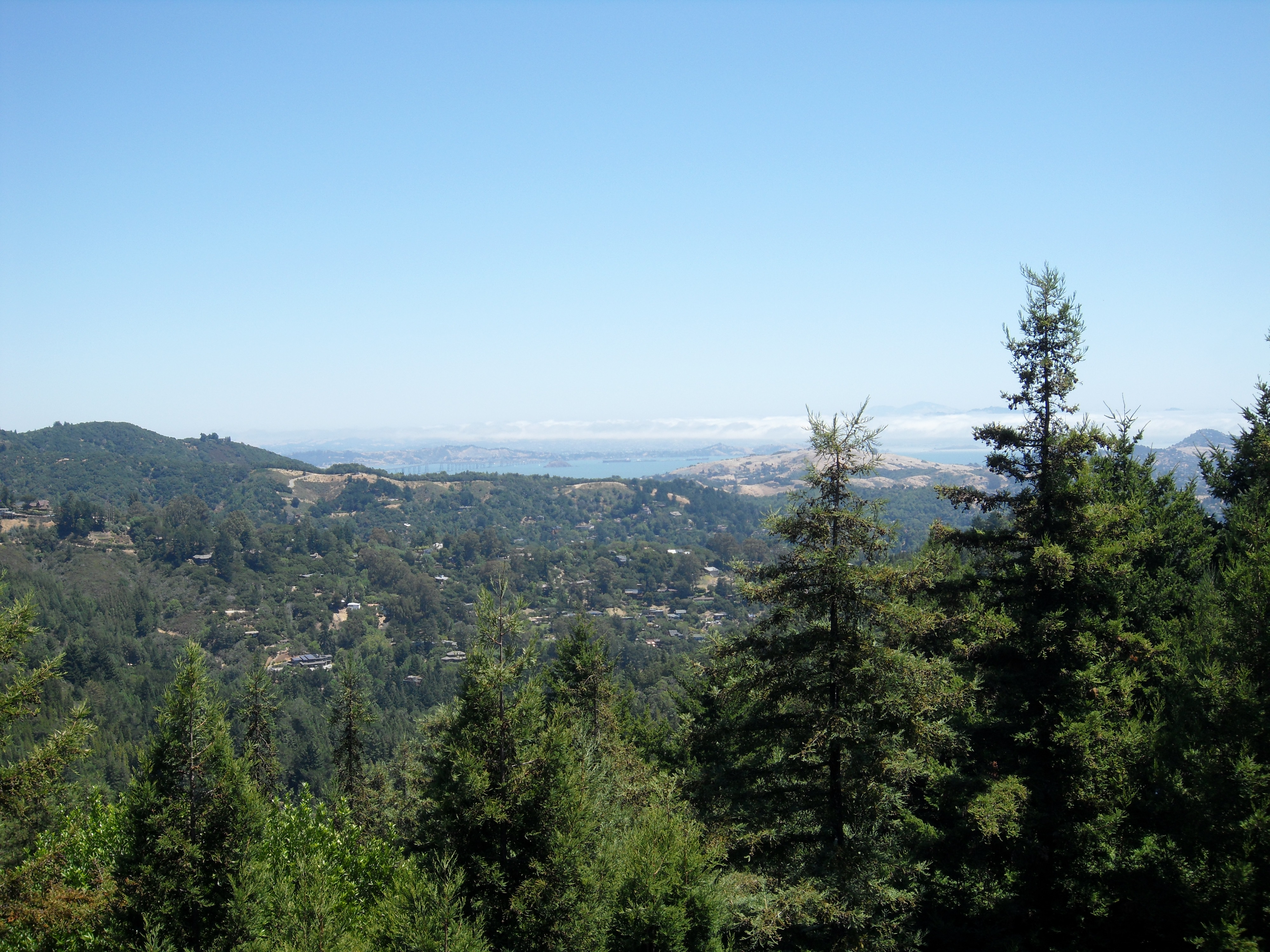
The second stage of the Mount Tamalpais climb contains some of the most breathtaking views in Western Marin County. Follow Panoramic Highway as it winds and climbs from Sequoia Valley Road to Pan Toll Road. Topping out at just over 1500 feet, climbing the 6.5 miles to the crest of Panoramic Highway is an achievement alone. No matter what direction you choose to go next, you’ll feel like a rockstar when you arrive! Read on…
PAYING THE TOLL — Mount Tamalpais Stage 3
Pan Toll Road the shortest stage of the climb to the summit of Mount Tamalpais, but it’s also the toughest. The route is full of relentless double-digit grade assents. If you are looking to test your grit and stamina, this is the place to do it. Once you pass the first mile, you can stop and break for some pictures of the sweeping views around you and then press on through the last half-mile of the stage. At the end of the trail you feel as major sense of accomplishment because you know you’ve made it through one bad ass climb! Read on…
WELCOME TO THE TOP OF THE WORLD – Mount Tamalpais Summit

The last stage of the Mt. Tam assent is grueling and sometimes just plain cruel! The steepness of the first mile will push you to your limits before you reach the first of three peaks. At the summit, take a breath, enjoy the view and brace yourself for a tough climb back to the first peak before you make the descent back to the Bay. Read on…
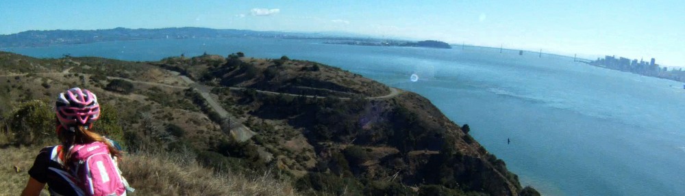
THE SHARK’S FIN — Paradise Loop — Tiburon to Larkspur
At the end of The Jaws of Life you have a few choices, follow Paradise Drive to Corte Madera and the Larkspur Ferry Terminal, wait for the ferry in Tiburon or return to Sausalito. “Get A Move On” is a glimpse of what you can expect to see on your ride along The Shark’s Fin – popularly known as ‘Paradise Loop’. Read on...
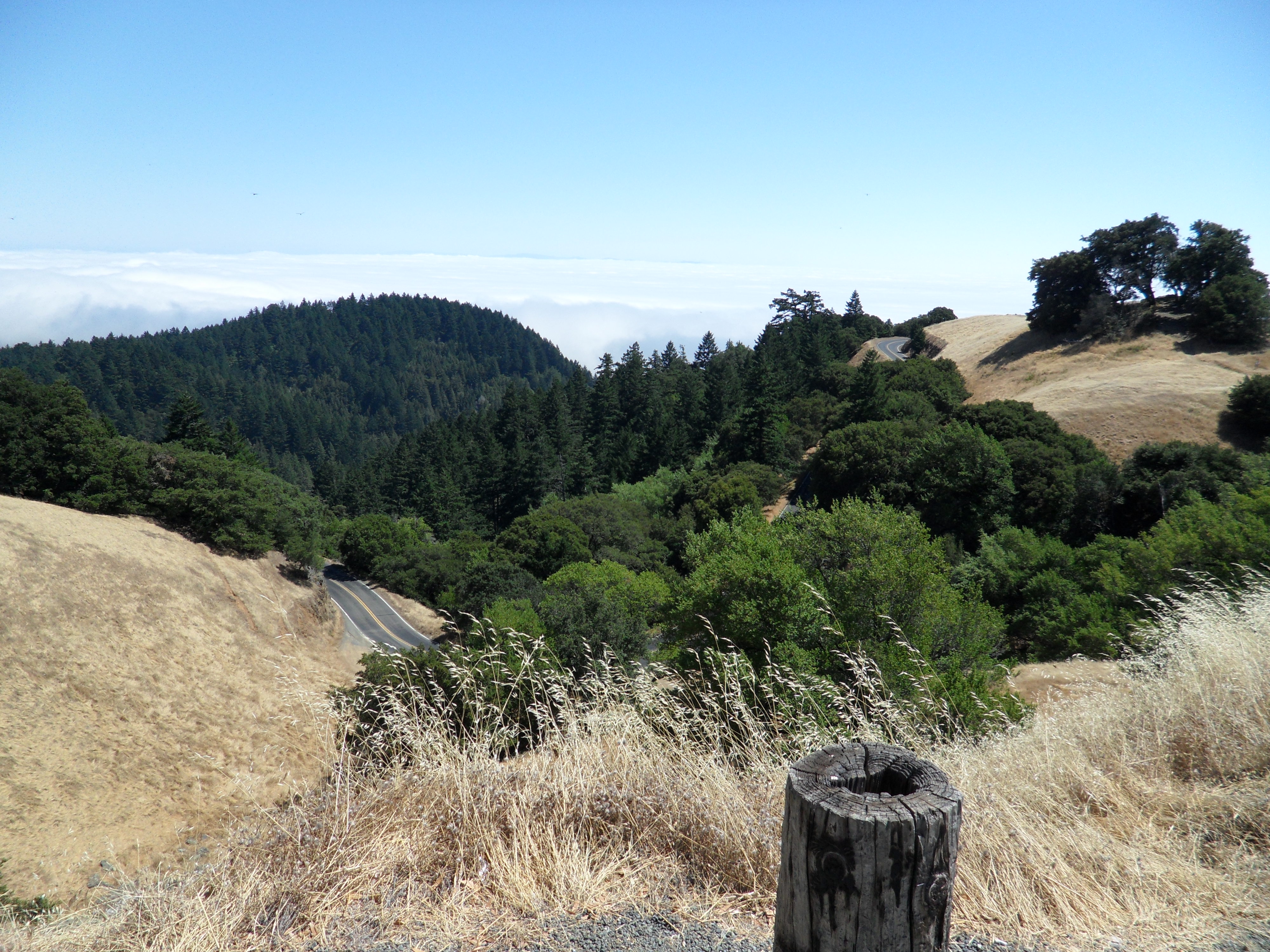
ROLLER COASTER RIDE — Descent to Stinson Beach
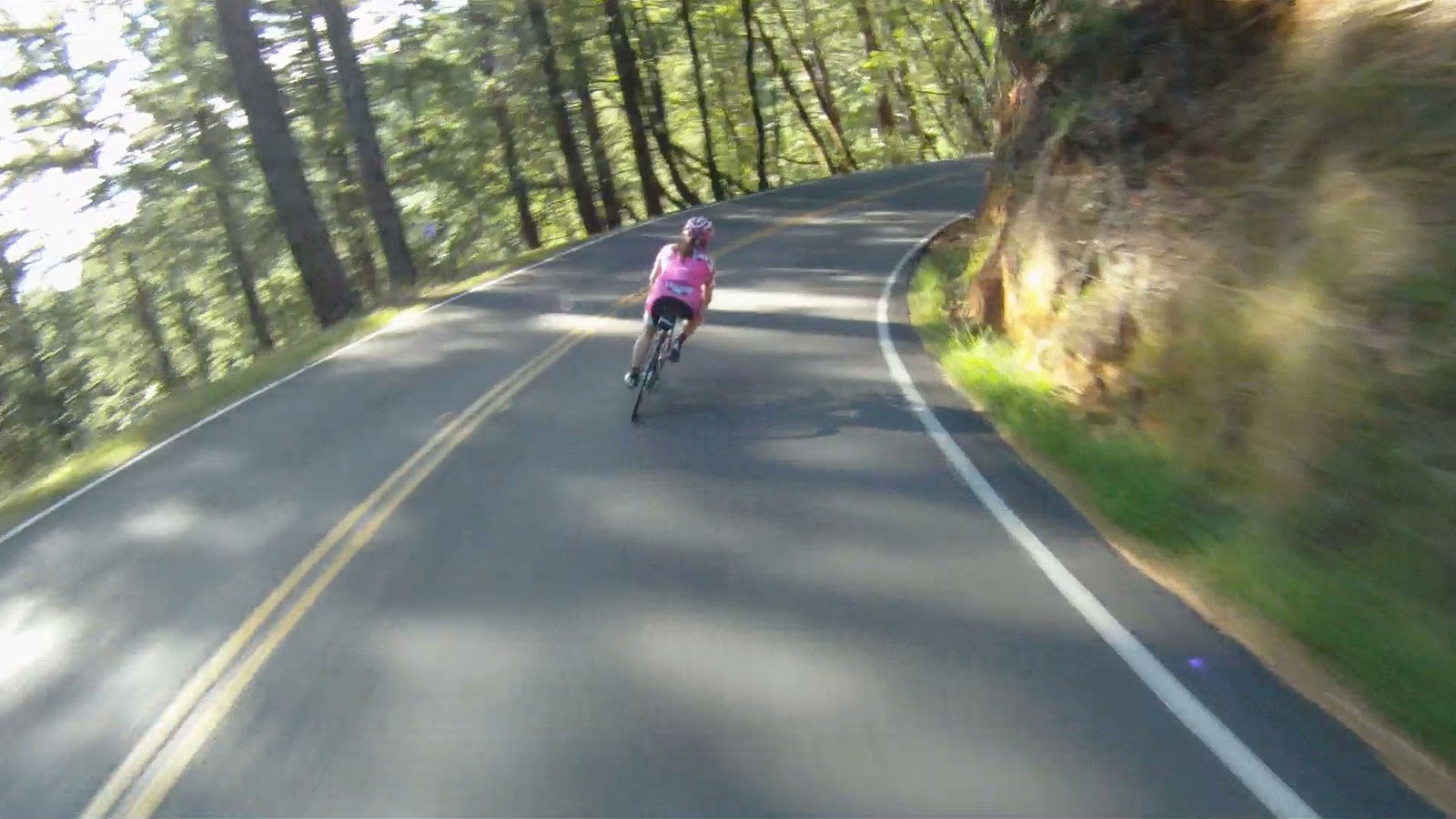
Making the journey to Stinson Beach is one of the most satisfying trails in Marin County. There are no tourists out this way because of the difficulty involved in both the climb and descent. The climb to reach the crest of Panoramic Highway is a long, arduous path, not for the faint of heart or legs. The descent to Stinson Beach is mentally challenging, very fast and highly technical. The switchbacks toward the end are a series of 180 degree turns over rough road which are entered at high speed and long, steep straightaways leading to the next switchback. The work is worth the reward as this descent is one of the most thrilling in the Bay Area! Read on…
THE DOG DAYS ARE OVER — Cruise Along the Pacific Coast Highway

The route from Stinson Beach to Muir Beach takes place along the nicest part of the Pacific Coast Highway where the road is wide and well-paved, and the views are breathtaking. Long climbs followed by gorgeous downhills are the rule. Though the journey to Muir Beach has its share of climbing, it is also filled with picturesque views to distract. This return may not be as challenging as the ride back up Panoramic Highway, but it is definitely more rewarding. After grabbing lunch in Stinson Beach, gear up and enjoy the views of the Pacific Ocean while making your way to Muir Beach and the next stage of the return to Sausalito. Read on…
BOOM BOOM POW! — Descent into Muir Woods
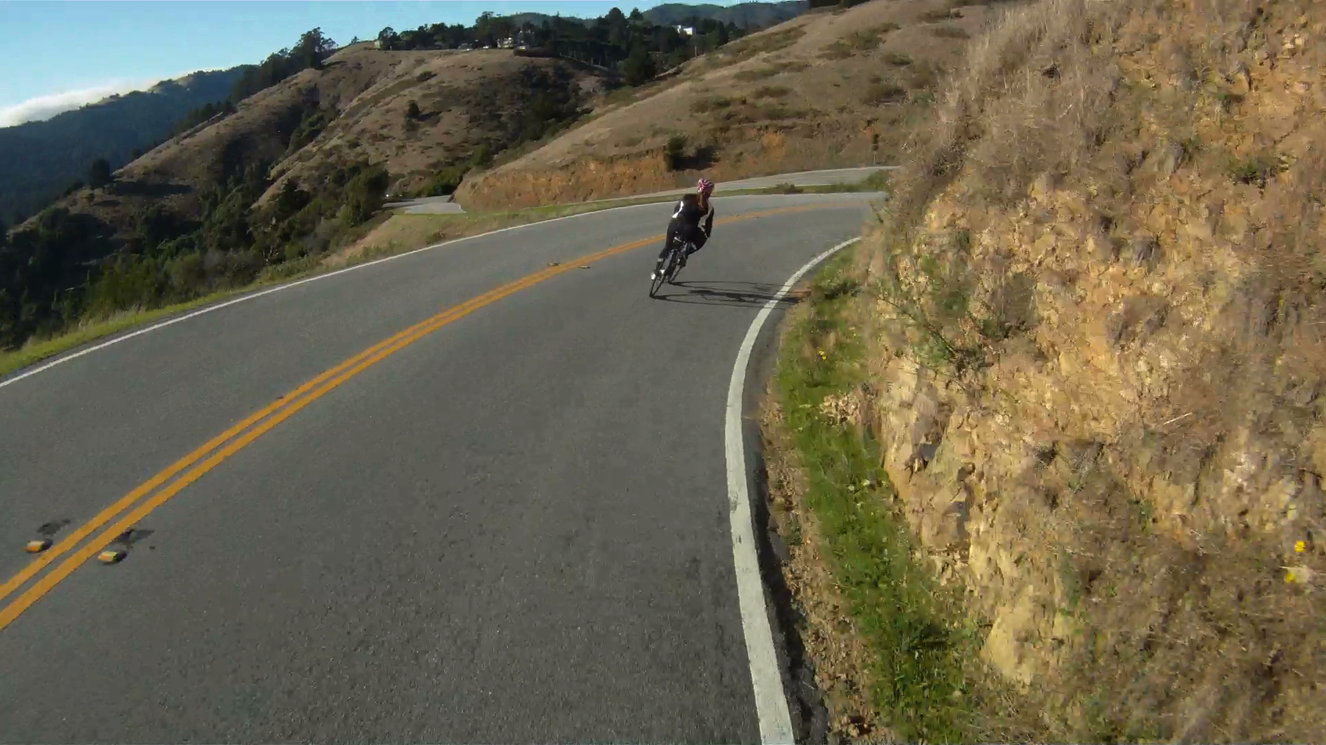
Dream descents are made of open roads, tight corners and beautiful views. Timed correctly, the descent into Muir Woods has all three. Descending from the top of Sequoia Valley Road down Muir Woods Road is an amazing journey. Though not as long as the Stinson Beach descent, Muir Woods is a good way to brush up your descending skills with a long series of technical twists and turns along the 1.5 mile descent. Once at the bottom, there is a rush of endorphins from the wild ride that will carry you the rest of the way to Muir Beach for your return up CA-1. Read on…
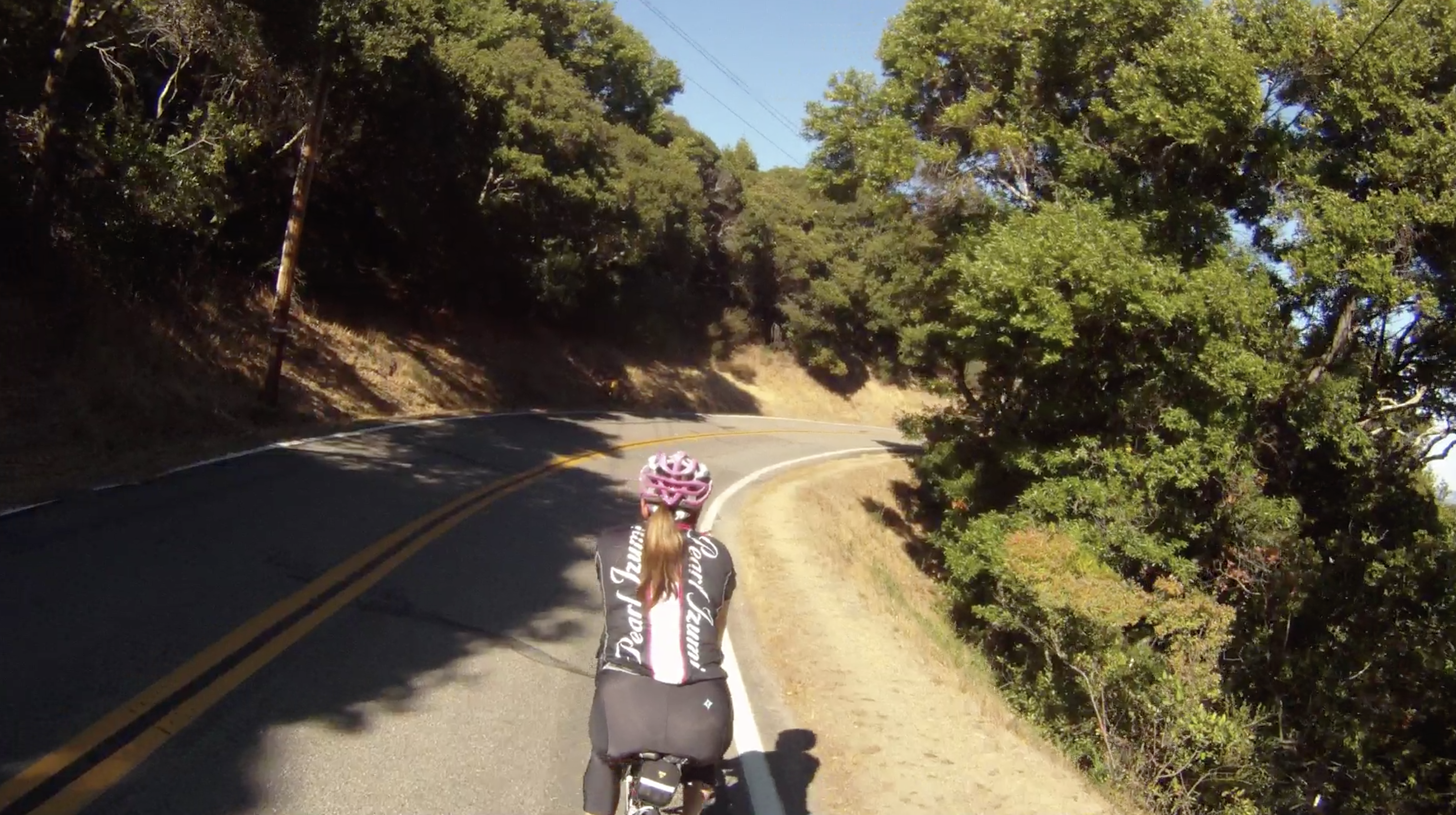
THREE AMIGOS: Return from Muir Beach to Sausalito along the Pacific Coast Highway

The routes from Stinson Beach and Muir Woods intersect at the Pelican Inn along CA-1. A tough climb from Muir Beach is rewarded by a great descent to Sausalito in The Three Amigos. The return route begins with a tough narrow climb along CA-1 with traffic nipping at your heals. If you can time the cars just right, you will experience a fantastic, high-speed return back to the Marin Crossroads. Each path that leads to this return is its own unique adventure. That adventure continues on in The Three Amigos’ journey back to Sausalito. Read on…

Connecting to the Larkspur Ferry Terminal is one of the easiest ways to return to San Francisco from a ride in Marin County. The route takes you from the end of the Marin Crossroads, through one of our favorite short descents we call “The Chase Scene,” through the town of Larkspur and back along another multi-use path to the Larkspur Ferry Terminal. Whether your goal is to have another way of getting back to San Francisco from deeper into Marin, or you just don’t feel like riding back to the city after cycling Paradise Loop, the Larkspur Ferry Terminal adds another option for your return home. Read on…
THE SHORTCUT — Larkspur Ferry Terminal to San Rafael

Have you ever wondered how to get from the Larkspur Ferry Terminal to San Rafael? Use the Cal Park Tunnel! Watch the video and check out the short, flat and easy way to get from Larkspur to San Rafael. Read on…
COFFEE RUN — San Anselmo and Fairfax

San Anselmo and Fairfax are quaint little towns that loom at the base of the Coastal Range. Both are great spots to start a ride or grab lunch. Restaurants and coffee shops are all along the main drag of each town. Some of our favorite places to eat during a ride are in this area. These towns also hold different festivals throughout the year, so feel free to stop in and find your own favorite spot.
LET’S GRAB A BEER — San Anselmo to Marin Brewing Company at Larkspur Landing via San Rafael

San Rafael is the gateway to China Camp and a great way to return to the Larkspur Ferry from Fairfax or San Anselmo. San Rafael is not for the faint of heart! The high traffic environment along 2nd Street requires superb bike handling skills and nerve as there are no bike lanes and the drivers see you as an intruder with no right to the road. If you are not ready for the intense traffic, a slower alternate route through San Rafael is also available. Read on…
ALPINE DAM — Fairfax to Mt. Tam, Hot Damn!

You have followed the Coffee Run and ended up in Fairfax, but aren’t ready to head home, what do you do? If you are up for a challenge, it’s time to head west! Once you reach the summit of Mt. Tam with this route, you’ll be on your way to 5000 feet of climbing from the Ferry Building and just over a mile of climbing if you are brave enough and have the energy to make it back to the Ferry Building. Read On…
CHINA CAMP: San Rafael to San Pablo Bay

China Camp State Park is a short ride from San Rafael and is home to some of the area’s best beginner mountain biking along with tons of wildlife and gorgeous views of the San Pablo Bay. If road biking is more your thing, then China Camp offers you a great ride around the coast of the San Pablo Bay that can be added on to a ride, or can just be a destination for the day. Read On…
