MTB Trail: Angel Island – The Jewel of the Bay


photo 1-3

Everyone that comes to San Francisco knows the most famous island in San Francisco Bay, Alcatraz, but only a few know about the Jewel of the Bay, Angel Island.

Angel Island State Park, the largest island in the San Francisco Bay offers some of the best views of the surrounding Bay Area.  It has been a cattle farm, a military barracks, a quarantine station, immigration station and now a nature conservatory.

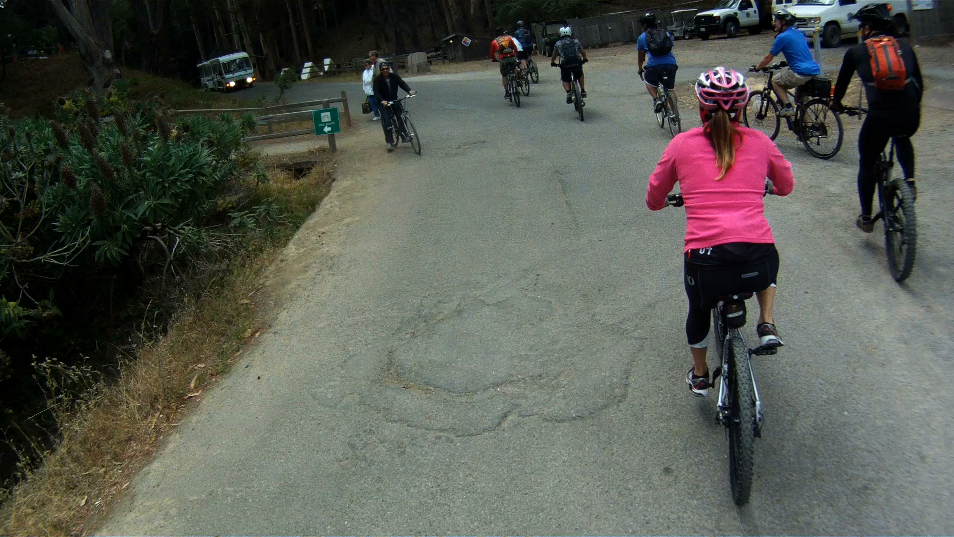
This was our first endeavor in mountain biking and makes a great introduction for everyone.

Screen Shot 2015-01-26 at 8.26.50 PM

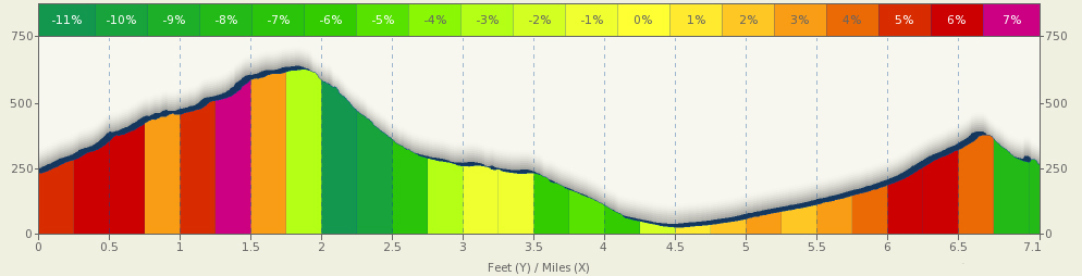
Distance: 9.1 mile (one loop around the top and bottom trails)

Elevation Gain: 1017 feet (310 m)

image image

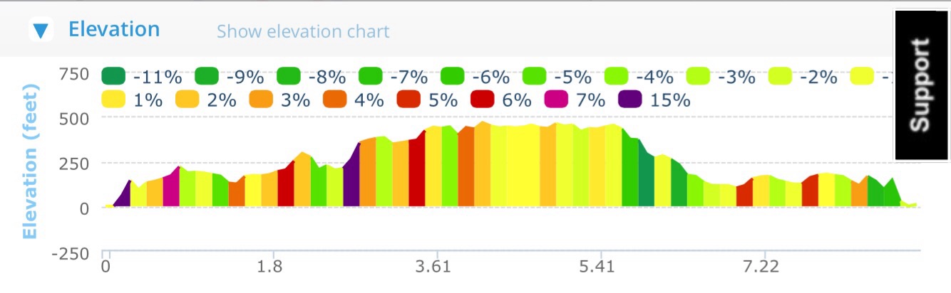
Difficulty: Although you can ride your road bike along the lower paved path, the real fun comes when you hit the trails.  This is a great beginner’s trail and gives you an amazing introduction to mountain biking without too much difficulty.

Getting to Angel Island

There are two ways to get to Angel Island.  The easiest way to get there is to take the Blue & Gold Ferry from Pier 41.  This ferry leaves at 9:45 am every day.  You can buy tickets at the box office at Pier 41 or onlineScreen Shot 2015-01-26 at 10.26.30 PM Screen Shot 2015-01-26 at 10.26.48 PM

The second way to get to Angel Island is to take the Angel Island Ferry from Tiburon.  This ferry runs at a less regular schedule which varies throughout the year.

You can return to San Francisco either by taking the Blue & Gold Ferry directly back, or your can return to Tiburon, and return on a later ferry back from Tiburon.

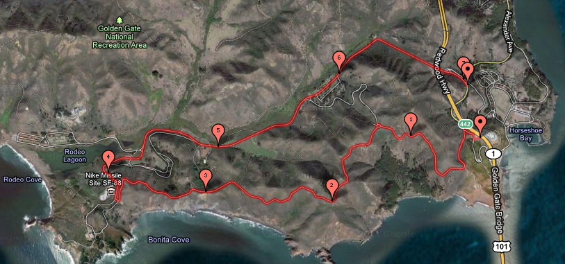
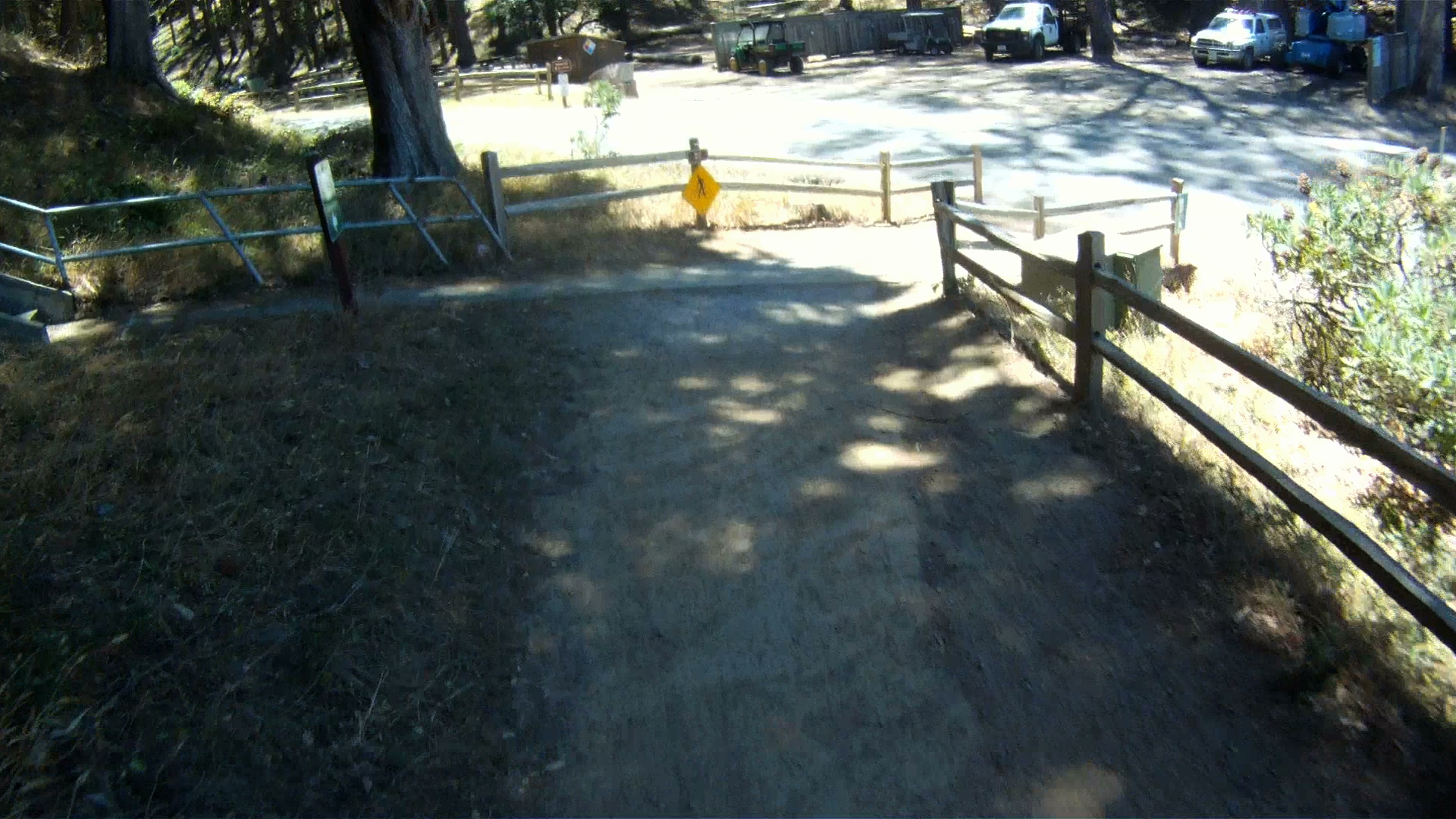
When you arrive at Angel Island, you dock at Ayala Cove. This route is a set of loops, so you begin and end at Ayala Cove. This is the dock where you catch the ferry to both Tiburon and San Francisco.

GOPR0245-2

From Ayala Cove, follow the trail to the Visitor’s Center. Bikes are not allowed on the pavement for a few hundred feet, so make a left onto the trial and follow it to the lower, paved route around the island.

GOPR0246-2

GOPR0246-4

GOPR0246-7

GOPR0246-10

GOPR0247-5

Approximately a mile and a half down the path, you encounter the trail to Camp Reynolds. Camp Reynolds includes the brick barracks you see from Sausalito and the ferry.

GOPR0247-11

This is an unpaved trail leads down to the Camp and the water’s edge if you turn right at the fork. At the Camp, you can experience a civil war cannon shot around 1 pm each day.

We prefer to continue along the path and turn left at the fork. This unpaved trail leads back to the main loop shortly ahead.

GOPR0247-13

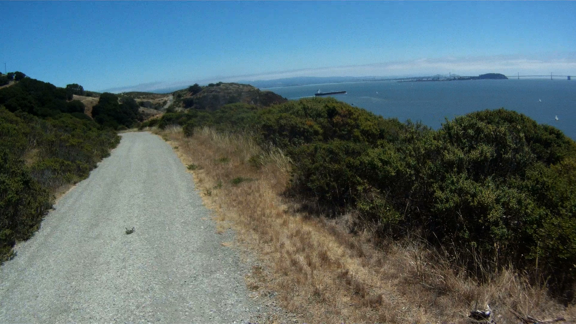
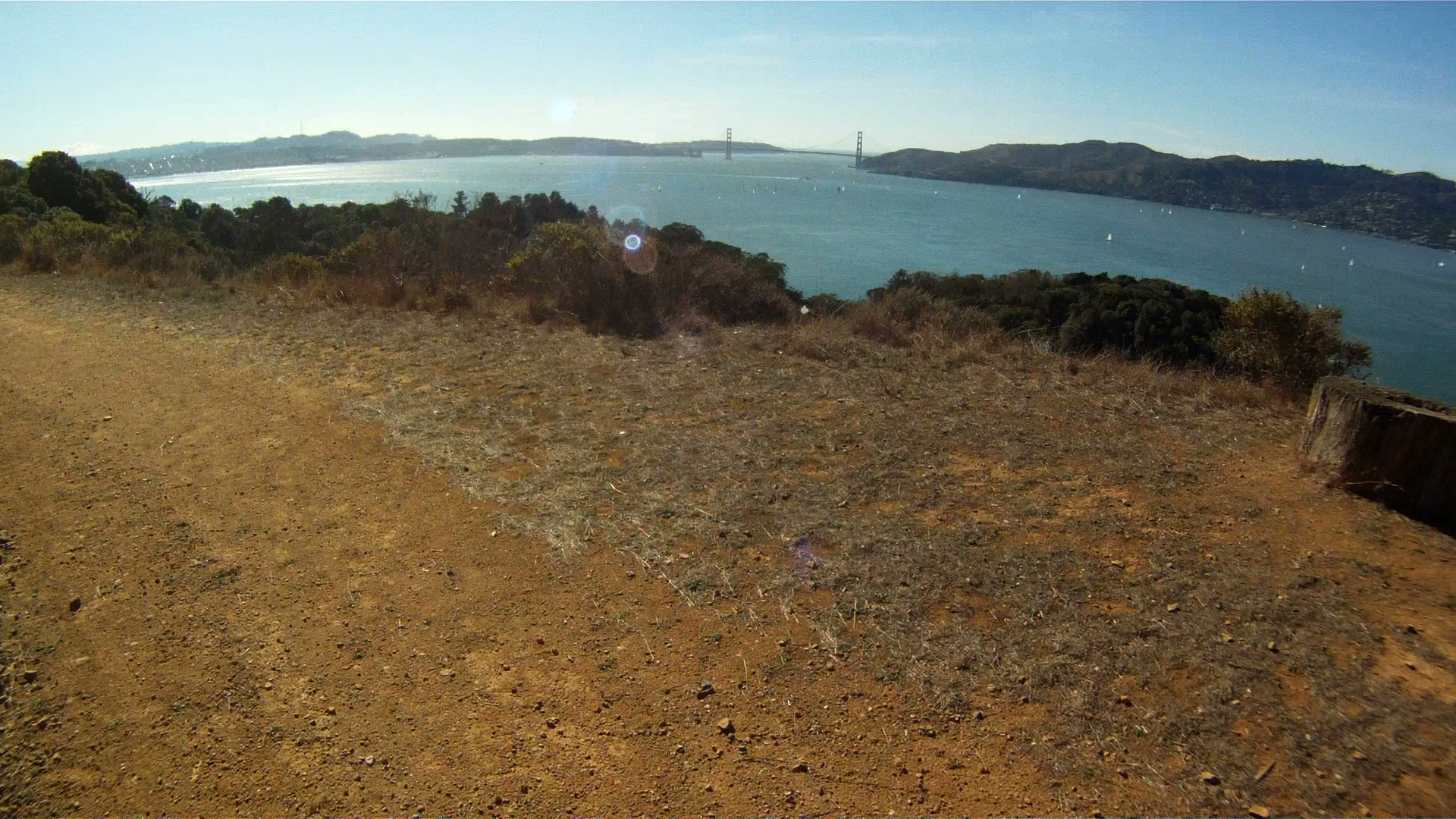
Back on the path, once you crest the hill you get amazing sweeping views of San Francisco from the Golden Gate Bridge to the Bay Bridge.  Make sure to stop and take a few pictures, this is really one of the best spots on the island.

GOPR0250

GOPR0250-1

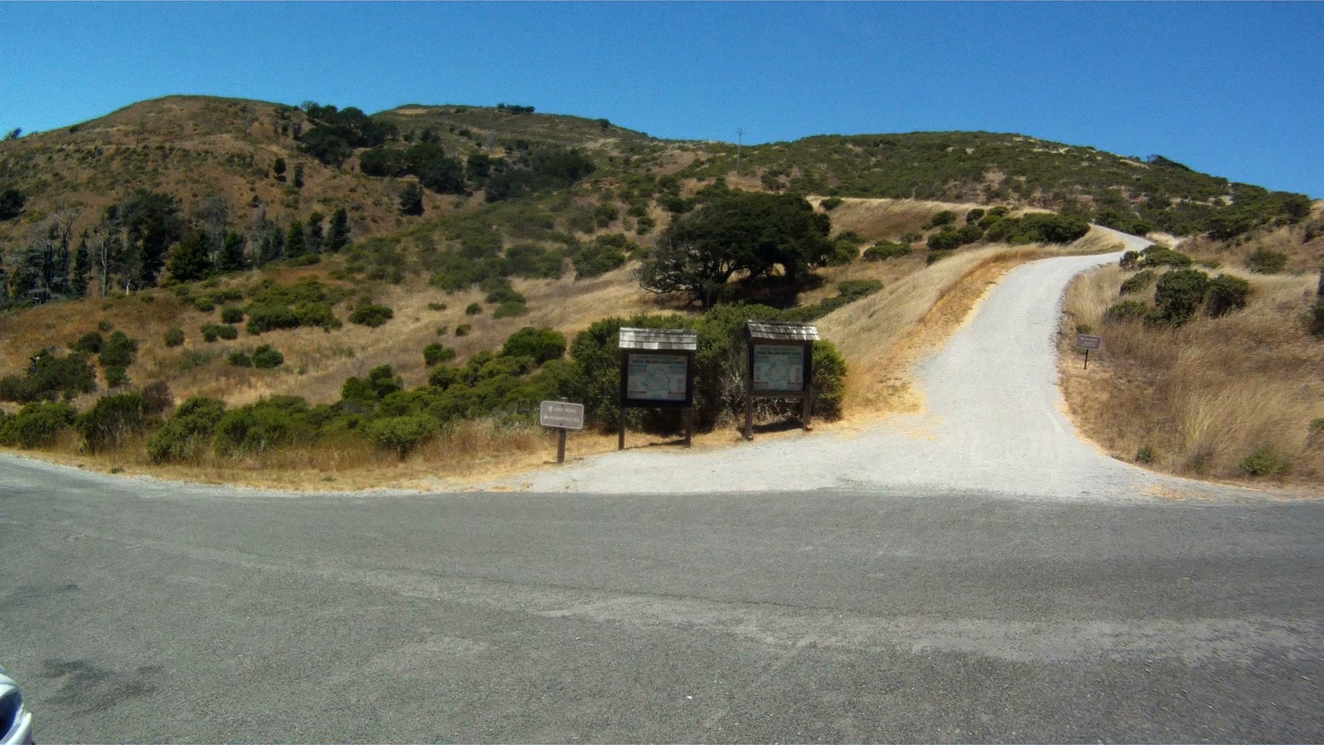
Continuing along the path, you can get your next round of trail riding on your way up to Battery Drew.  To get there, take the left fork and head up the hill.

GOPR0250-3

Keep climbing and you’ll get some more great views.

GOPR0250-6

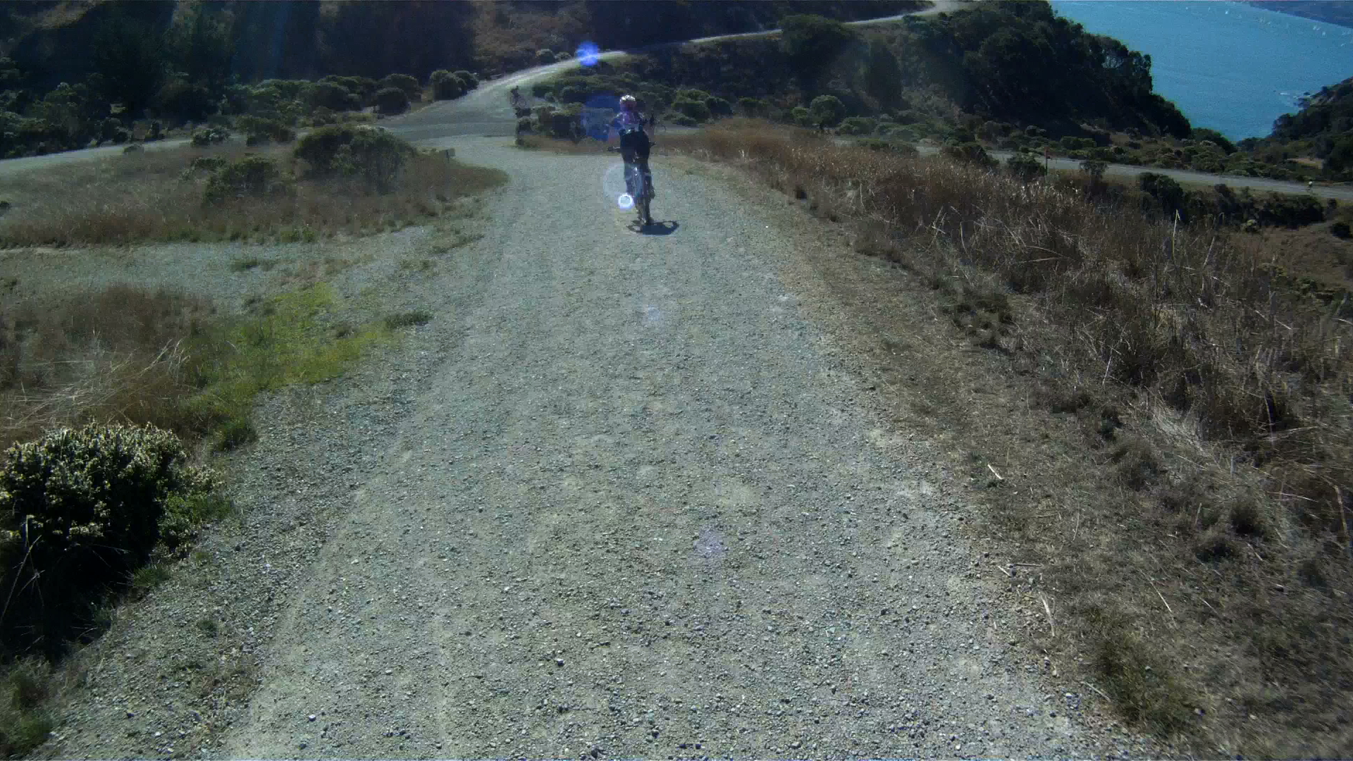
Your next taste of an off-raod downhill is next up.  Its got some loose gravel, some dirt and an nice fast slope.

GOPR0250-8

A short ride back along the the path and your entrance to the upper off-road trail is on the left.

GOPR0250-10

The entrance is a steep path with loose rock, so get a head of steam and power your way to the top, where you’ll immediately turn right.

GOPR0250-11

GOPR0262-11

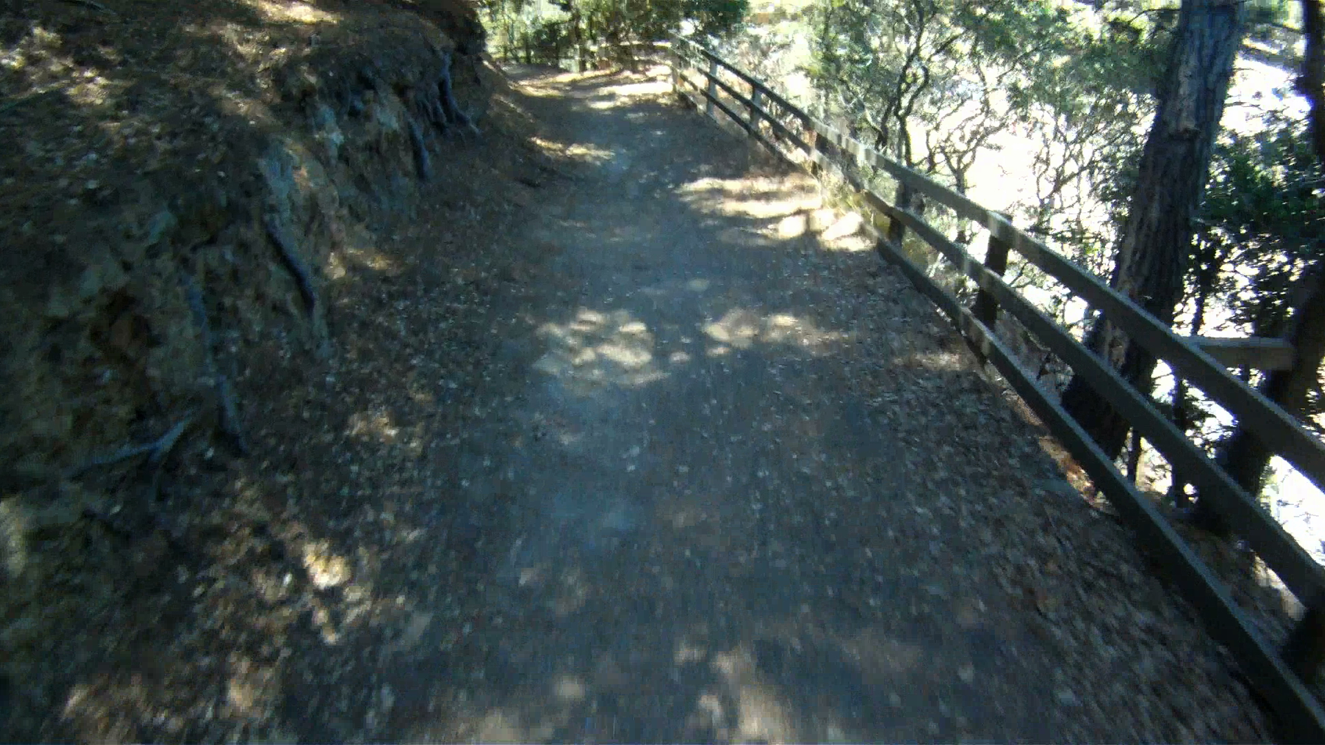
Follow the upper path as it rolls along with eastern shore of the island with many of the island’s buildings below.

GOPR0262-13

About halfway along the eastern side, the path makes a sharp left up the hill, away from the picnic area.

GOPR0262-19

Climb past the water housing area, and watch for deer here. Just past then fence the path takes another left.

GOPR0262-22

Continue along the gently rolling path and enjoy the gorgeous scenery as you traverse the northern side with Tiburon across the channel.

GOPR0262-31

As you approach the western side of the island, you’ll see Sausalito and the Golden Gate Bridge.

GOPR0262-33

The path rolls downhill as it leads you back to the return to the lower main road.

GOPR0263-9GOPR0263-17

You can ride the upper path again if you are up for it, or you can turn right and go back to complete the lower path.

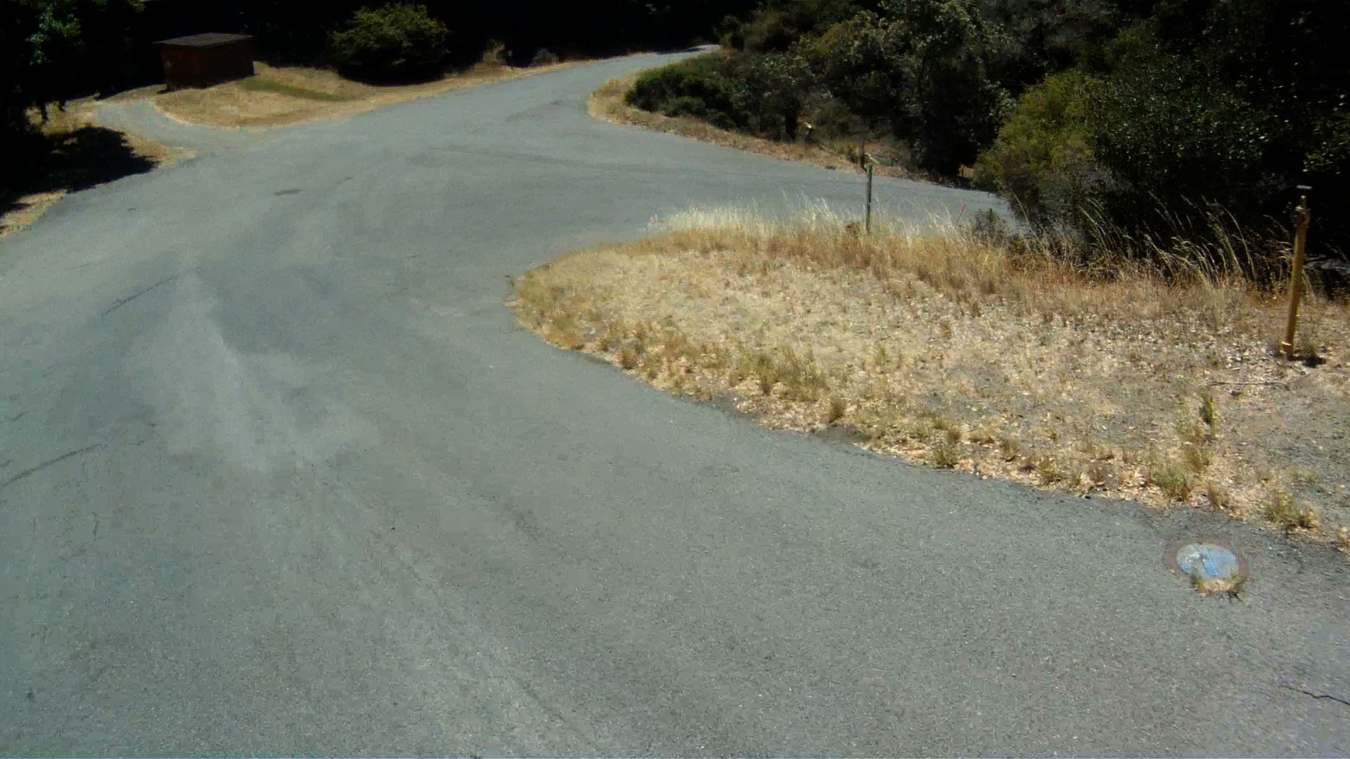
When you are ready to head back to the lower path, turn right down the hill and continue straight at the intersection. You’ll get more sweeping views of San Francisco from the Bay Bridge to the Golden Gate Bridge.

GOPR0263-19GOPR0263-23GOPR0251-2

A short way down the path is the best paved downhill of the day. It’s a quick descent with a curve to the left at the bottom where the road forks.

GOPR0251-5GOPR0251-6

Quarry Point is down the road on the right. You’ll see housing barracks on the left of the main path and a dock lower down the hill to the right. This part of the island was a rock quarry from 1850 through 1922 and used to construction buildings from Alcatraz to Fort Point and even the California Bank building in the Financial District of San Francisco.

GOPR0251-7

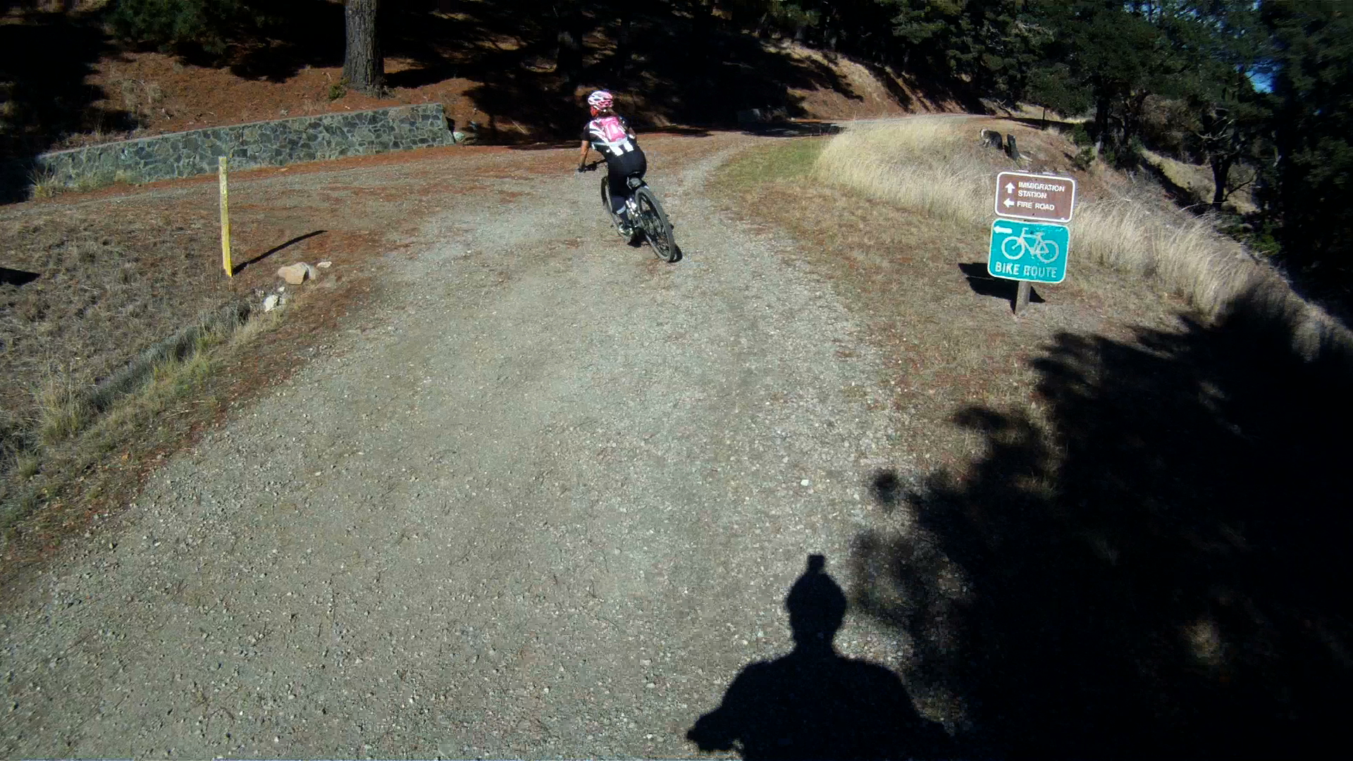
Further along the path you’ll pass by the Immigration Station. You can go for a stroll or take a tour of the Immigration Station. This immigration station was in use from 1910 thought 1940.

GOPR0251-9

The rest of the route is another 1.5 miles of rolling path back to Ayala Cove. Watch for the entrance back to the bike route, it is a sharp right after a quick downhill.

GOPR0251-13

If you miss the turn, no big, just continue on and turn around.

GOPR0251-15

Follow the path and return back to the docks at Ayala Cove where you can pick up a ride back to Tiburon or San Francisco.

GOPR0251-17GOPR0251-18GOPR0251-20GOPR0251-21

After a day of adventure on Angel Island, you really get a sense of how much fun mountain biking can be. While most of the route is pretty tame, there is some loose terrain and quick descents that give you a sense of trail riding.

While accessing this park is a bit more complicated than just hopping in your car, it is totally worth while. The views, the experience and the fun you will have both on the island and on the boat to the island are memories waiting to be made.


Trail: THE LARKSPUR CONNECTION


Connecting to the Larkspur Ferry Terminal is one of the easiest ways to return to San Francisco from a ride in Marin County. The route takes you from the end of the Marin Crossroads, through one of our favorite short descents we call “The Chase Scene,” through the town of Larkspur and back along another multi-use path to the Larkspur Ferry Terminal.

Distance from San Francisco Ferry Building (see Golden Gateway Trail): 22.65 miles; Distance from Marin Crossroads: 8.22 miles; Distance from Sausalito: 12.24 miles
Elevation Gain on trail: 305 feet
Difficulty: It’s not about the road, it’s about the destination. With a mix of on-road riding and multi-use paths, this rolling eight miles runs from the end of the Marin Crossroads to the Larkspur Ferry Terminal and is a short, but fun adventure.
Download your route sheet here: Directions – Larkspur Connection
The path to the Larkspur Ferry Terminal begins at the end of the Marin Crossroads.
At the light, cross East Blithedale Ave. and continue down the path along Route 5 until you reach the the first paved intersection, and make a right and continue to follow Route 5 down the path.
Continue along Lomita Drive past the hill where the local horses graze.
Lomita Drive turns left up a hill to the path that follows along US-101.
Keep to the left and follow Route 5 to Meadowsweet Drive.
Continue along Meadowsweet Drive as you cruise downhill.
At the “Y” in the road at the bottom of the hill, veer left and continue along Meadowsweet Drive.
At the next intersection, make a right toward the stop light, continuing along Route 5.
Continue through the light along Madera Boulevard.
Follow Madera Boulevard until you reach the stoplight at Womum Drive.
Just before Womum Drive, merge onto the sidewalk to cross Madera Boulevard at the crosswalk.
Follow Route 16 along the Larkspur Bike Path until it ends at Montecito Drive.
 An alternate to the Route 16 bike path is to take the path to the right after the bridge, Route 18, and follow Lucky Drive to the bridge over the channel as seen in The Sharks Fin.
Turn left at Montecito Drive, then make a right at the stop sign onto Tamalpias Drive.
Make another quick right at the light on to Magnolia Avenue and Route 15.
Follow Magnolia Avenue, Route 15 towards Ross, through downtown Larkspur.
Go through the light at the bottom of he hill and stay towards the center of the lane at the next light staying in the bike lane.
After the light, hop up on to the path on your right.
Follow the path until you reach Bon Air Road.  Once you reach Bon Air Road, this is the point where you would continue along Magnolia Avenue to reach San Anselmo, Fairfax and beyond.
Take a right on Bon Air Road, follow it over the bridge and make a right onto South Eliseo Drive.
Follow South Eliseo Drive, Route 20, just over a mile, up the hill and down to the bike path along the channel.
Follow the bike path until you reach the bridge…
Keep following Route 20 toward the Larkspur Ferry as it winds under the overpass and over the wooden bridge.
Then follow the path next to Sir Frances Drake Boulevard all the way to the Larkspur Ferry Terminal.
Make a right just before the parking lot entrance.
Once you reach the Larkspur Ferry Terminal your journey is complete.  Check the ferry schedule for times, but most of the ferries go directly to the San Francisco Ferry Building, except for the 5:30 p.m. ferry on weekends which stops in Sausailto first.  If you are going to take this ferry, make sure to check out The Hat Trick to protect your bike from the heavy comfort bikes of the tourists.
Whether your goal is to have another way of getting back to San Francisco from deeper into Marin, or you just don’t feel like riding back to the city after cycling Paradise Loop, the Larkspur Ferry Terminal adds another option for your return home.

Golden Gate Bridge West Side Reopened!


Jon and Miko Like Totally Pause Near Fort Point

On September 10, 2011 the West Side of the Golden Gate Bridge reopened to bicyclists. The West Side of the bridge will now be open 24/7 until seismic renovations are completed on the East Side of the Bridge. However, there are some restrictions on bikers during the week in the construction zone where the repainting is occuring. See the release for full details.

The East Side of the Bridge has limited access until mid-January 2012

As of September 12, 2011 pedestrians are unable to walk across the Golden Gate Bridge. Presently, pedestrians entering from Vista Point in Marin County are limited to the area immediately surrounding Vista Point and a 700 foot section of the Bridge. The renovations will be at the north anchor-housing and will last through mid-January 2012. Visitors from the San Francisco side of the Bridge are able to walk past the second tower, but must turn around at that point.

BIKES ONLY on the West Side! NO Pedestrians, Joggers, Rollerbladers or Skateboarders!

This effectively means that pedestrians, joggers, skateboarders and everyone else, EXCEPT bicyclists WILL NOT be able to cross the Bridge until it reopens in mid-January 2012. If you are a jogger and feel you should be able to run on the bike side of the bridge, DON’T! Bridge Police will be out and cite pedestrians trying to cross on the West Side of the Bridge. So if you want to walk to Sausalito, you will have to park in Marin County to do so.

Although tempting, pedestrians are not to ender the West Side of the Bridge

Bicyclists, you can now rejoice in the fact we can once again ride across the bridge without dealing with pedestrians. So don’t be bike douches, just slow down around the towers and in the construction zone because we all paused for pictures on the Golden Gate Bridge at one point in time and may do so once again.

Miko pauses for a picture at the south tower on the West Side

Trail: I’M SKY HIGH! — Marin Headlands


One of the most recognizable landmarks of San Francisco is the Golden Gate Bridge, especially the perspective from the Marin Headlands. The Marin Headlands themselves are beautiful sea cliffs with sweeping views of San Francisco, the Golden Gate Bridge and the Pacific Ocean. The initial climb is a challenge and great training while the descent is extremely steep with sharp turns. It has the perfect mix of beauty and challenge. All of this excitement is accessible with a short ride just across the Golden Gate Bridge.

Three time Tour de France winner Alberto Contador riding the Marin Headlands                 PHOTO courtesy of Velodramatic.com and IamSpecialized.com

Try this ride out as a trainer for climbing or just as an introduction to cycling in the Bay Area like Alberto Contador did on October 4, 2011 with some friends from Mike’s Bikes.

This route is fully open again.  For more information regarding the recent improvements see Marin Headlands Closure Information for more details.

Distance: from San Francisco Ferry Building 15.18 miles

–Trail Starts at mile 7.7 of The Golden Gateway

–Trail Ends at mile 8.13 of The Golden Gateway — East Side Wee Fast Fun Route
Difficulty: The climbing is long and steep, but the initial descent is even steeper!

Climbing on Route: 925 feet (282 meters)

Descent on Route: 896 feet (273 meters)

Download your route sheet here: Directions – I’m Sky High

FOR A MORE DETAILED LOOK click here for the full Geoped Map provided by g-map-pedometer.com

Elevation Map for the Route provided by MapMyRide.com

This route starts in the parking lot on the northwest side of the Golden Gate Bridge. This is at the end of the bike side of the Bridge.

The beginning of this path just under 8 miles from the start of the Golden Gateway. The climbing starts immediately out of the parking lot.

At the top of the stop sign, make a left and head up the hill.

The first part of this climb is he steepest and the toughest. Just keep going and if you need a break, take it to admire the view at the first rest area.

Us taking in the view at the first rest stop

Though less steep, the climbing continues up to the round about.

If you take the first exit of the round about, you will go down McCullough Road toward Bunker Road and back to Alexander Avenue towards US 101 through the tunnel.

Keep going around the round about, and take the second exit to continue up the Marin Headlands.

Keep climbing to get to the top, you have just under one mile to the top.

Take in the scenic views of the Golden Gate Bridge and San Francisco as you are now higher than the bridge’s towers.

The tunnels signal Hawk Hill, the top of the Headlands, where you can take a break and take in the views, wait for or catch up with the rest of your group before turning around, or prepare for the hair-raising descent down the back of the Headlands.

Miko and Jon take in the views from the top of the Marin Headlands

The narrow, one way road is just the beginning of the challenges that face you on the descent down the backside of the Headlands.

The backside of Marin Headlands is not for the faint of heart, cause it’s all downhill from here!

“Hill” is an understatement, but the 18% grade is dead on! You build up speed quickly and two of the first three turns are 90+ degrees! Keep your descending class rules in mind: stay in the drops; just touch your brakes to regulate your speed, don’t hold them; inside knee up to pull your body into the turn; and always keep your eyes up and looking where you want to go because that’s where the bike is going to take you!

After that second right hand turn, the grade reduces but the speed stays high, so make sure to stay on your game.

Though the remaining turns are not as sharp and the grade not as steep, the rest of the way down is still wicked fast!

The descending turns to a short climb as you pass by the lookout point near the Upper Fisherman’s Parking Lot.

The Point Bonita Lighthouse is just up the road past the bunkers.

It is just a short climb before you reach the bunkers and Lower Fisherman’s Parking Lot.

And a couple of more twisties before the main part of your descent is complete.

Turn right at the next intersection to head back to US-101 along Fort Barry Road.  If you want to visit the Point Bonita Lighthouse, keep going straight, the road is two-way traffic again past the intersection.

Then another right at the stop sign.

Follow Fort Barry Road down the hill and around the corner, notice the tidal pool and Sausalito Beach to your left.

You will then pass Simmond’s Road and the Marin Headlands Hostel on your right. Keep following Fort Barry Road as it becomes Field Road here.

Follow Field Road through the next intersection as it merges with Bunker Road toward San Francisco.

You are now on the Marin Headlands return route.  It’s a slight climb back out to Alexander Avenue towards US-101 from here.

At McCullough Road you can climb back up the Headlands and descend the front side towards the Golden Gate Bridge, or you can keep along Field Road towards Alexander Avenue.

A bit farther down the road is the Bunker Road Tunnel.  The tunnel is signal controlled by a stop light.

When the light turns green, head on through.

At the beginning of the tunnel there is a button to signal to the on-coming cars a biker is in the tunnel.

The tunnel is pretty dark, but the main obstacles are the water, mud and slime covering the bike lane.  It’s all downhill, but your tires are never totally planted on the road, so be careful going through here.

Once you exit the tunnel, you are just about to the intersection with Alexander Avenue.

If you haven’t gotten your fill of the climbing or descending yet, you can always head back up Alexander Avenue to the Golden Gate Bridge and the beginning of the Marin Headlands to do it all over again by taking the fork to the right.

Or if you are ready to head on to other adventures, take the fork to the left and rejoin the Golden Gateway Trail for the descent to Sausalito.

The Marin Headlands is a challenging ascent and with an absolutely spectacular and breathtaking descent. This is a great route to work on both your ascending and descending skills when you don’t have a lot of time on your hands, or don’t want to travel too far from the city. Keep hydrated on the way up and your head up on the way down!

Enjoy!