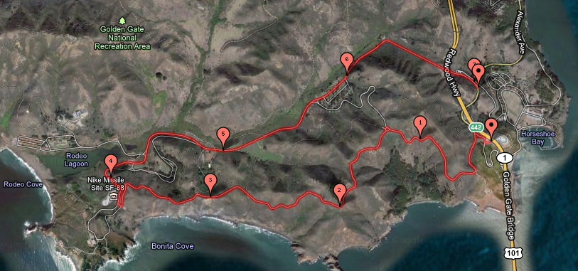
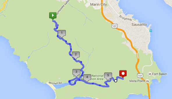
If you are up for a challenge, the Miwok Trail adds a degree of difficulty to your ride with its technical climb out of the Tennessee Valley back towards the Marin Headlands. With its horse trail stairs and deep ruts, this is no trail for beginners. Conquering this trail gives you appreciation for your front shock and builds your climbing prowess.
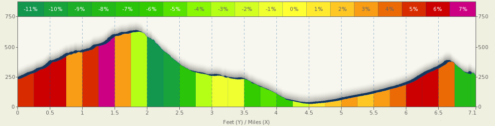
Distance: 5.75 miles (9.3 km)
Elevation Gain: 1068 feet (325 meters)
Difficulty: This trail has a technical assent with stairs and a fast descent back toward the Marin Headlands. This is definitely an intermediate ride.
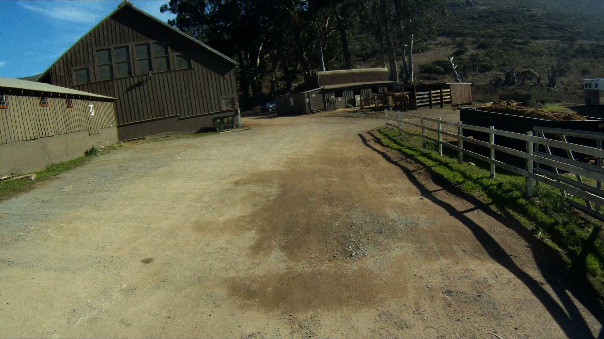
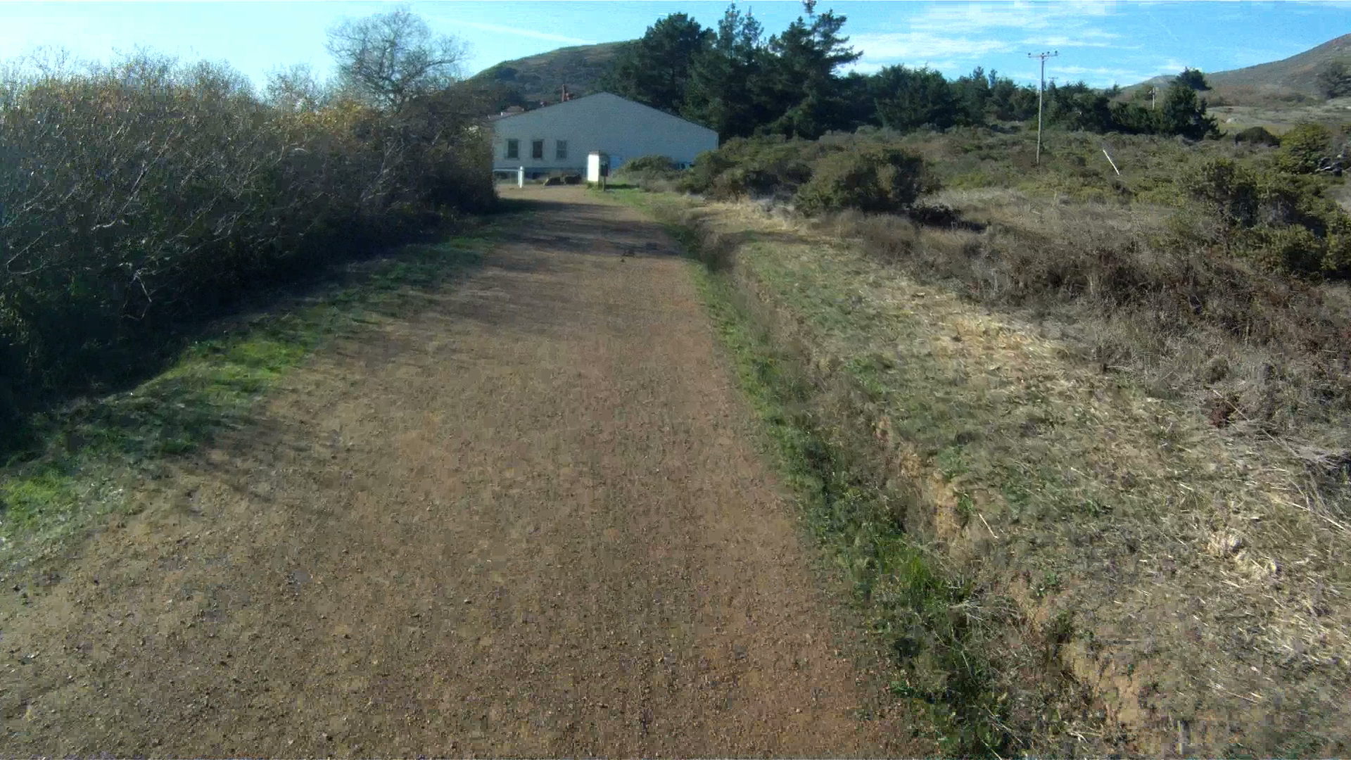
Starting at the Tennessee Valley parking lot, walk your bike through the Miwok Stables until you see the trail on the right next to the manure pit.
This is the beginning of the Old Springs Trail.
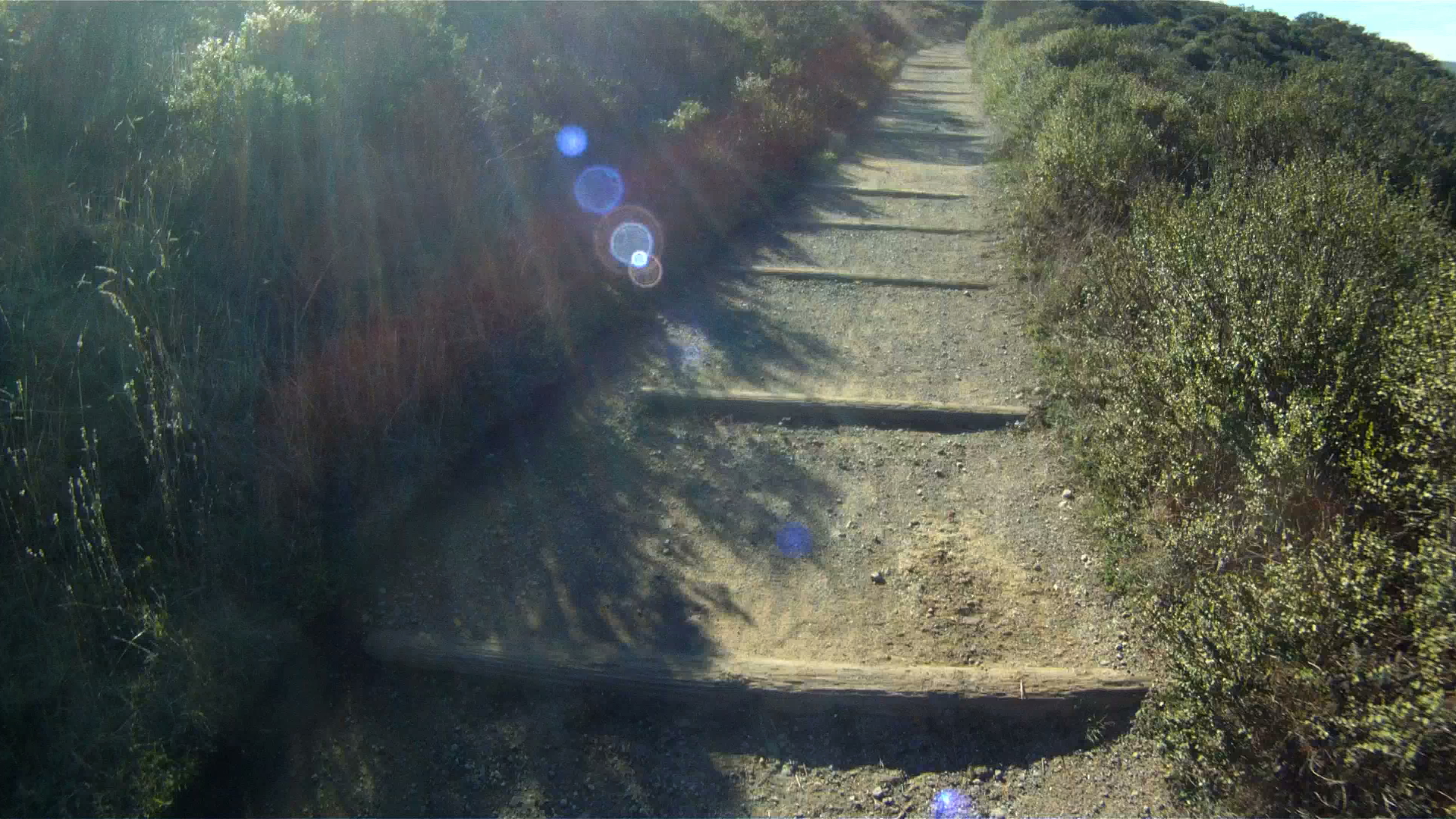
The Old Springs Trial has a series of stairs and bends as you climb the 1.3 miles to the Miwok Trail.
This trail can get technical in spots where the dirt gets larger rocks and the pitch increases.
Continue to follow the Miwok Trail as it continues to roll over the wooden bridges before turing onto the Miwok Trail.
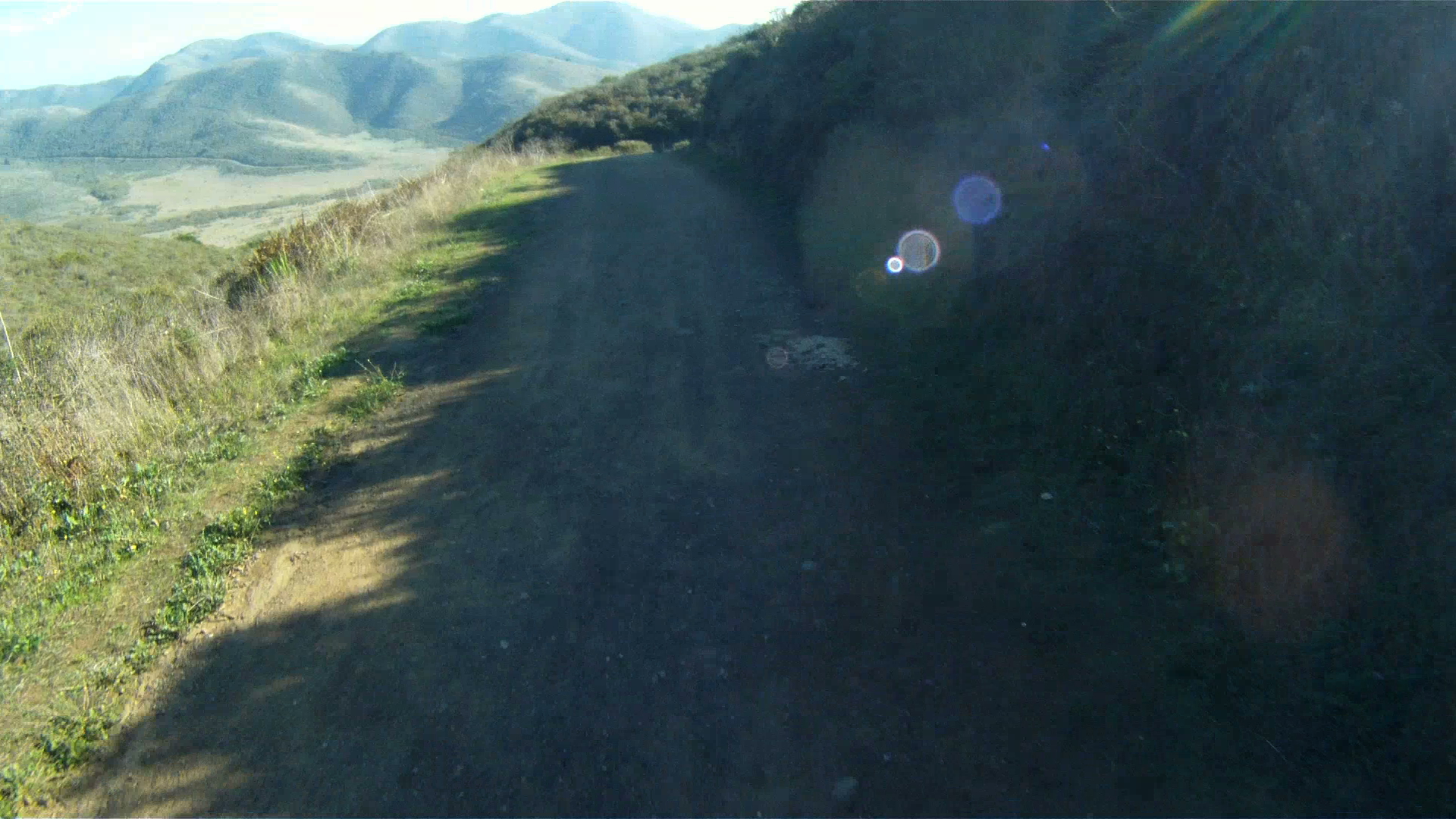
At the top of Old Springs Trail, make a right onto the Miwok Trial and start the descent.
The descent is fast, so check your brakes and stay in control. Watch out for the deep ruts and hikers on the descent as well.
As the descent flattens out, watch for a turn to the left to return to the Bobcat trail and the Marin Headlands. The left turn is 2.75 miles from the start. If you make the left, watch for a quick right just after a set of stairs. Follow this trail for a few hundred feet to the bridge and make a right, then a left on the other side of the bridge to return to Bunker Road.
Or…
If you miss the turn (like I did on this particular run), continue straight on the Miwok Trail and you will end up in a parking lot along Bunker Road.
Make a left on Bunker Road and follow it to the entrance to the Coastal Trail on your right, the same trail you came down on our Bobcat Trail route.
Follow the Coastal Trail as it climbs its way back to the roundabout in the Marin Headlands.
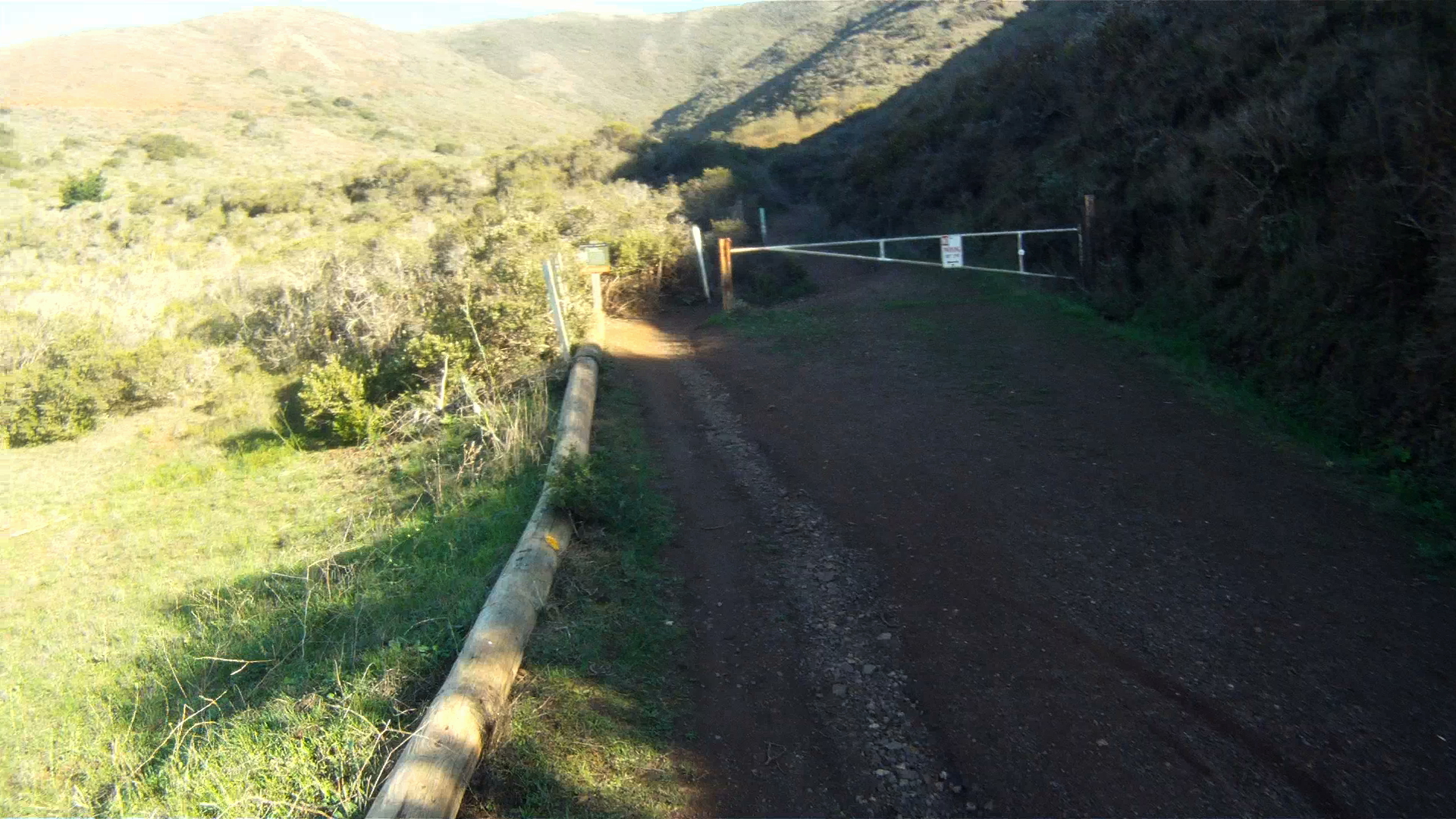
Go through the gate and start up the trail.
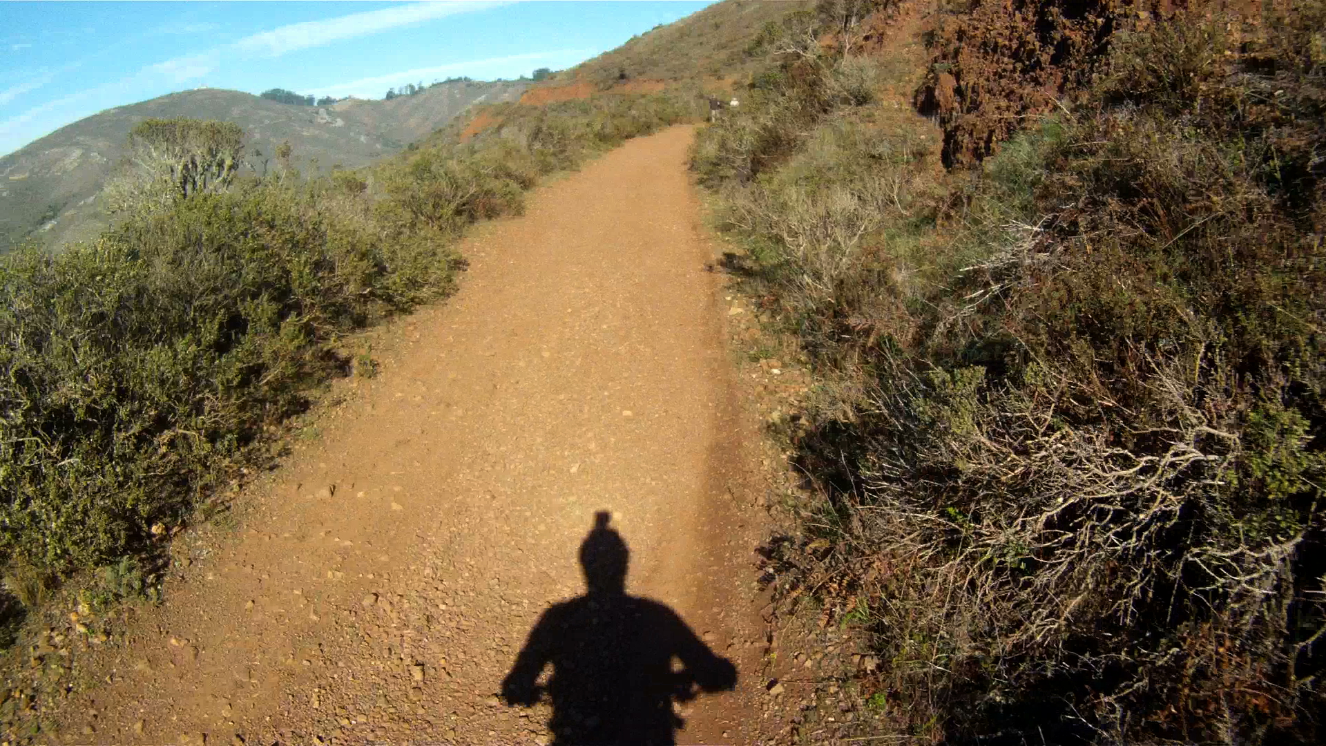
As you experienced on the way down, this trail narrows in places and has loose rock in others.
Continue winding your way back up the trail and through the narrow single-track.
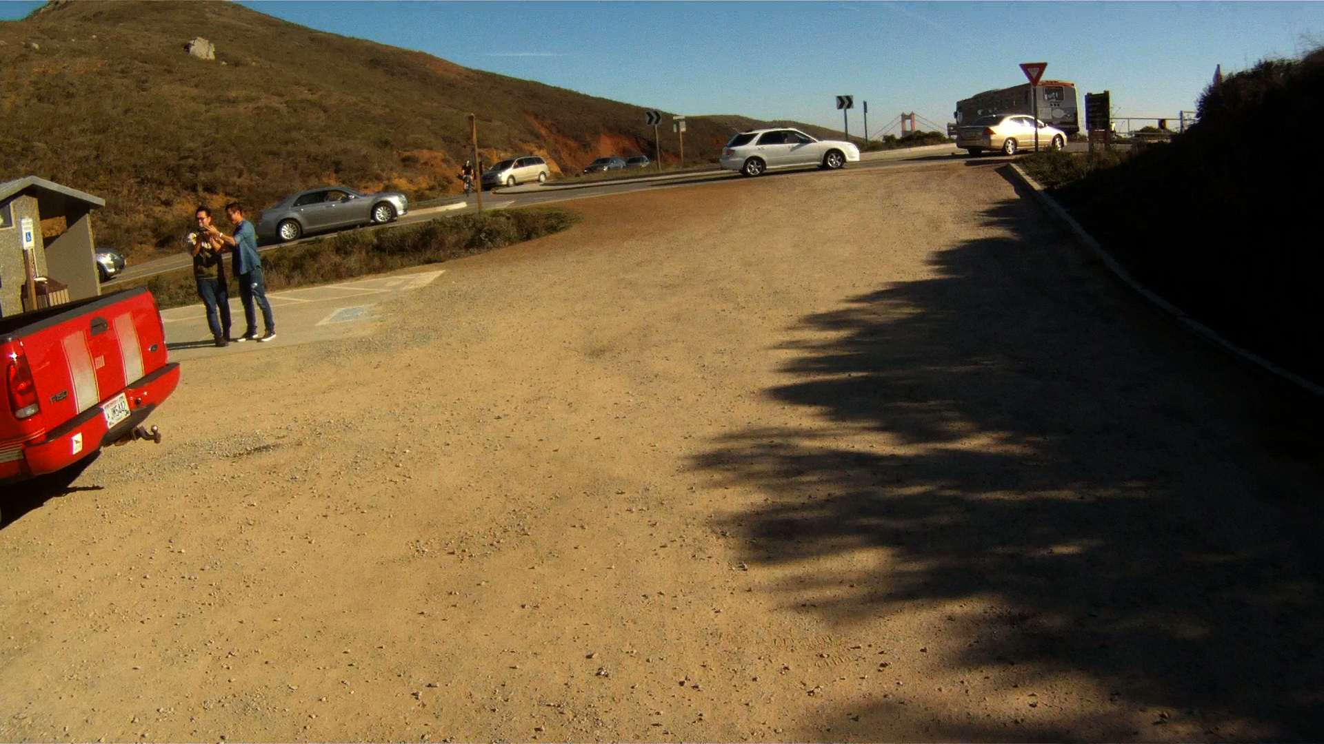
At the top of the climb, you’ll be back at the parking lot next to the roundabout and will be able to see the familiar red paint on the North Tower of the Golden Gate Bridge.
While challenging, the Miwok Trail is rewarding not only for the views, but also the sense of accomplishment once you realized what your mountain bike and you can do! Enjoy and stay safe.
China Camp State Park is a short ride from San Rafael and is home to some of the area’s best beginner mountain biking along with tons of wildlife and gorgeous views of the San Pablo Bay. If road biking is more your thing, then China Camp offers you a great ride around the coast of the San Pablo Bay that can be added on to a ride, or can just be a destination for the day.
Distance from The Short Cut: 8.4 miles (16.8 miles round-trip); Larkspur Ferry Terminal and Larkspur Connection: 10.70 miles; Marin Crossroads: 18.92 miles; Distance from Sausalito: 22.94 miles; Distance from San Francisco Ferry Building (seeGolden Gateway Trail): 32.75 miles.
Elevation Gain on trail: 312 feet (624 feet round trip)
Difficulty: The ride features an urban ride through San Rafael which gives way to rolling hills and scenic views of San Pablo Bay, out far enough to make it a full day ride, but not so hard to get to a tourist couldn’t make it.
-Elevation Map for the Route provided by MapMyRide.com
Starting at the intersection of Lincoln Avenue and Second Street in San Rafael, the end of The Short Cut or partially through Let’s Grab a Beer, continue north along Lincoln Ave. Basically, follow Lincoln Ave. across Second St., or with the heavy traffic on Second St. if you are coming from downtown San Rafael (the faster route detailed in Let’s Grab a Beer), the safer option is to make a right onto Lincoln Ave. from Second St. and do a U-Turn on Lincoln Ave. and then cross Second St.
Follow Lincoln Ave. to Fourth Street (the route for the slower option detailed in Let’s Grab a Beer), then make a right onto Fourth Street, or continue to go straight if you are coming from Fourth St.
Follow Fourth St. as it crosses over the railroad tracks and under US-101.
Continue to follow Fourth St. until you reach Union St. Make a right at Union St.
Follow Union St. and make a left onto Third St. at the light.
Follow Third St. through San Rafael as it leaves the city and climbs to the rolling hills toward San Rafael Bay. Third Street becomes Point San Pedro Rd. This is Bike Route 24.
Continue to follow Route 24 as it passes by San Rafael Bay with views of the McNear Brickyard along the way.
Just a bit further up the road is McNears Beach. McNears Beach has an outdoor pool, tennis courts, fishing and walking trails.
The hill leading up to and past McNears Beach is a tough climb ranging from 7 to 11%. Fortunately, it’s a short hill, so just power through it and you’ll almost be to China Camp.
After the climb, you get a nice descent to gain some speed as you enter China Camp.
At the entrance to China Camp Route 24 ends and Route 26 begins. Continue through the next 3.5 miles of rolling hills through China Camp. Click here for a map of China Camp.
The first section of China Camp is a bit of a climb as you go by the entrance to the Shoreline Trail and mountain bike paths on your left.
Your first descent takes you past China Camp Point as you round the sweeping left hand curve which leads to Five Pines Point.
Rounding Five Pines Point takes you on a descent with views of San Pablo Bay.
You’ll pass the Ranger Station on your right and then the road levels out for a short stint before climbing up to Weber Point where you can stop and take a short break.
The hills keep coming as you make another climb past Buckeye Point and descend through a couple of “S” curves to the next section of flats and the first section of marshlands.
Continue past Chicken Coop Hill and another entrance to the Skyline Trail will be on your left.
You’ll then pass by Bullet Hill with the Bullet Hill Trail entrance on your left and marshlands on your right.
Another quick rolling hill takes you past Turtle Back Hill with another trail entrance on either side of the road.
The flats after the descent from Turtle Back Hill takes you past the campground entrance on your left.
Once you past the campground entrance, you are just about out of the China Camp. Another mile and a half of flats brings you up to the boat launch area, which is where we typically turn around.
At this point, you have two options for returning back to San Rafael. The first is to turn around and take the same route back to San Rafael.
The second option is to continue along North San Pedro Rd. under US 101, make a left at Los Ranchitos Rd. and Los Ranchitos until it become Lincoln Ave. Continue along Lincoln Ave. until you cross Second St. in San Rafael and then make a right onto Irwin St. You will then meet up with Let’s Grab a Beer or The Short Cut and head back to Larkspur.
We typically turn around and take the scenic route through China Camp back to Larkspur. It’s a nice ride with a lot less traffic. If you decide to turn around as well, follow the road and once you get to San Rafael, continue on Third Street until you reach Lincoln Avenue, then make a left on Lincoln Ave. Follow Lincoln Ace. as described above and you’ll be back to Larkspur in no time.
No matter if you are looking to add some extra miles, or have just never been past San Rafael, China Camp is a great place to cycle.
On September 10, 2011 the West Side of the Golden Gate Bridge reopened to bicyclists. The West Side of the bridge will now be open 24/7 until seismic renovations are completed on the East Side of the Bridge. However, there are some restrictions on bikers during the week in the construction zone where the repainting is occuring. See the release for full details.
The East Side of the Bridge has limited access until mid-January 2012
As of September 12, 2011 pedestrians are unable to walk across the Golden Gate Bridge. Presently, pedestrians entering from Vista Point in Marin County are limited to the area immediately surrounding Vista Point and a 700 foot section of the Bridge. The renovations will be at the north anchor-housing and will last through mid-January 2012. Visitors from the San Francisco side of the Bridge are able to walk past the second tower, but must turn around at that point.
BIKES ONLY on the West Side! NO Pedestrians, Joggers, Rollerbladers or Skateboarders!
This effectively means that pedestrians, joggers, skateboarders and everyone else, EXCEPT bicyclists WILL NOT be able to cross the Bridge until it reopens in mid-January 2012. If you are a jogger and feel you should be able to run on the bike side of the bridge, DON’T! Bridge Police will be out and cite pedestrians trying to cross on the West Side of the Bridge. So if you want to walk to Sausalito, you will have to park in Marin County to do so.
Although tempting, pedestrians are not to ender the West Side of the Bridge
Bicyclists, you can now rejoice in the fact we can once again ride across the bridge without dealing with pedestrians. So don’t be bike douches, just slow down around the towers and in the construction zone because we all paused for pictures on the Golden Gate Bridge at one point in time and may do so once again.
Miko pauses for a picture at the south tower on the West Side
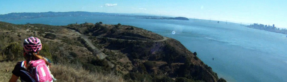
One of the most recognizable landmarks of San Francisco is the Golden Gate Bridge, especially the perspective from the Marin Headlands. The Marin Headlands themselves are beautiful sea cliffs with sweeping views of San Francisco, the Golden Gate Bridge and the Pacific Ocean. The initial climb is a challenge and great training while the descent is extremely steep with sharp turns. It has the perfect mix of beauty and challenge. All of this excitement is accessible with a short ride just across the Golden Gate Bridge.
Three time Tour de France winner Alberto Contador riding the Marin Headlands PHOTO courtesy of Velodramatic.com and IamSpecialized.com
–Trail Ends at mile 8.13 of The Golden Gateway — East Side Wee Fast Fun Route
Difficulty: The climbing is long and steep, but the initial descent is even steeper!
FOR A MORE DETAILED LOOK click here for the full Geoped Map provided by g-map-pedometer.com
Elevation Map for the Route provided by MapMyRide.com
This route starts in the parking lot on the northwest side of the Golden Gate Bridge. This is at the end of the bike side of the Bridge.
The beginning of this path just under 8 miles from the start of the Golden Gateway. The climbing starts immediately out of the parking lot.
At the top of the stop sign, make a left and head up the hill.
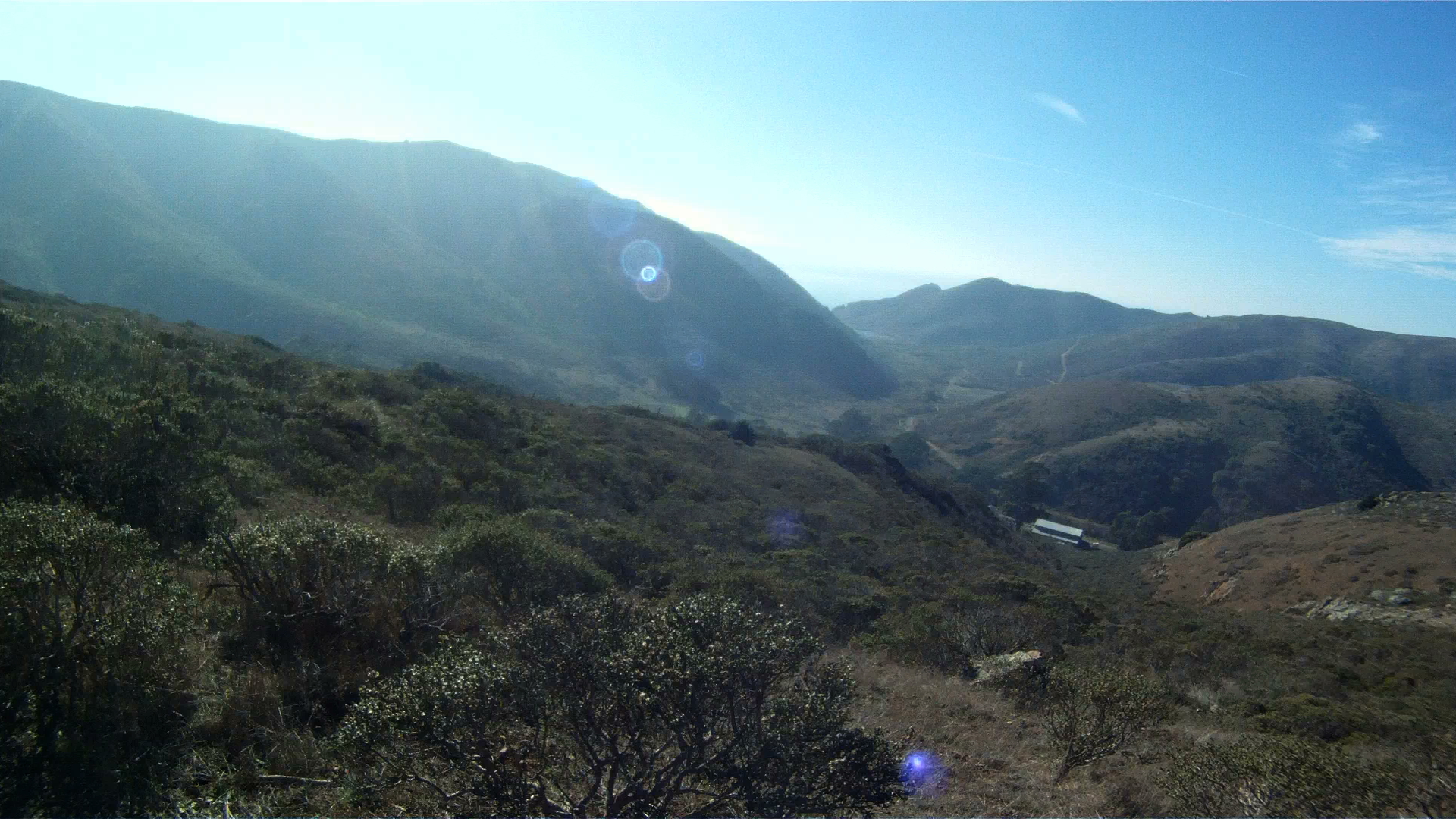
The first part of this climb is he steepest and the toughest. Just keep going and if you need a break, take it to admire the view at the first rest area.
Us taking in the view at the first rest stop
Though less steep, the climbing continues up to the round about.
If you take the first exit of the round about, you will go down McCullough Road toward Bunker Road and back to Alexander Avenue towards US 101 through the tunnel.
Keep going around the round about, and take the second exit to continue up the Marin Headlands.
Keep climbing to get to the top, you have just under one mile to the top.
Take in the scenic views of the Golden Gate Bridge and San Francisco as you are now higher than the bridge’s towers.
The tunnels signal Hawk Hill, the top of the Headlands, where you can take a break and take in the views, wait for or catch up with the rest of your group before turning around, or prepare for the hair-raising descent down the back of the Headlands.
Miko and Jon take in the views from the top of the Marin Headlands
The narrow, one way road is just the beginning of the challenges that face you on the descent down the backside of the Headlands.
The backside of Marin Headlands is not for the faint of heart, cause it’s all downhill from here!
“Hill” is an understatement, but the 18% grade is dead on! You build up speed quickly and two of the first three turns are 90+ degrees! Keep your descending class rules in mind: stay in the drops; just touch your brakes to regulate your speed, don’t hold them; inside knee up to pull your body into the turn; and always keep your eyes up and looking where you want to go because that’s where the bike is going to take you!
After that second right hand turn, the grade reduces but the speed stays high, so make sure to stay on your game.
Though the remaining turns are not as sharp and the grade not as steep, the rest of the way down is still wicked fast!
The descending turns to a short climb as you pass by the lookout point near the Upper Fisherman’s Parking Lot.
The Point Bonita Lighthouse is just up the road past the bunkers.
It is just a short climb before you reach the bunkers and Lower Fisherman’s Parking Lot.
And a couple of more twisties before the main part of your descent is complete.
Turn right at the next intersection to head back to US-101 along Fort Barry Road. If you want to visit the Point Bonita Lighthouse, keep going straight, the road is two-way traffic again past the intersection.
Then another right at the stop sign.
Follow Fort Barry Road down the hill and around the corner, notice the tidal pool and Sausalito Beach to your left.
You will then pass Simmond’s Road and the Marin Headlands Hostel on your right. Keep following Fort Barry Road as it becomes Field Road here.
Follow Field Road through the next intersection as it merges with Bunker Road toward San Francisco.
You are now on the Marin Headlands return route. It’s a slight climb back out to Alexander Avenue towards US-101 from here.
At McCullough Road you can climb back up the Headlands and descend the front side towards the Golden Gate Bridge, or you can keep along Field Road towards Alexander Avenue.
A bit farther down the road is the Bunker Road Tunnel. The tunnel is signal controlled by a stop light.
When the light turns green, head on through.
At the beginning of the tunnel there is a button to signal to the on-coming cars a biker is in the tunnel.
The tunnel is pretty dark, but the main obstacles are the water, mud and slime covering the bike lane. It’s all downhill, but your tires are never totally planted on the road, so be careful going through here.
Once you exit the tunnel, you are just about to the intersection with Alexander Avenue.
If you haven’t gotten your fill of the climbing or descending yet, you can always head back up Alexander Avenue to the Golden Gate Bridge and the beginning of the Marin Headlands to do it all over again by taking the fork to the right.
Or if you are ready to head on to other adventures, take the fork to the left and rejoin the Golden Gateway Trail for the descent to Sausalito.
The Marin Headlands is a challenging ascent and with an absolutely spectacular and breathtaking descent. This is a great route to work on both your ascending and descending skills when you don’t have a lot of time on your hands, or don’t want to travel too far from the city. Keep hydrated on the way up and your head up on the way down!


")