MTB Trail: West Point Inn to East Peak, Mt. Tam, Part 2


Reaching the peak of Mt. Tam is an achievement for any biker, road or mountain.  The second part of the ride from West Point Inn to East Peak is relatively tame, but worth the additional time for the wonderful views and sense of accomplishment.

Map - West Point to Tam

Elevation - West Point to Tam

Length: 1.7 miles (2.7 km)

Elevation Gain: 534 ft (163 m)

Difficulty:  The second part of the climb is very tame with an optional steep grade at the entrace to the parking lot at the East Peak.

GOPR0254-46

At the West Point Inn you will encouter the interstection with Old Stage Road.  Old Stage Road is the trail that will take you back to the ranger station at the intersection of Panoramic Highway and Pan Toll Road as seen in the road bike trail …

GOPR0255-1

From the West Point Inn, continue climbing and go toward the right past the interstection with Old Stage Road.

GOPR0255-2 GOPR0255-4

The climbing continues for just under two miles.

GOPR0256-5 GOPR0256-7 GOPR0256-15

The trail ends at the “saddle” of Mt. Tam.  The “saddle” is the  dip between the Middle Peak and East Peak.

GOPR0256-12

The top of the trail is marked by a gate.

Past the gate is East Ridgecrest Drive.  From the gate, make a right and onto the road.  Follow the road another hundred feet and your big decision of the day presents itself.  There is a bike and pedestrian walking path on your right and the road to the parking lot straight ahead and the entrance to Eldridge Grade Trail to your left.

IMG_7670

Eldridge Grade Trial will take you down the backside of Mt. Tam toward Ross and Fairfax.  Following East Ridgecrest you will encounter a short, 18% climb leads directly to the parking lot and panoramic views all around.  Taking the path winds you below the parking lot directly to the picnic table and bathrooms.  It’s a much easier way to reach the top and just a quarter mile long.

IMG_7673


IMG_7679

To your left, just past the picnic benches is a short path that leads you up to the parking lot, which have sweeping views of the Bay Area.  At this point you’ve reached one of the pinnacle climbs in the Bay Area.

Enjoy the view and get ready for the 8.5 mile descent just ahead of you.

MTB Trail: Old Railroad Grade – Mill Valley to West Point Inn, Mt. Tam, Part 1


GOPR0254-33

Mount Tamalpias (aka Mt. Tam) is the highest peak in Marin County and can be seen from all around San Francisco Bay. Making it to the top on your road bike is a feet as you conquer stage after stage of steep, leg-busting climbs.

However, on a mountain bike the climb to the top is a bit more gentle. It still includes a significant and lengthy climb, but the trail was carved by using the old railroad bed from “The Crookedest Railroad in the World” which took passengers and timber to and from the top of Mt. Tam from 1896 to 1930.

GOPR0254-47

This first part of the trail takes you to the West Point Inn, a stop that has been open since 1904.

The total route is 8.25 miles long with gradients ranging from 4%-7%, and an average grade of 5%. While the significant uphill section is long and winding, the downhill is also steep and fast as the original trail was meant for a gravity train.

Screen Shot 2015-03-12 at 9.24.42 PM

Screen Shot 2015-03-12 at 9.25.15 PM

Screen Shot 2015-03-14 at 5.57.47 PM
Length: 6.51 miles (11 km)

Elevation Gain: 1,704 feet (519 m)

Difficulty: The major challenge to this route is the constant climbing along with some rocky ground. While the pitch doesn’t go above 7%, breaks may be necessary just to keep you moving. This trail is not for beginners, but it can be conquered by mountain bikers with some pretty minimal experience.

Route

This route starts in downtown Mill Valley at the intersection of Throckmorton and Miller Avenue.

GOPR0252

You’ll recognize this intersection from our route, Somewhere Over the Rainbow. This time, make a right on to Throckmorton and then another right onto Corte Madera Avenue.

GOPR0252-1

Next, make a left on to West Blithedale Ave.

GOPR0252-2

Follow West Blithedale for the next mile to Old Railroad Grade.

GOPR0252-3

Make sure to make a left to follow West Blithedale at the intersection with Woodline Road.

GOPR0252-6

Continue along West Blithedale for another half mile.

GOPR0252-9

You’ll see the path entrance on your right through a gate.

GOPR0252-10 GOPR0252-12

Cross over the bridge just past the gate.

GOPR0252-13

The climbing starts now.  If you’re lucky, you’ll have the opportunity to see mountain biking pioneer and legend Gary Fisher as he swoops past you.

GOPR0253

Gary Fisher 1 Zoom

Continue climbing through the wooded fire road as it climbs higher and higher.

GOPR0253

GOPR0253-9

The tree cover will open as you continue climbing.  Watch for the sweeping views.

GOPR0253-1

GOPR0253-19

You’ll then encounter a gate with a bench and then Fern Canyon Road, which is a public road open to cars.  Keep right and continue climbing.

GOPR0253-22

GOPR0254-1

Another mile or so along Fern Canyon Road and you’ll be back on the trail after going through the gate.

GOPR0254-4 GOPR0254-7

GOPR0254-13

A short way down the path you will wind around a couple of 180 degree turns and pass Gravity Car Road.  These are the start the next twisting climbs.

GOPR0254-14 GOPR0254-16

The Gravity Car Road leads back to Panoramic Highway right at the Mountain Home Inn.  If you’re done climbing for the day, this is a good bail out option.

GOPR0254-17

If you are ready to continue climbing, make a right where the trail intersects with the Gravity Car Road to continue climbing as Old Railroad Grade twists and winds around the mountain. 

GOPR0254-20 GOPR0254-30

GOPR0254-34

The climbing will continue for another mile or two until you reach the West Point Inn.

GOPR0254-41 GOPR0254-43

This is a great place to stop, use the “facilities” and take a well-deserved break.  

GOPR0254-45 GOPR0254-46

We’ll pick up from here to take you the rest of the way to the top of Mt. Tam in the next installment.  Stay tuned and have a great ride! 


Trail: ALPINE DAM — Fairfax to Mt. Tam, Hot Damn!


You’ve followed the Coffee Run and ended up in Fairfax, but aren’t ready to head home, what do you do? If you are up for a challenge, it’s time to head west! This route takes you toward Bolinas, up the Seven Sisters and drops you 2.9 miles from the summit of Mt. Tamalpais. If you still have the energy after conquering this much climbing, the route to the summit is detailed in Welcome to the Top of the World. Once you reach the summit with this route, you’ll be on your way to 5000 feet of climbing from the Ferry Building and just over a mile of climbing if you are brave enough and have the energy to make it back to the Ferry Building.
-Distance from San Francisco Ferry Building (see Golden Gateway Trail): 46.46 miles; Distance from Marin Crossroads: 33..05 miles; Distance from Sausalito: 37.07 miles; Distance from Coffee Run: 14.26 miles
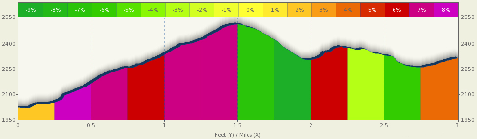
-Climbing on Route: 2,329 feet (710 meters)
-Distance/Climbing remaining to Mt. Tamalias Summit: 2.9 mile/630 feet (192 meters)
-Difficulty: This is the more difficult way to ascend to the top of Mt. Tam with an initial climb 3.5 miles long that is just the beginning of a tough ride that will challenge any experienced cyclist.
-FOR A MORE DETAILED LOOK click here for the full route provided by MapMyRide.com.
-Elevation Map for the Route provided by MapMyRide.com
At the end of The Coffee Run you are left with a question, “Am I feeling up for climbing?”
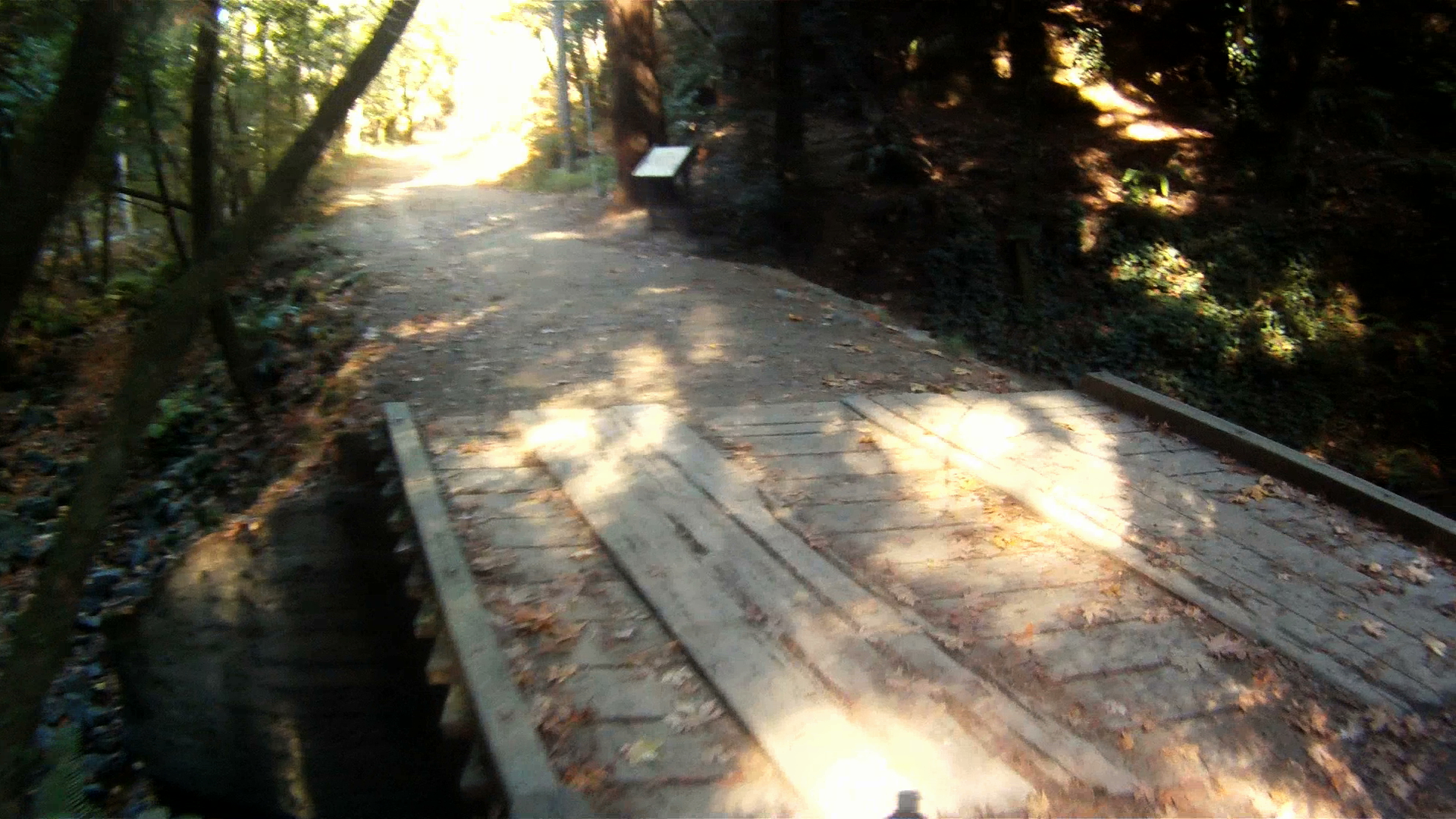
From the Fairfax Coffee Roastery, make a left onto Bolinas Road.
At the stop sign with Cascade Drive and Frustuck Avenue, follow Bolinas Road toward the left and towards Mt. Tam and Alpine Dam.
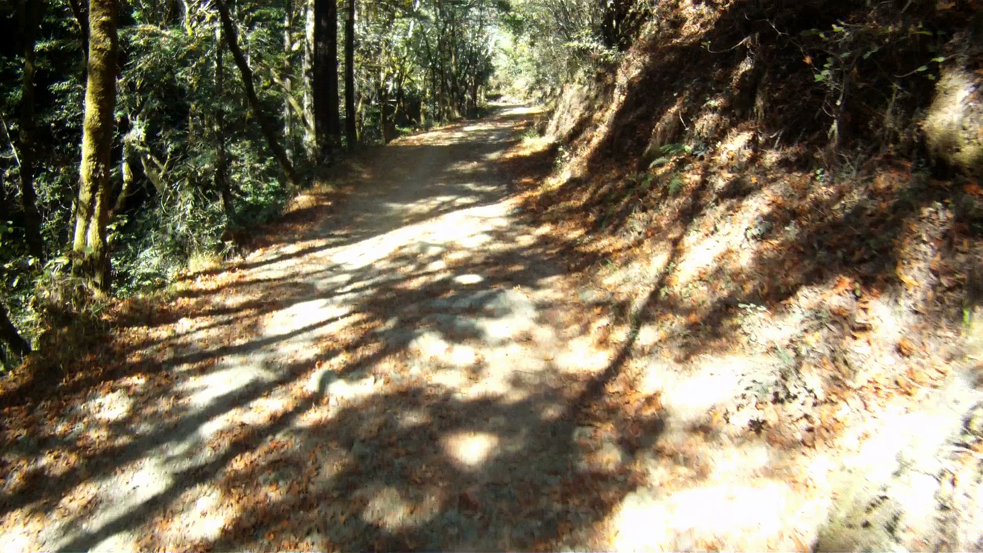
Continue following Bolinas Road as it starts to climb just past Deer Park Villa.
The initial climb is quite steep at the beginning approaching grades of 8% and continues for 3.5 miles with an average grade of 4.5%.
Once you reach the Meadow Club Golf Course you then enter the Mt. Tam Watershed district and are only 0.75 miles from the top of the first climb.  The traffic along the road at this point starts to dissipate.
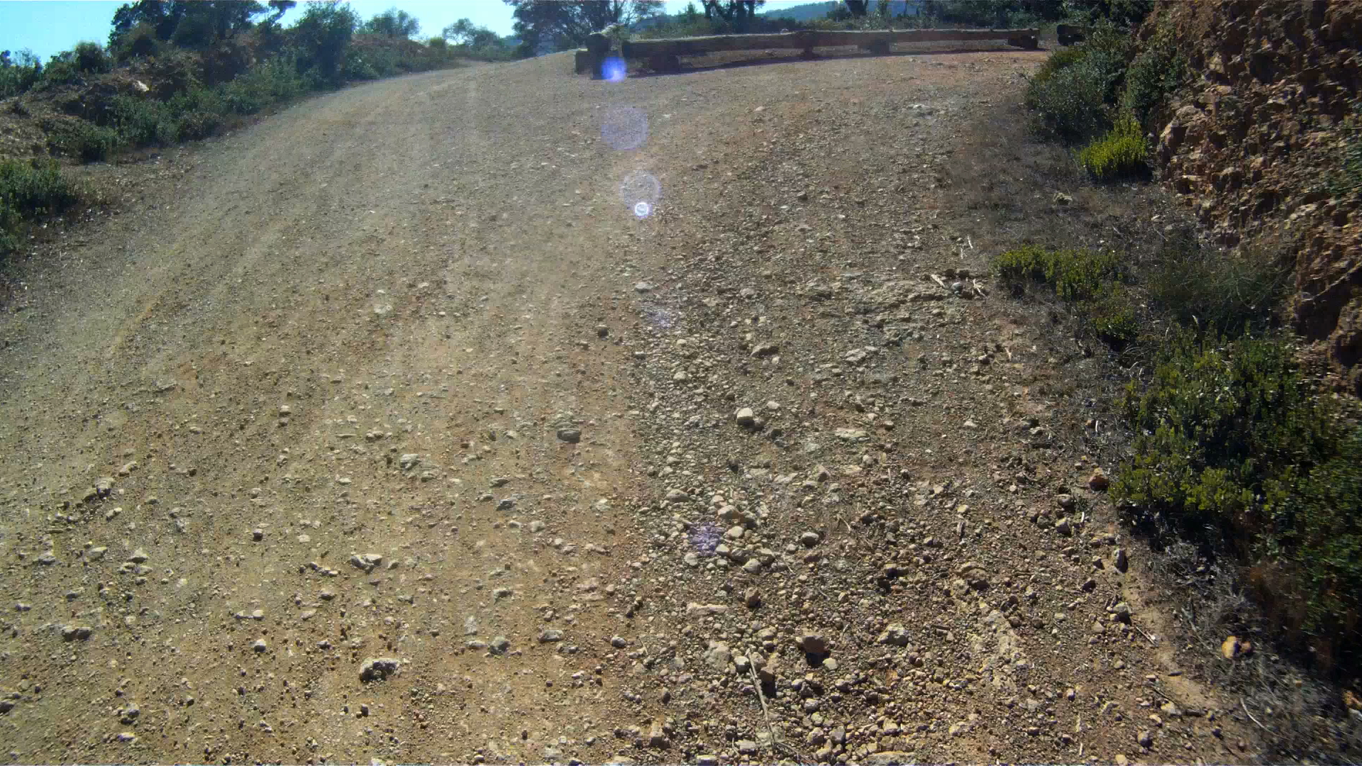
The top of the climb is a parking lot, but just beyond the views of the valley below and Alpine Lake are beautiful.
Follow the road as it descends around hairpin turns and then undulates all the way to Alpine Dam.
Alpine Damn is your last flat road until you return back to the Marin Crossroads.  This is the place to stretch and refill your water bottles before the next climb.
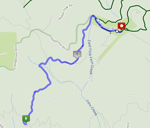
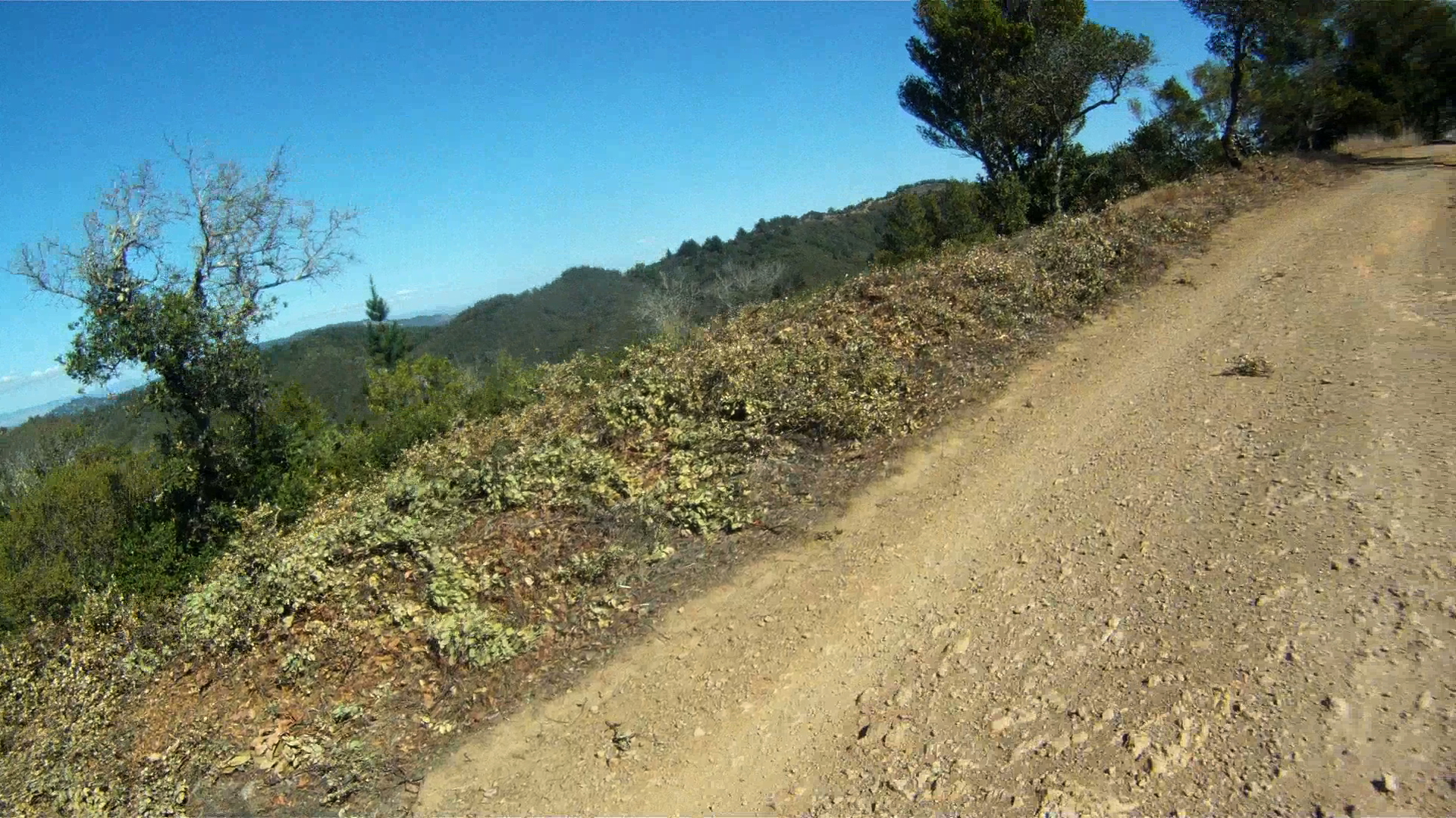
The next climb begins on just the other side of the dam. This second climb is 2.75 miles long and by far the hardest on your way to the summit of Mt. Tam.  It has an average grade of 5.7%, but hovers between 7-8% for most of the climb up to West Ridgecrest Road.
Don’t burn yourself out on this climb, because there is still another two mile climb once you reach the top. Take your time and take in the views.
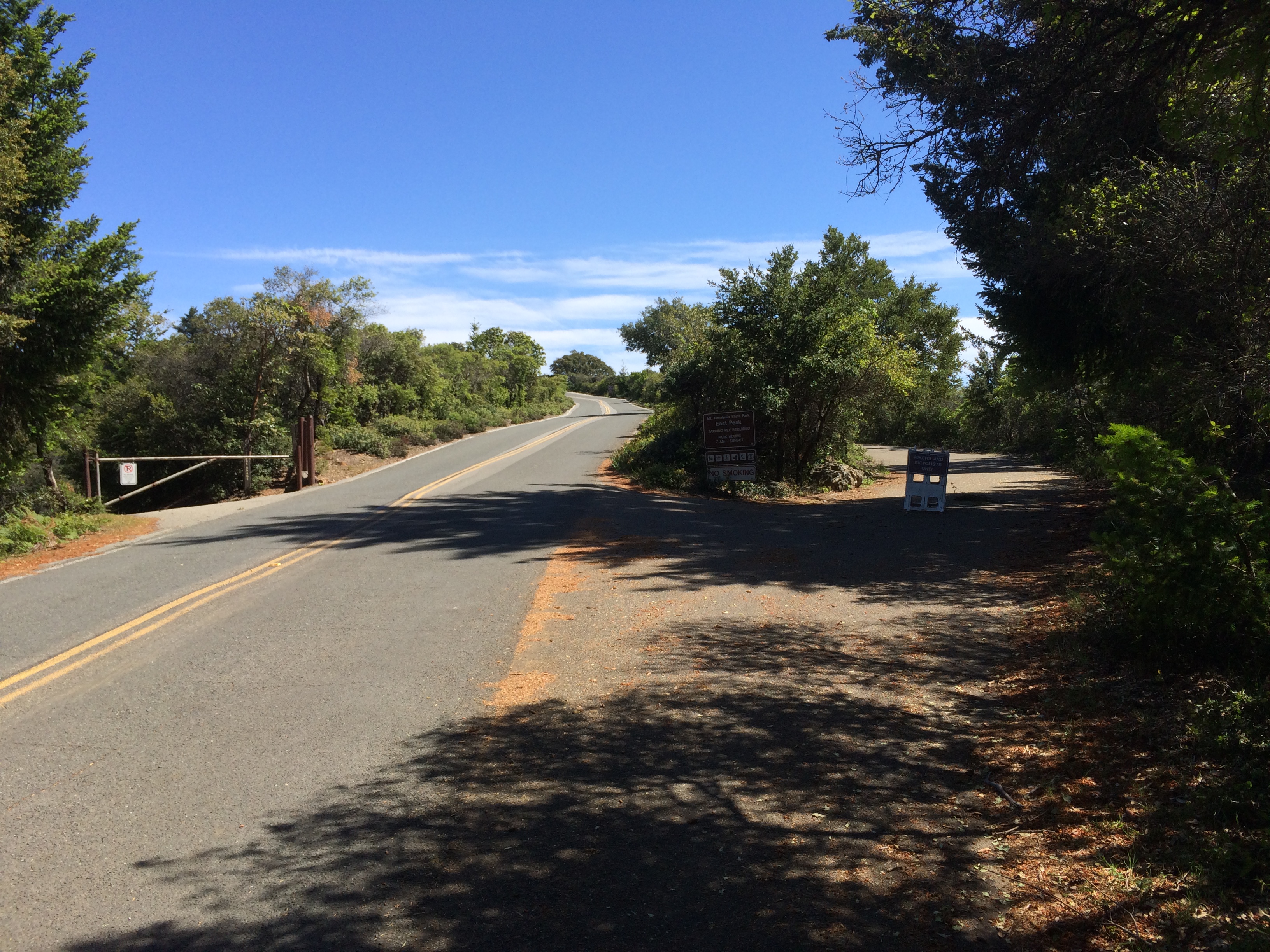
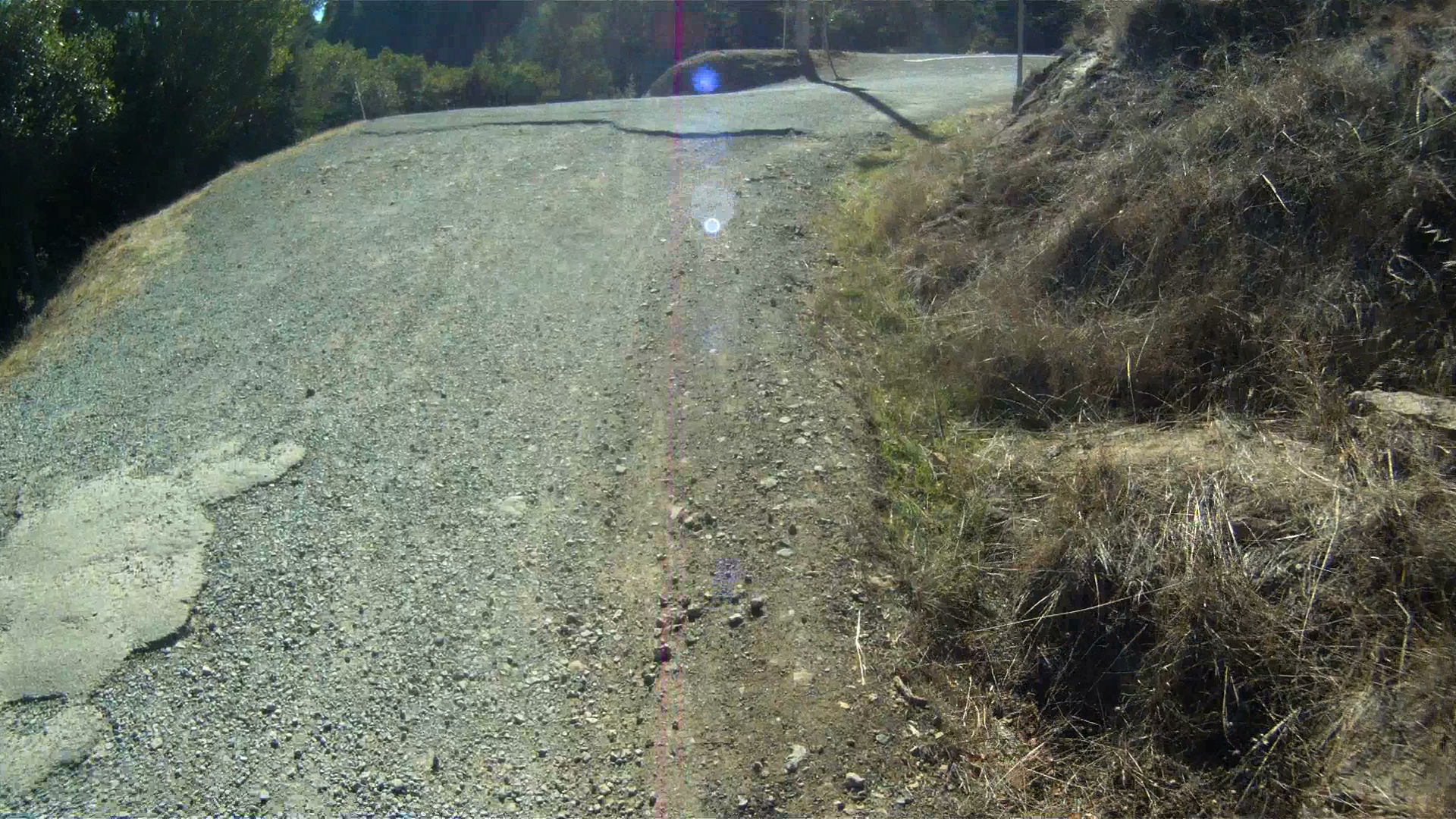
Once you reach the top, take a left onto West Ridgecrest Road.
This is another good place to stop and stretch as the next climb, the climb up The Seven Sisters (aka The Seven Bitches), starts right away.
The climb up The Seven Sisters is not your normal climb. It is a 2 mile long series of upward undulations with an average grade of 3.4%.  There are sections with grades between 5 & 6% towards the last set of undulations.
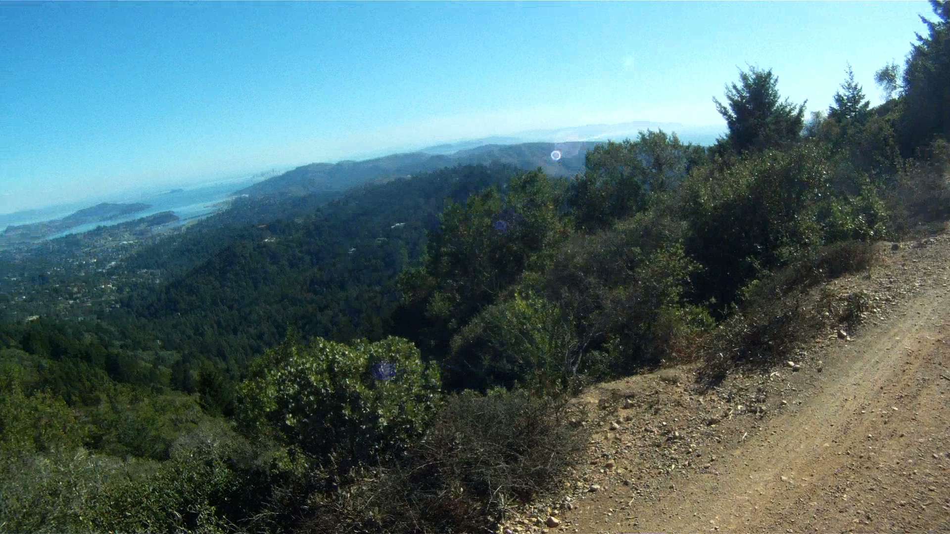
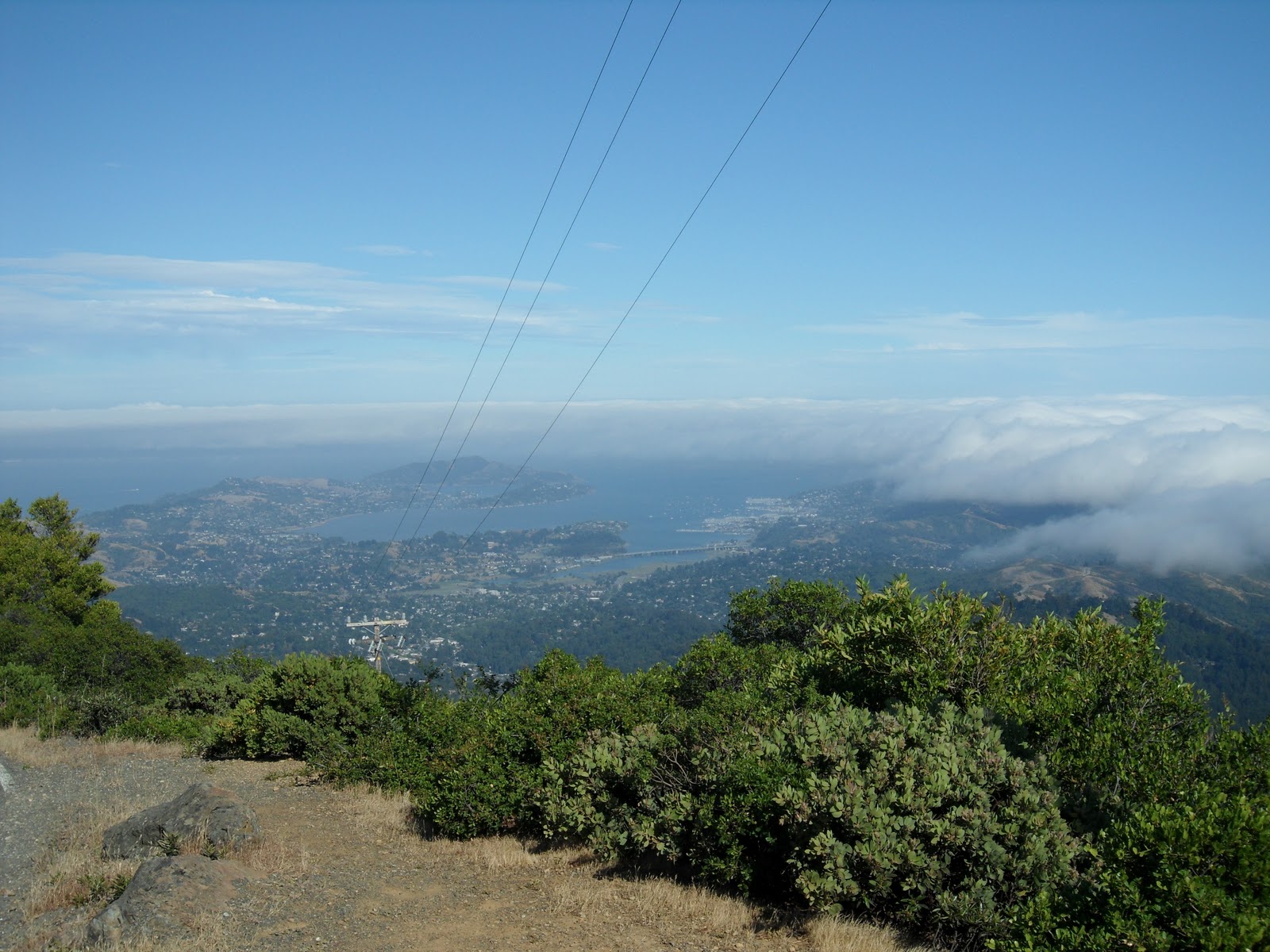
Your legs will beg for relief as you make your way up this series climbs, but the views can’t be beat as you will overlook Bolians Lagoon and Stinson Beach below.
Just before the last climb, there is a great place to take a brake, take in the views and maybe even see some hang gliders as they glide over the ocean.
After a quick break to take in the views, you have one last climb until you reach the intersection of West Ridgecrest Road, East Ridgecrest Road and Pan Toll Road.
Once you reach Rock Springs point you’ve climbed over 2,300 feet from Fairfax alone, if you came from San Francisco you are at over 3,000 feet. Now its up to you to determine whether you have the legs to keep climbing up to the summit of Mt. Tam, or if you want to take a break from climbing and head back to Sausalito where you will meet up with the route from the Three Amigos at the intersection with CA-1.
If you decide to finish off the last 2.9 miles of climbing and summit Mt. Tam, follow East Ridgecrest Road to The Top of the World for the last 630 feet.  This is a challenge after such a tough climb, but the views are well worth it!

Trail: WELCOME TO THE TOP OF THE WORLD – Mount Tamalpais Summit


After Paying the Toll, the summit of Mount Tamalpais is almost within reach.  The last stage of the Mt. Tam assent is grueling and sometimes just plain cruel! The steepness of the first mile will push you to your limits before you reach the first of three peaks.  At the summit, take a breath, enjoy the view and brace yourself for a tough climb back to the first peak before you make the descent back to the Bay.

Distance from San Francisco Ferry Building (see Golden Gateway Trail) 27.42 miles; from the Marin Crossroads 12.99 miles; from Somewhere Over the Rainbow 8.91 miles; from A Panoramic View 4.42 miles; from Paying the Toll 2.99 miles

Difficulty: If you’re not prepared for a tough slog back from the summit as well, you might be spending the night on the mountain!

Climbing on Route: 630 feet (192 meters)

Total Elevation Gain from Marin Crossroads: 2641 feet (805 meters)

Download your route sheet here: Directions – Welcome to the Top of the World

Download your route sheet for the entire Mount Tamalpais Route here: Directions – There and Back Again

FOR A MORE DETAILED LOOK click here for the full Geoped Map provided by g-map-pedometer.com.

Elevation Map for the Route provided by MapMyRide.com

From the top of Paying the Toll, make a right onto East Ridgecrest Boulevard and follow it all the way to the third peak which is the summit of Mount Tamalpais.

Make a right onto East Ridgecrest Boulevard to Summit Mt. Tam

The first peak is the hardest to reach.  This peak is next to the Doppler Radar station at the top of a 1.25 mile climb.  Though less steep than the climbs on Pan Toll Road, this first climb is lengthy and difficult. By the time you finish the first climb, your legs will be Jello!

View from the top of the first peak

Make sure to pause at this first peak and take in the views of Mill Valley below.  Get some energy back as you take the first descent and start making the climb toward the next peak.

Stand and push up the second climb and take another break at the top of the second peak.

The view from the second peak gives you better views of Tiburon and Sausalito

From the top of the second peak, the views of Tiburon and Sausalito get closer.  One last peak to climb before heading back.

Another short descent and the last peak is all that stands between you and the summit.  The last climb is steep.  Once you make it to the summit, take in the views and know you’ve climbed over 2,500 feet on your way to this point!

View of Tiburon, Belvedere, Strawberry, Mill Valley and Sausaltio from the summit of Mount Tamalpais

On a clear day, you can see San Francisco, East Bay and all over Marin County from the summit of Mount Tamalpais.  At over 2,500 feet in altitude, you can see above the fog as it rolls over San Francisco Bay.

The historic Mt. Tam Fire Lookout and Ranger Station

At the summit, you can lock up your bikes and take a stroll up the stairs to the Fire Lookout and Ranger Station.  On a clear day, you can see not only San Francisco and East Bay, but also out to the Farallon Islands (to the west and 25 miles off-shore in the Pacific Ocean) and it’s even been reported that you can see the snow-capped peaks of the Sierra Nevada range 150 miles to the east.  At the parking lot, there are bathrooms and a water fountain at the top so you can relieve and refill.  Enjoy your time at the summit, because once you are ready to go, you have more hill climbing awaiting.

Elevation Map for the Route provided by MapMyRide.com

Another 300 feet of climbing over two more hills looms once you leave the summit of the third peak.  The return to the second peak is a breeze compared to the climb back to the first peak.  The climb to the west peak is almost a half-mile long and is very steep.  Push through this tough climb and then it’s all down hill from there.

Once you’ve gone there and back again, the summit of Mt. Tam allows you have options of where to go next.  You can continue on Ridgecrest Boulevard and head towards Fairfax-Bolinas Road, or you can turn back down Pan Toll Road and go to Mill Valley or Sausalito. If you’re feeling particularly adventerous that day, you can even head to Stinson Beach from where A Panoramic View and Paying the Toll meet. No matter which way you decide to go, after reaching the summit of Mount Tamalpais, you have entered a club with others who have pushed themselves to conquer this beast! Enjoy the journey, but make sure to stop and enjoy the view as well.