As Bike4Breath approaches we here at Team WeLikeToBike are getting ready for our 100k ride. Part of getting ready for the ride is knowing the route and the total ascent we will encounter.
Distance from Life Technologies: 60.3 miles
Total Ascent: 1,532 feet (467 meters)
Difficulty: A few tough climbs with a lot of rolling hills and flats.
The route through the Peninsula will take us by the Bay on a bike path, over US-101, through neighborhoods, past Crystal Springs Reservoir and through parts of the Stanford University campus.
Team WeLikeToBike is getting ready for this ride in our local area over the next couple of weeks by training after work with 50k rides and full 100k rides over the weekend.
You can use a program like Map My Ride or Bike Route Toaster to plan and view your training route, the climbs and get a printout of the directions for your ride. We use a Garmin Edge 800 to keep us on track and record the route as we ride.
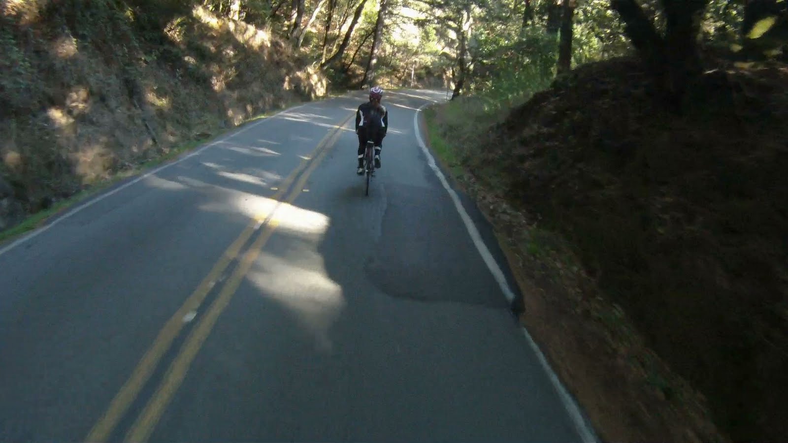
Dream descents are made of open roads, tight corners and beautiful views. Timed correctly, the descent into Muir Woods has all three. Descending from the top of Sequoia Valley Road down Muir Woods Road is an amazing journey. Though not as long as the Stinson Beach descent, Muir Woods is a good way to brush up your descending skills with a long series of technical twists and turns along the 1.5 mile descent. Once at the bottom, there is a rush of endorphins from the wild ride that will carry you the rest of the way to Muir Beach for your return up CA-1.
FOR A MORE DETAILED LOOK click here for the full Geoped Map provided by g-map-pedometer.com.
Elevation Map for the Route provided by MapMyRide.com
The descent into Muir Woods starts at the top of Sequoia Valley Road and the end of Somewhere Over the Rainbow. This is Marin County Bike Route 6.
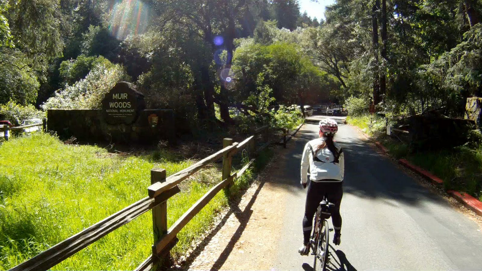
Miko at the entrance to Muir Woods, Panoramic Highway and Muir Woods Drive
From the top of Sequoia Valley Road, cross Panoramic Highway onto Muir Woods Road.
Intersection of Sequoia Valley Road, Panoramic Highway and Muir Wood Road
The descending starts right away.
Entrance to Muir Woods
View from the Top
Round the first corner and the next corner looms in the distance as you are already on picking up speed.
Round the next corner and the snaking road ahead gives you a visualization of the ride you are in for over the next mile and a half.
The road snakes below as you further descend into Muir Woods
This technical descent is all about control in and out of the numerous corners all the way down the side of the mountain. The mental checklist for cornering running through your mind constantly, “find the line, brake before the turn, inside knee up and out, release the brakes so you don’t lock or slide, initiate the turn, counterstear, hit the apex, accelerate out” and half a second later it starts all over again!
Miko executes perfect cornering technique as she leans and counterstears while hitting the apex of one corner and has her head up looking at her path through the next.
After the first relentless set of corners, you get a brief reprieve to catch your breath and can gain some speed.
And then it’s back to high-speed cornering.
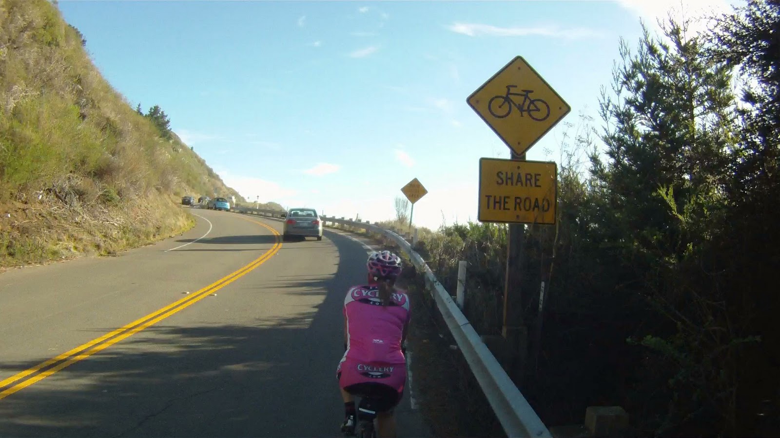
Keep your eyes up to watch for the corners, random pedestrians and cars that are much, much slower than you!
Cars on this road tend to be driven by tourists who can go as slow as 10 mph.
If you get frustrated, you can pull over and give the car a couple of minutes to get ahead of you and start your descent again. No worries if you stop, the grade is steep enough you will pick up speed quickly and be back leaning into the next corner with ease.
Under the canopy, the road starts to degrade and the rough surface makes the descent even more challenging.
Just a few corners left when you see the sign pictured above.
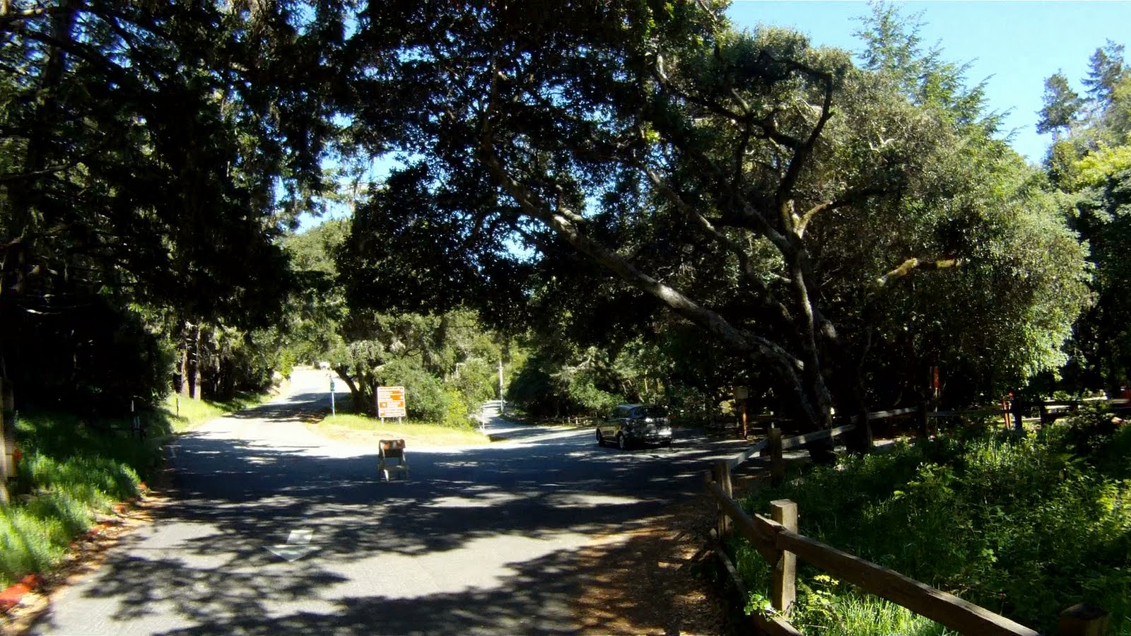
You will then come upon a relatively flat straightaway and the last big turn at the ranger station.
After you round the corner you’ll see the entrance to Muir Woods straight ahead.
And you might even see the car you gave a two-minute head start to at the end of the descent.
Welcome to Muir Woods
Take a break if you need it. Bathrooms are at the end of the parking lot. The descent is over, but there’s still another 2.5 miles until the intersection with CA-1 and Muir Beach.
From the entrance, head to the right.
View from the entrance to Muir Woods
The next part of the journey is relatively flat with a slight downward gradient. Follow the road and you will pass cars parked along the road.
Muir Woods is not only a great descent for cyclists, but it’s also a favorite spot for hikers. Many trailheads merge near the bottom of the descent.
Not long after leaving the Muir Woods entrance, you will enter Mt. Tamalpias State Park.
Just over a mile from the base of the descent you will come upon a couple of houses.
Then the last mile and a half to CA-1, the trees open up into a valley.
The stop sign indicates you have reached the end of Muir Woods Road and Bike Route 6. This is where The Dog Days Are Over and Boom Boom Pow intersect.
Muir Beach and CA-1 South toward Sausalito and San Francisco is straight ahead, while CA-1 North toward Stinson Beach is to the right.
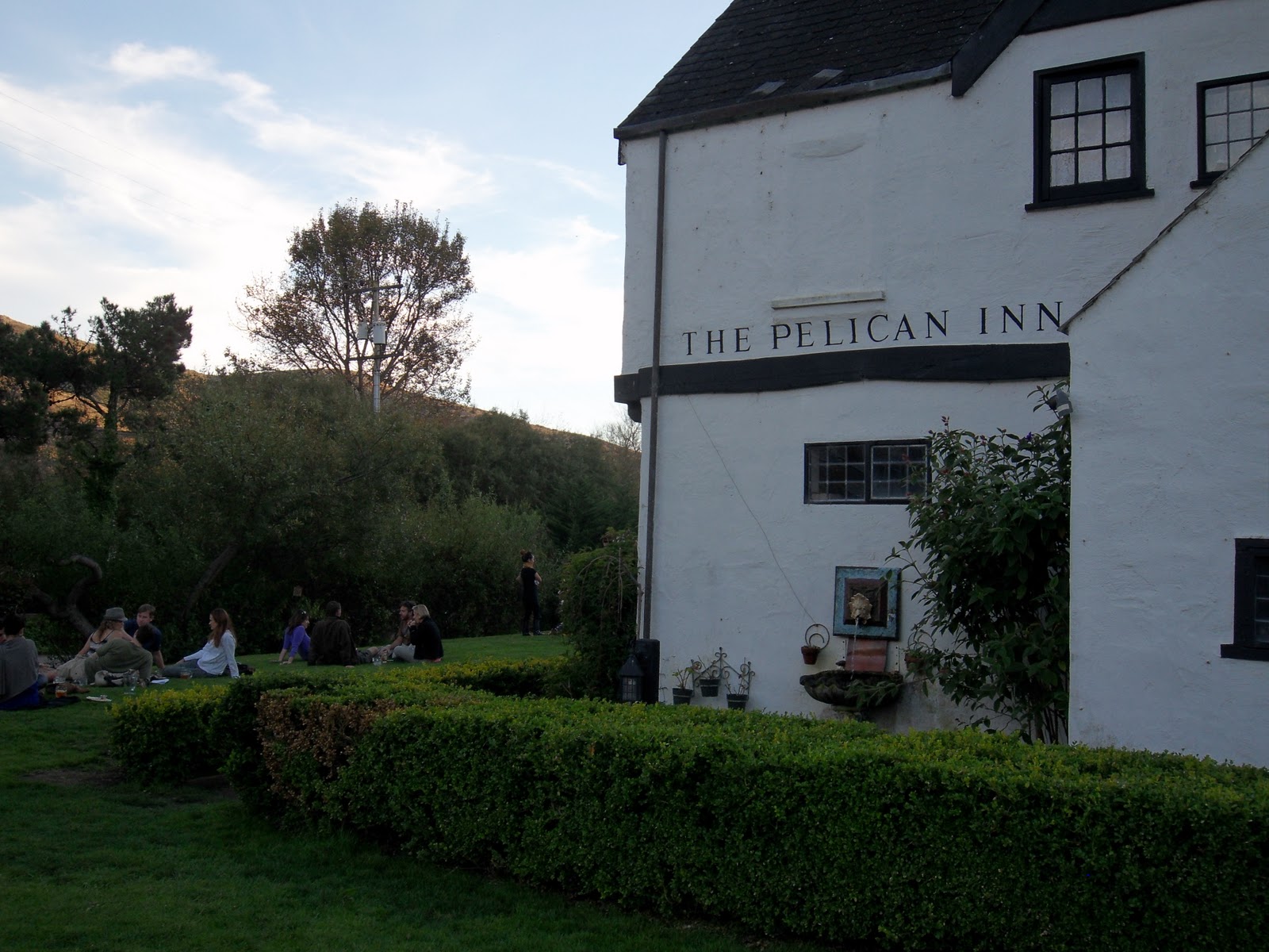
Go straight at the stop sign toward San Francisco and pass by the Pelican Inn.
The Pelican Inn is on your right, just before Pacific Way.
The intersection of CA-1 and Pacific Way in Muir Beach is the end of this journey, but the starting point of the trail that returns you from both Muir Woods and Stinson Beach back to Sausalito.
Whether this is your first time on a technical descent or you are brushing up from a long off-season, Muir Woods is fun and challenging. Though on every bike tourist’s map, you don’t see too many there. The rewards of Muir Woods are not only in the amazing ride and spectacular views, but also in the stories you share with your friends from the ride.
WeLikeToBike.com would like to welcome our friend Kelton to our rides! You have seen him in some of the pictures above, stay tuned for him to take the spotlight as one of our featured stunt people in the video for the return to Sausalito!
Miko and Kelton at the top of Marin Headlands
Kelton and Jon taking a break at the top of Marin Headlands
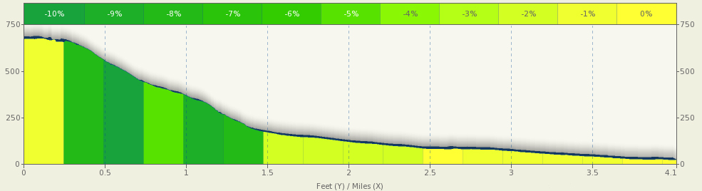
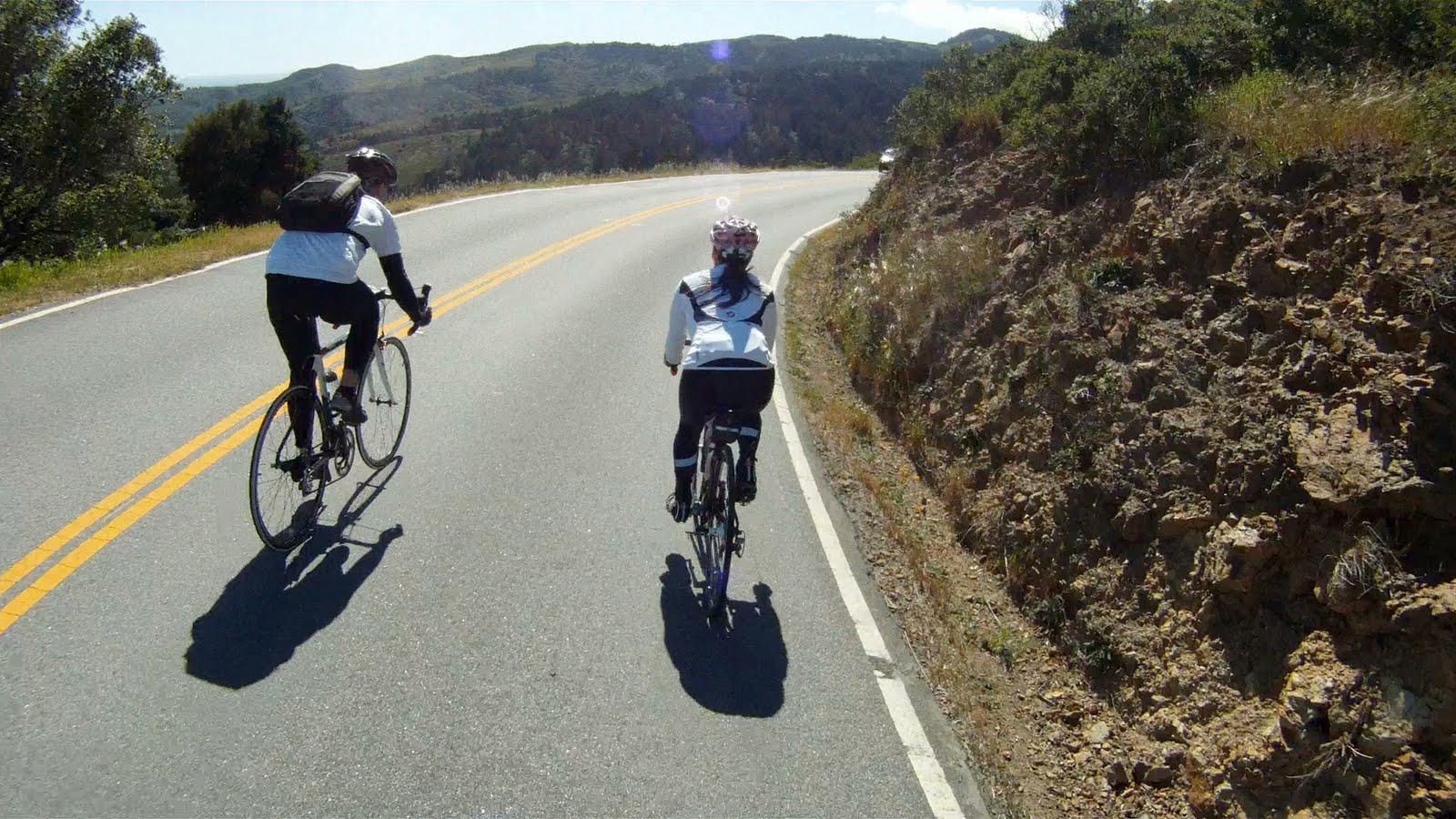
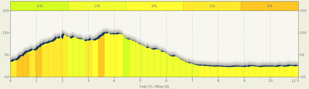
The route from Stinson Beach to Muir Beach takes place along the nicest part of the Pacific Coast Highway where the road is wide and well-paved, and the views are breathtaking. Long climbs followed by gorgeous downhills are the rule. Though the journey to Muir Beach has its share of climbing, it is also filled with picturesque views to distract. This return may not be as challenging as the ride back up Panoramic Highway, but it is definitely more rewarding. After grabbing lunch in Stinson Beach, gear up and enjoy the views of the Pacific Ocean while making your way to Muir Beach and the next stage of the return to Sausalito.
Elevation Map for the Route provided by MapMyRide.com
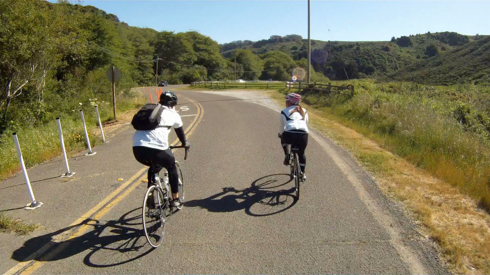
When it’s time to leave Stinson Beach, you have a few options to consider. The first is to continue on to Fairfax-Bolinas Road to the north.
Ride along the main drag of Stinson Beach
You can also return the way you came along Panoramic Highway.
The turn from CA-1 back up Panoramic Highway
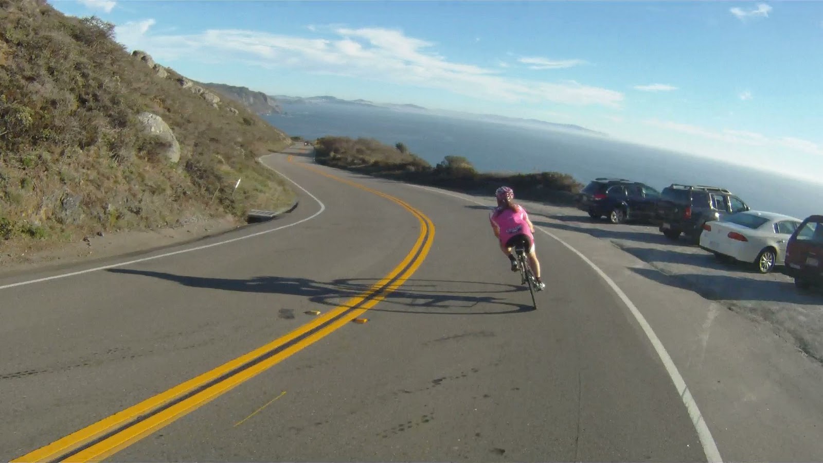
Or you can follow the Pacific Ocean along the scenic Pacific Coast Highway (CA-1) to Muir Beach. If you choose to follow the coast, you are in for a scenic ride.
The beginning of the initial climb along the Pacific Coast Highway
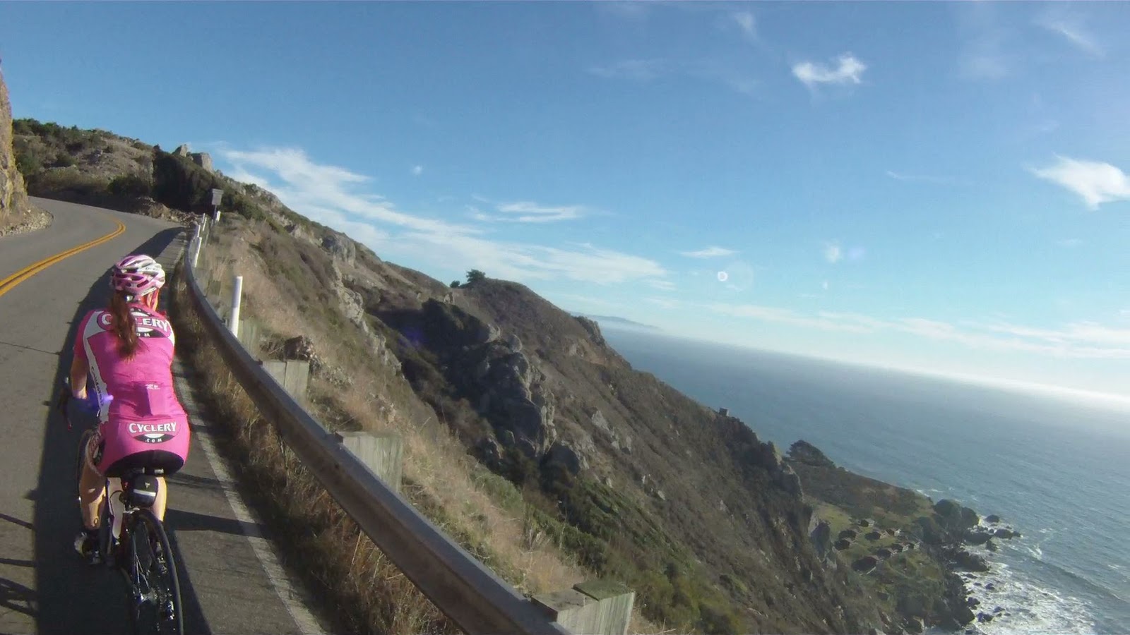
The views of the cliffs, beach and ocean below make the climb much more tolerable.
View along the Pacific Coast Highway
But the views also tempt you to stop and take pictures frequently along the journey.
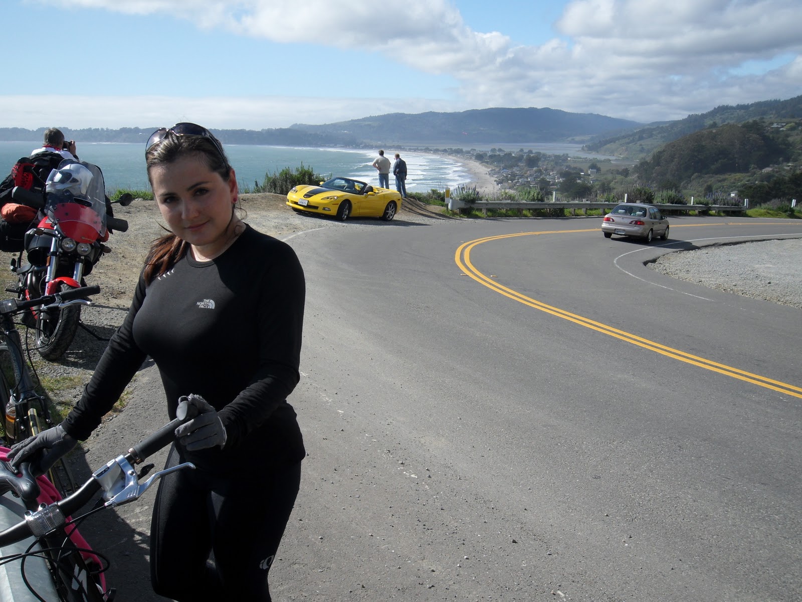
Miko with Vita (our first journey to Stinson Beach was on the hybrids!), a Hertz Corvette and Stinson Beach below
Don’t pause for too long, there’s still a lot of climbing to go.
Along the climb, there are many places to stop, take a break or take pictures. Part of biking in this area is enjoying the natural beauty of your surroundings. Make sure to not miss the incredible views along the ride.
At points along the ride you can see where the coastline juts out into the ocean near Pacifica, more than 15 miles away.
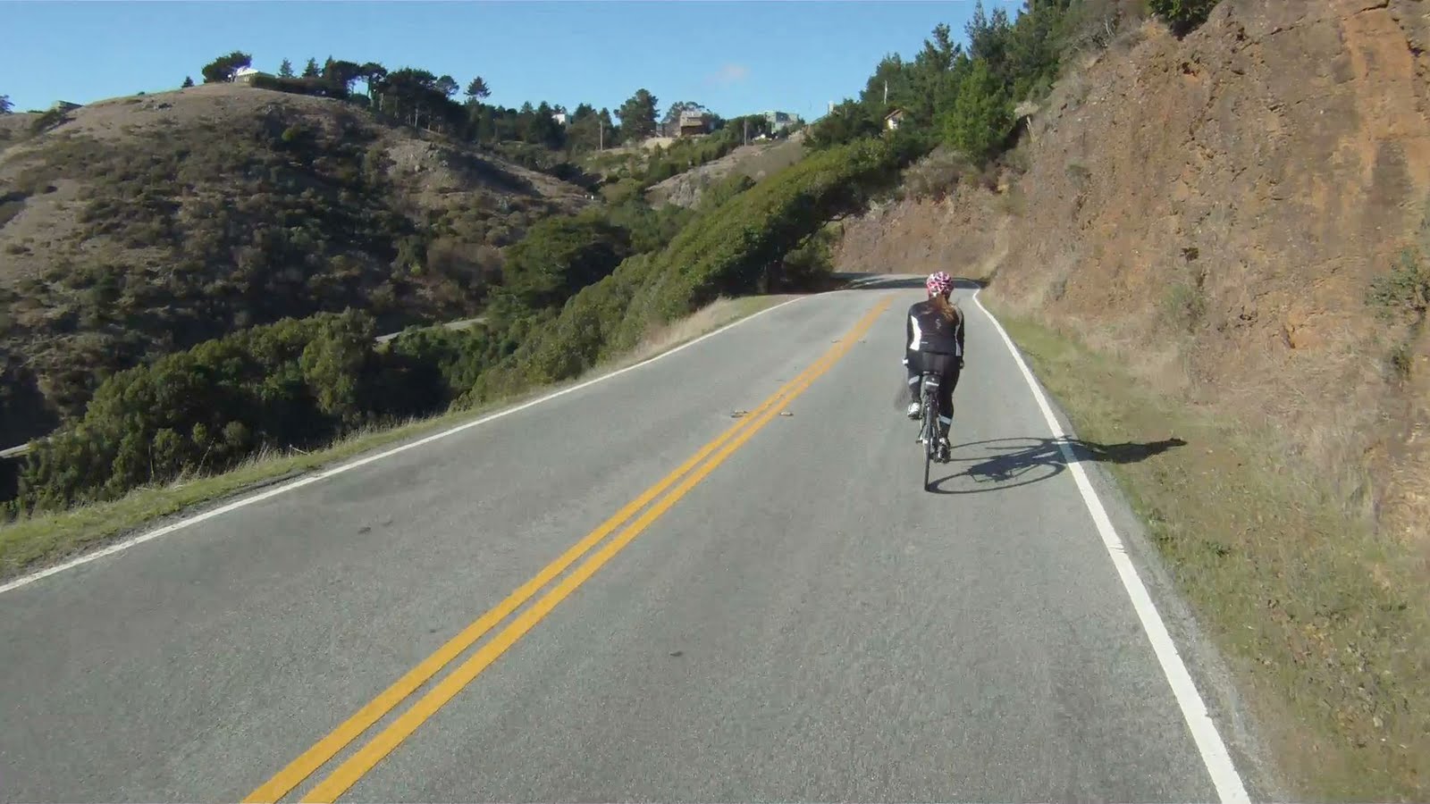
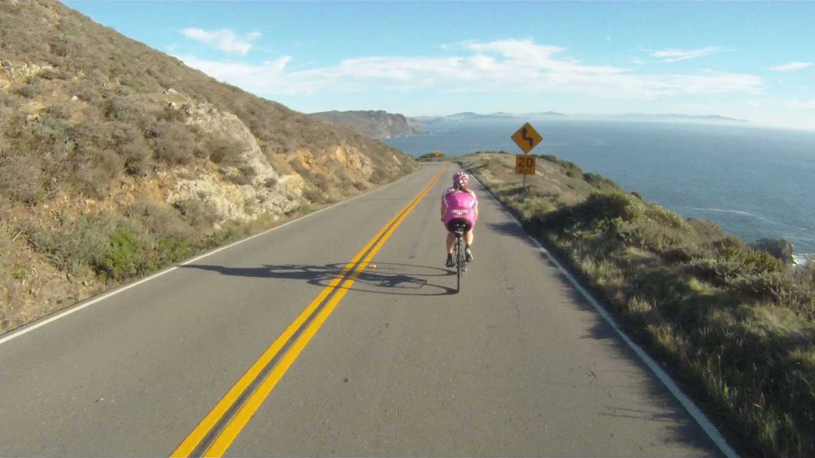
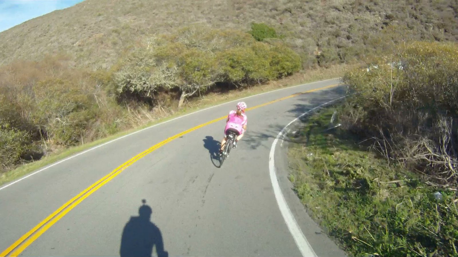
Other points along the journey have the views, but also have the fun of a spectacular downhill.
Though not as technical as the descent to Stinson Beach, these are still fast corners where you can get your tip on.
At the end of this downhill, you have one more climb and a last descent before you reach Muir Beach. The last climb has great views as well, but is a solid 6% grade the entire time with the most difficult section at the end.
On your way back down you will pass the Muir Beach Overlook.
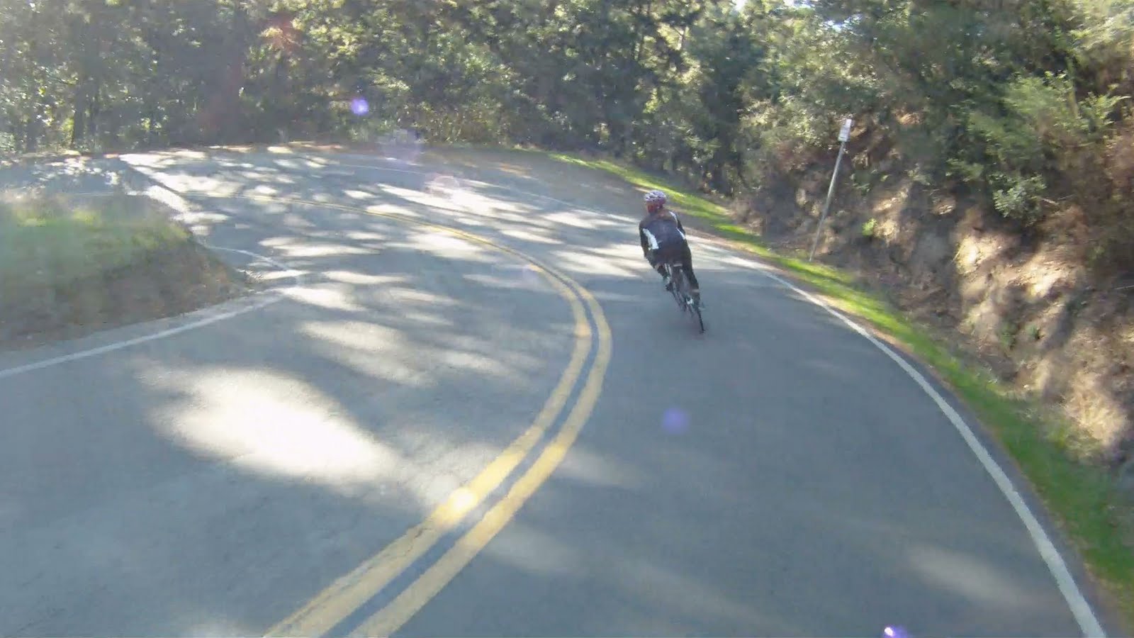
Then it’s game on for the final descent to Muir Beach and more “wee fast fun” corners.
After a curve to the right over a small bridge CA-1 intersects Muir Woods Road. Follow CA-1 to the right towards San Francisco and to Muir Beach.
A quarter-mile or so down the road, you will arrive at the Pelican Inn. The entrance is before the sign, so look for the parking lot on your right. If you see the sign with the pelican…
You’ve just passed the entrance.
The Pelican Inn is owned by the same company as the Mountain Home Inn that was along Panoramic Highway on the climb to Mt. Tam. This is a great place to get some more food, use the facilities or just relax and take a breather before the next stage of your journey.
From the Pelican Inn you can follow CA-1 all the way back to Marin Crossroads and the Sausalito Ferry.
For now, check our video Three Amigos and enjoy the ride.
At the end of The Jaws of Life you have a few choices, follow Paradise Drive to Corte Madera and the Larkspur Ferry Terminal, wait for the ferry in Tiburon or return to Sausalito. “Get A Move On” is a glimpse of what you can expect to see on your ride along The Shark’s Fin – popularly known as ‘Paradise Loop’.
Difficulty: Those comfort bikes are not longer so comfortable after the 20+ mile ride to Tiburon, so this route is typically only for Bay Area bikers and a good workout with the initial climb and the constant rolling hills.
FOR A MORE DETAILED LOOK click here for the full Geoped Map provided by g-map-pedometer.com.
Elevation Map for the Route provided by MapMyRide.com
It is just over eight miles from Tiburon to the Corte Madera Bike Path, but being able to gauge how far you’ve ridden along the Shark’s Fin and how far you have to go is key when attempting to catch the Larkspur Ferry on the weekends. Below are the intersections along Paradise Drive as you ride from Tiburon to Larkspur.
Print out a copy to carry along for the ride.
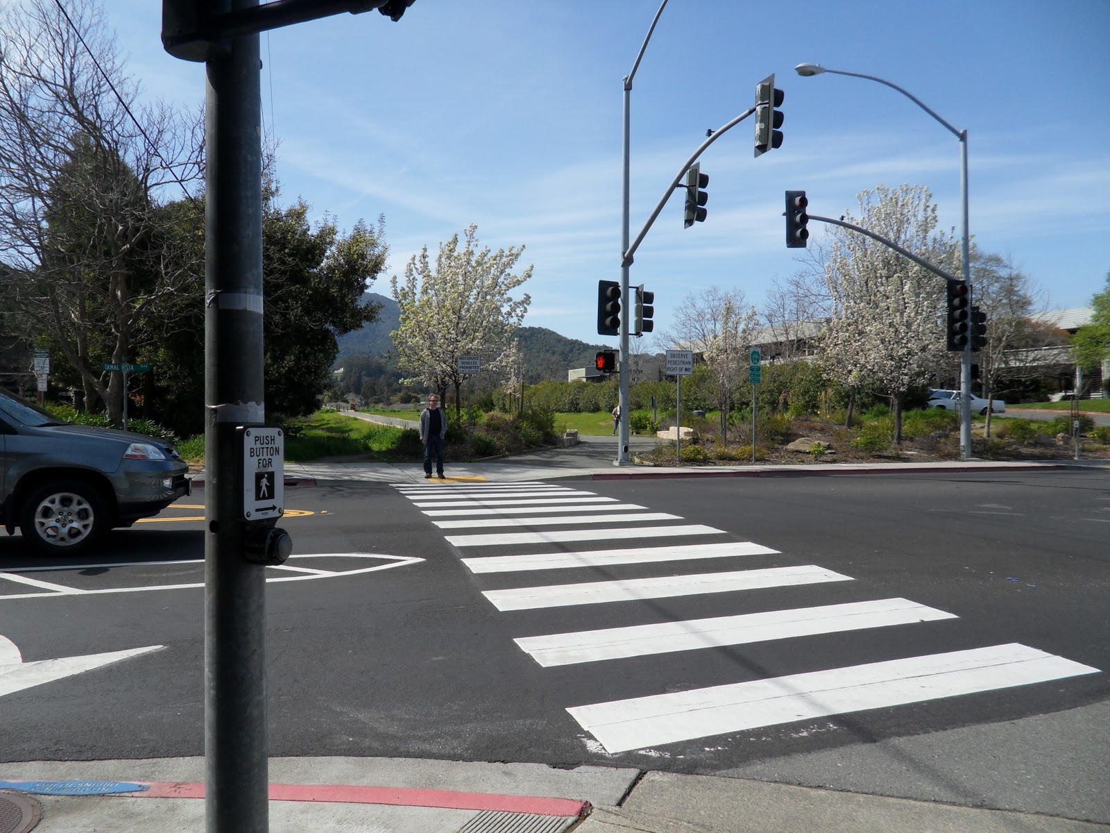
At the intersection of Wornum Drive, cross Redwood Highway and under the US-101 overpass until you reach the intersection with Tamal Vista Boulevard.
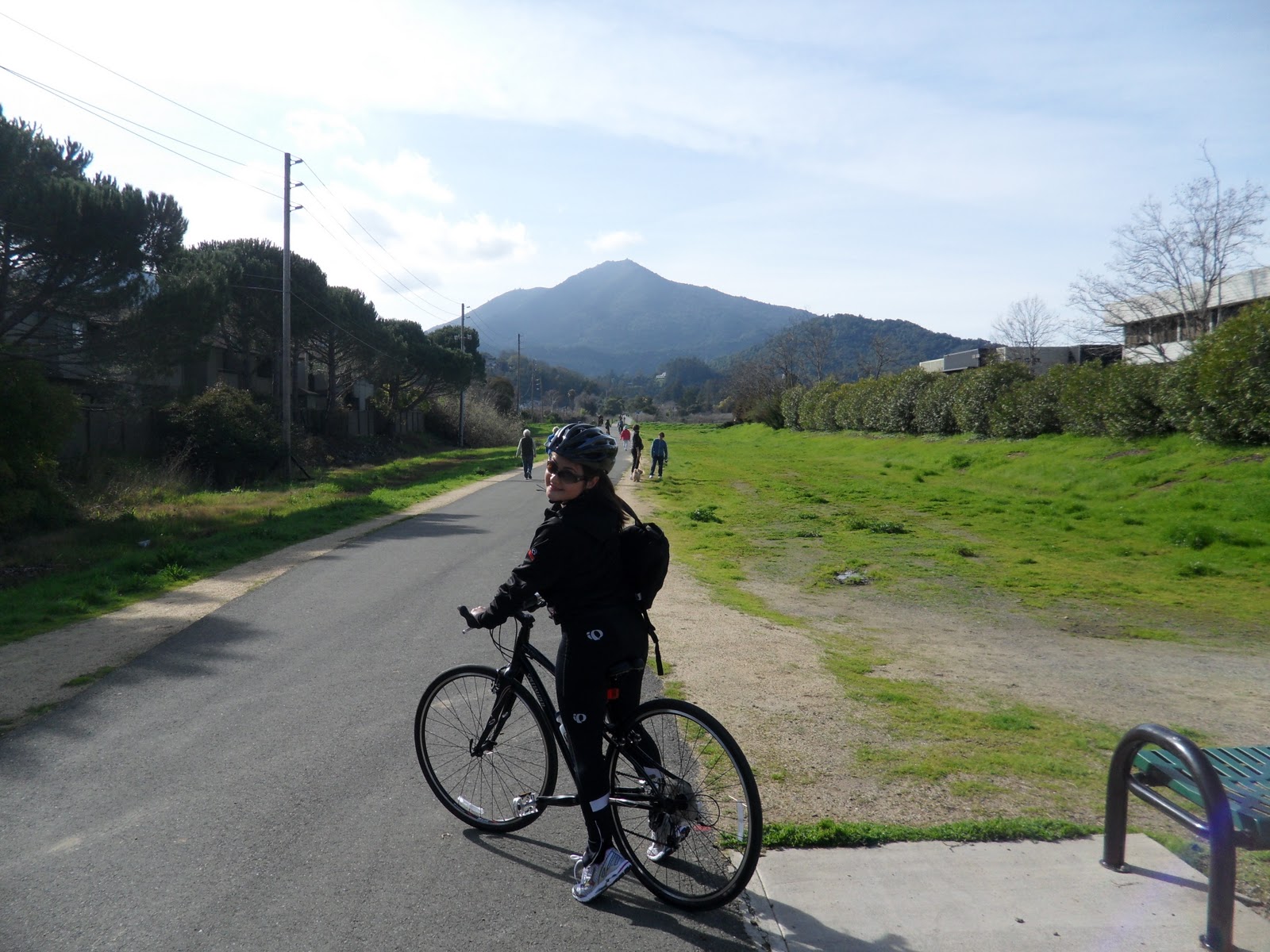
Cross the street and you will be on Bike Route 16, the Larkspur-Corte Madera Bike Path. You will recognize Mount Tamalpais in the background.
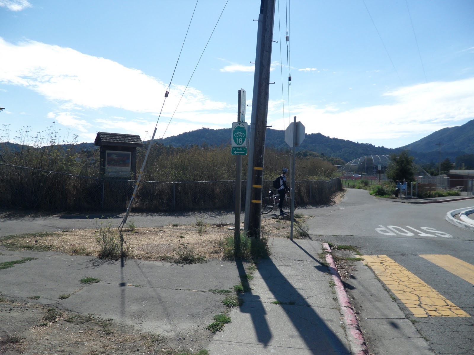
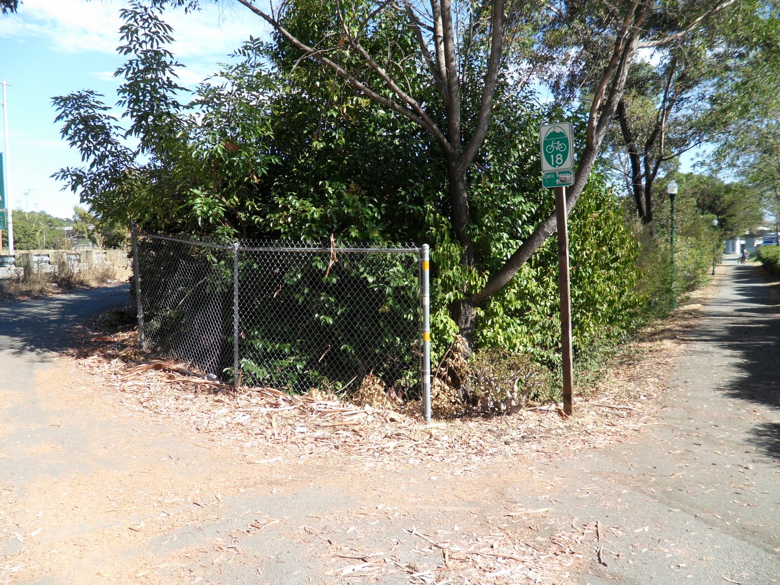
Follow the Route 16 over the bridge and make a right onto Route 18 at the path just over the bridge.
Follow the path to Lucky Drive, where Route 18 makes a right.
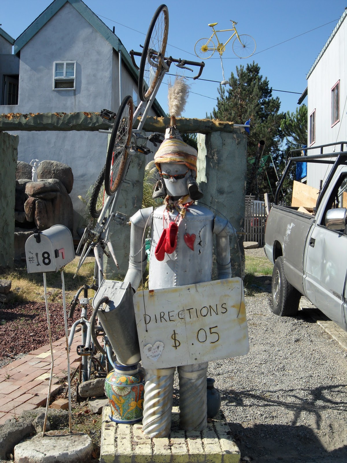
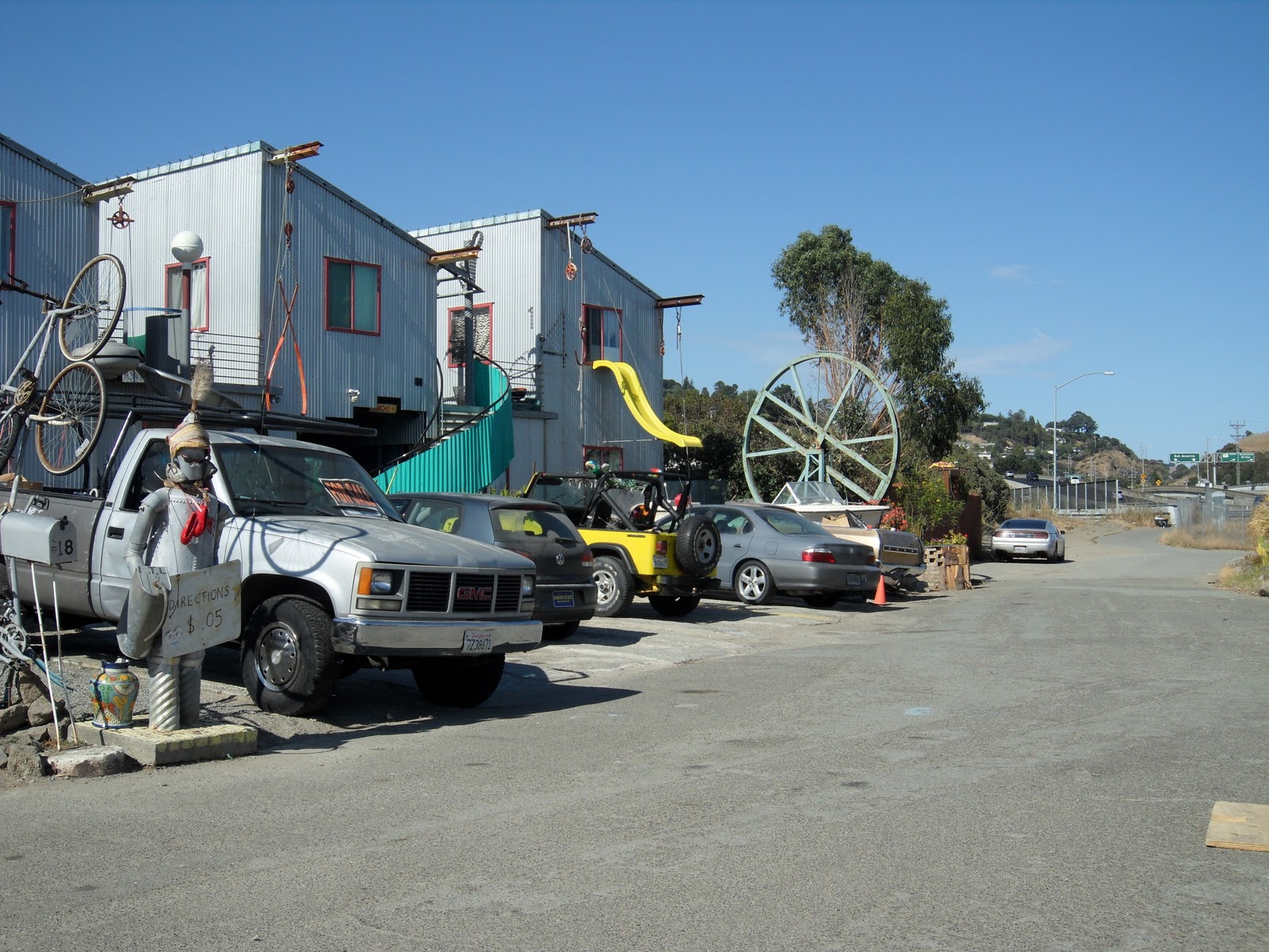
Follow Lucky Drive until you reach the “Bike Boneyard”.
If you deposit $0.05 with the Tin Man, he will let you know to keep going past the end of the culdesac and up the path to the bridge over the river.
Don’t worry, the pavement doesn’t end for bikes, it keeps going over along the bike path over the bridge. At the end of the bridge, make a hard, almost 180 degree, left-hand-turn and keep on Route 18.
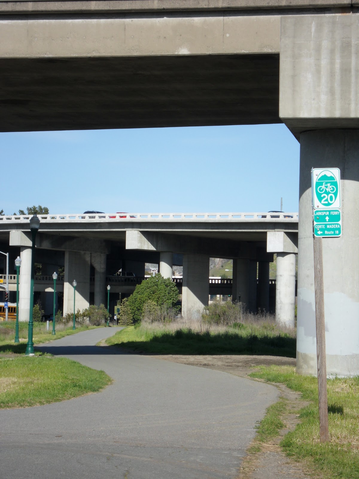
At the end of the path, make a left on to Route 20 towards the Larkspur Ferry Terminal.
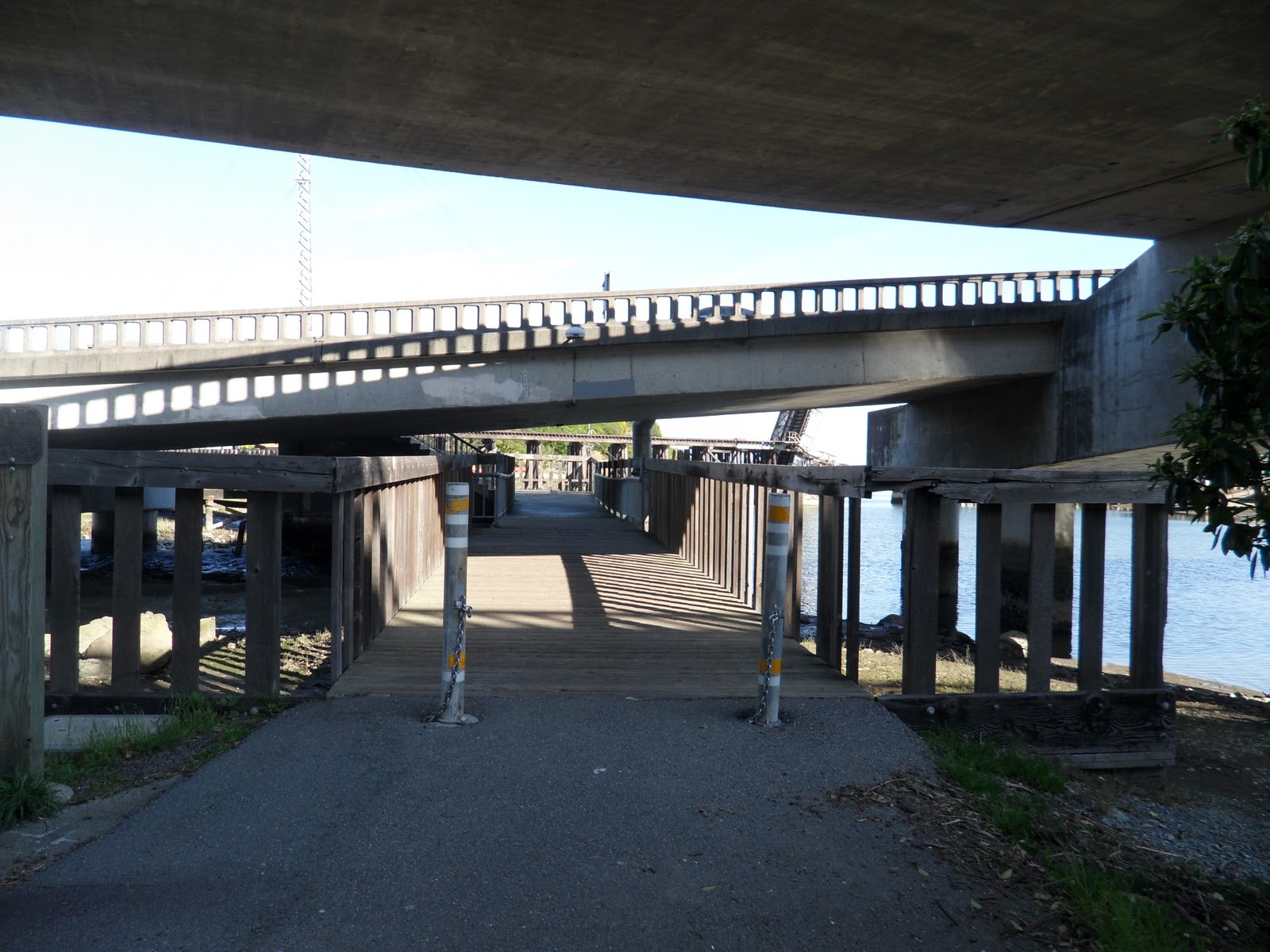
Follow Route 20 under the bridge.
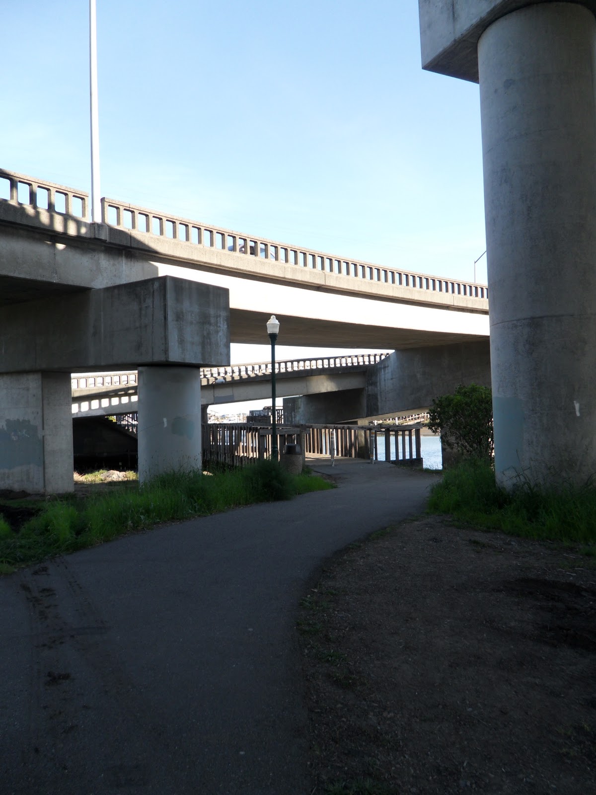
Under the bridge, you’ll follow Route 20 over the wooden bridge.
At the end of the bridge, make a right towards the ferry terminal.
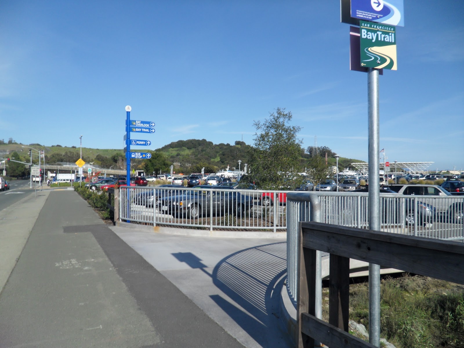
A little ways down the path you’ll see the bike turn in for the Larkspur Ferry Terminal, make a right and follow the path to the terminal ticket booth.
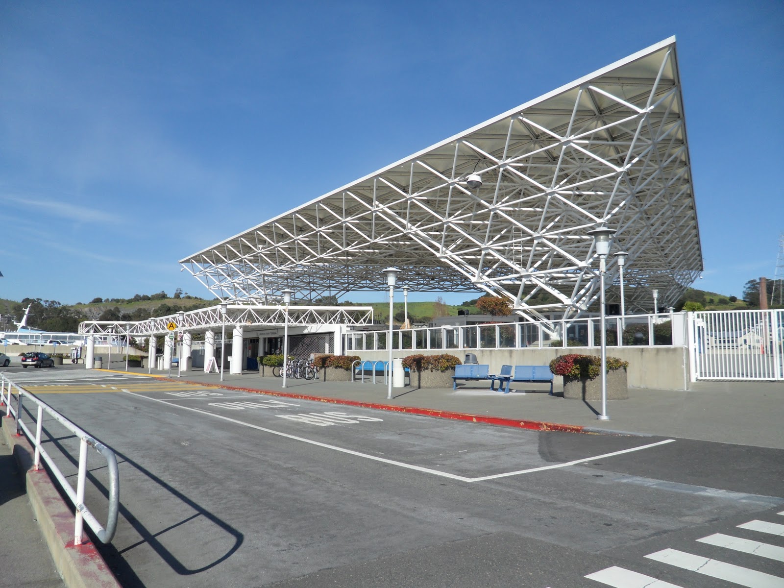
Once at the Larkspur Ferry Terminal, wait on the next ferry back to the San Francisco Ferry Building. The 5:30p.m. ferry on weekends goes through Sausalito, so make sure you check out our article on the Hat Trick.
After completing the Shark’s Fin, relax and enjoy an adult beverage on the ferry ride back to San Francisco. Whether your decide to go back to San Francisco or keep going beyond Larkspur, have a great ride and a wonderful ride back to San Francisco.