Trail: THE SHORT CUT – Cal Park Tunnel – Larkspur Ferry to San Rafael


Have you ever wondered how to get from the Larkspur Ferry Terminal to San Rafael? Use the Cal Park Tunnel! Watch the video and check out the short, flat and easy way to get from Larkspur to San Rafael.

Distance from the Larkspur Ferry Terminal and Larkspur Connection: 2.30 miles; Marin Crossroads: 10.52 miles; Distance from Sausalito: 14.54 miles; Distance from San Francisco Ferry Building (see Golden Gateway Trail): 24.35 miles

Elevation Gain on trail: 157 feet

Difficulty: Whether you are heading home after work, or are going to China Camp to ride, using the Cal Park Tunnel is a short and easy route to make your way to San Rafael from the Larkspur Ferry Terminal.
-Elevation Map for the Route provided by MapMyRide.com
Originally a tunnel constructed in 1884 for lumber and freight trains, the Cal Park Tunnel closed over twenty years ago. It was reopened in June 2010 to pedestrians and bicyclists as part of the North-South Greenway as the most direct route between the Larkspur Ferry Terminal to San Rafael.
The directions in the video will take you from the Larkspur Ferry Terminal to the intersection of Lincoln Avenue and 2nd Street in San Rafael.  This intersection opens the routes to China Camp and Sir Frances Drake Boulevard toward Nicasio and Point Reyes Station.

Trail: LET’S GRAB A BEER — San Anselmo to Marin Brewing Company at Larkspur Landing via San Rafael


San Rafael is the gateway to China Camp and a great way to return to the Larkspur Ferry from Fairfax or San Anselmo. San Rafael is not for the faint of heart! The high traffic environment along 2nd Street requires superb bike handling skills and nerve as there are no bike lanes and the drivers see you as an intruder with no right to the road. If you are not ready for the intense traffic, a slower alternate route through San Rafael is also available.

-Trail Starts at mile 2.9 of the Coffee Run
-Distance from San Francisco Ferry Building (see Golden Gateway Trail): 44.39 miles; Distance from Marin Crossroads: 30.96 miles; Distance from Sausalito: 34.98 miles; Distance from San Anselmo: 6.37 miles.
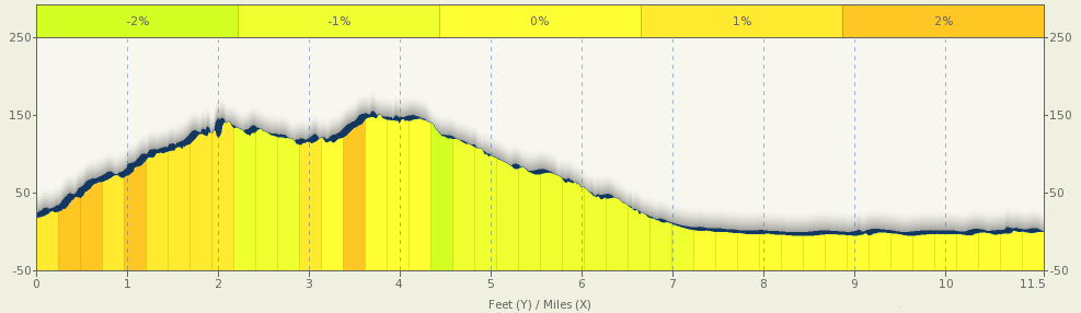
Elevation Gain on trail: 374 feet
Difficulty: Overall, this is not a difficult route, although the traffic is a bit intense through San Rafael along 2nd Street and the last descent along The Dragon’s Spine is quite fast with a short stopping distance at the end. The two alternate routes provide easier alternatives to both potential obstacles.


Starting in San Anselmo a couple of blocks after Marin Coffee Roasters, turn right onto Bridge Avenue toward Route 24 and then make a

Make a right onto Center Boulevard, following Route 24, follow Center Boulevard across Sir Frances Drake Boulevard. Just after crossing Sir France Drake Boulevard, keep following Route 24 and make the jog to the right off of Center Boulevard and on to Greenfield Avenue.

Follow along Greenfield Avenue until just before it reaches the stoplight, make a right along West End Avenue at that point.

Follow the short West End Avenue until it meets with 2nd Street.

At this point you have two options for going through San Rafael. The shorter, more direct route is to merge with 2nd Street and follow along 2nd Street all the way to Lincoln Avenue.

Faster Option through San Rafael

The slower, less intense alternate route, above, is to cross 2nd Street and take 4th Street all the way to Lincoln Avenue and make a right. 

This route has a bit less traffic, but more stop lights. Neither route has a dedicated bike lane, but the traffic is a bit more friendly on 4th Street.

Slower Option through San Rafael

Once you reach Lincoln Avenue, turn right. Follow Lincoln Avenue until it reaches Irwin Street, then make a right on Irwin Street.

The next traffic light is at Anderson Drive, which is your next decision point.

There are distinct options for getting to the Larkspur Ferry from this point, the first is our favorite, while the second is a good option if you are short on time, or have already had a long ride.

OPTION 1: The Dragons Spine

To follow The Dragons Spine, go straight through the light at Andersen Drive and continue to follow Irwin Street.

There is a stop sign at the intersection with Woodland Avenue, follow Irwin Street straight through the stop sign.

You will start a climb along Irwin Street as it winds its way through a residential neighborhood and by Bret Harte Park.

Along the climb Irwin Street becomes Tiburon Boulevard (although you will notice). After 5 to 7 minutes of climbing, it then becomes Via La Cumbre and the fast rolling portion of the ride begins. Via La Cumbre will skirt along the side of a hill with views of Larkspur and US-101 below.

After another short climb you will pass the intersection with Bret Harte Drive.

Stay to the right and stand for the short, but steep climb as Via La Cumbre splits into parallel one way roads.

This narrow residential road has cars parked and driveways to your right, stay in control and watch for cars as you descend the next hill which will roll into another steep climb.

Follow the road as it continues to wind through the neighborhood to the first Stop sign. Go straight through the stop sign and climb the next small, steep hill.

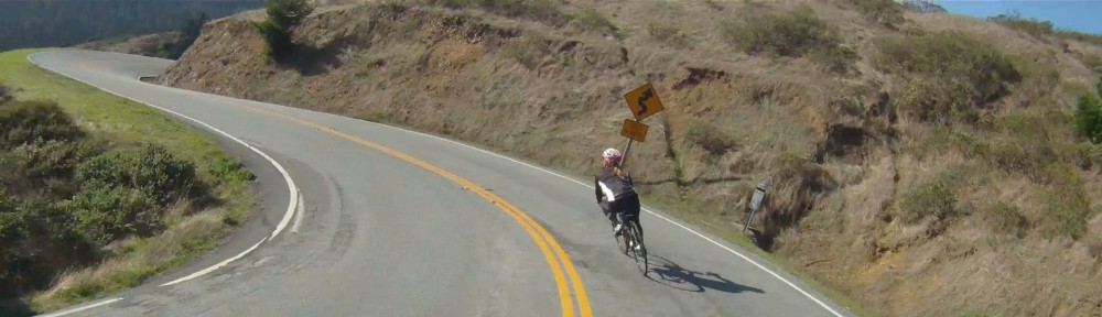
Then when the coast is clear let it rip and see what you can clock on the radar at the bottom!

Stay vigilant though, as cars may start to back out of their driveways around the corner at the bottom of the run.

Then one last climb and a wide open “Wee Fast Fun” hill to go.

Again, wait for it to be clear and then follow the Pink Bomber’s lead and fly down the last of the descents! The next Stop sign is at the bottom of the hill just after the road starts to flatten out.

Be ready to stop at that point as Via La Cumbre intersects the busy Eliseo Drive. Turn left at Eliseo Drive. Eliseo Drive intersects Sir Frances Drake Boulevard at the stoplight.

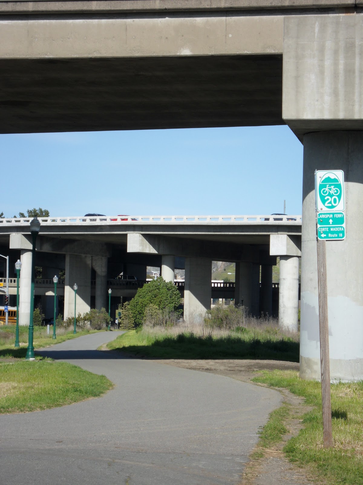
Keep following Eliseo Drive straight through the intersection to the next stop sign. Make a left onto the sidewalk and follow the path into Niven Park.

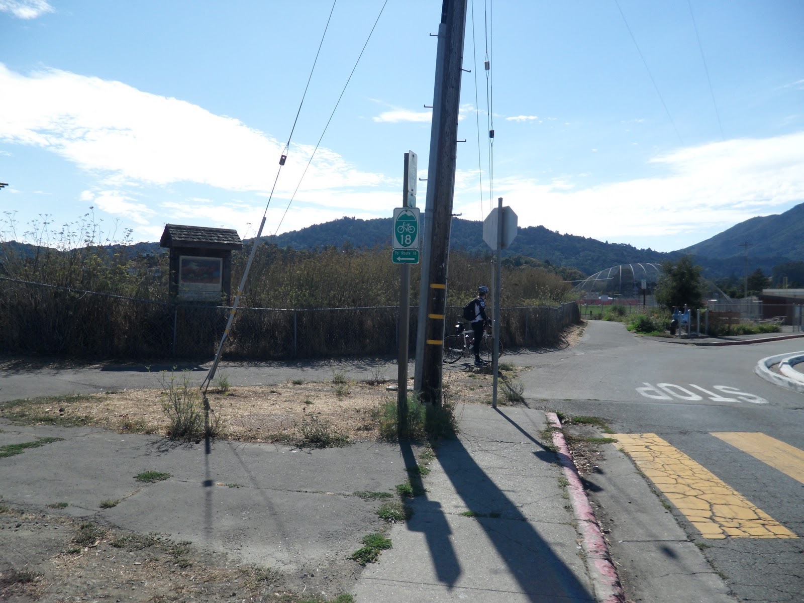
Keep following the path through the park, but watch for dogs off leashes. The path will shortly intersect Bike Route 20.

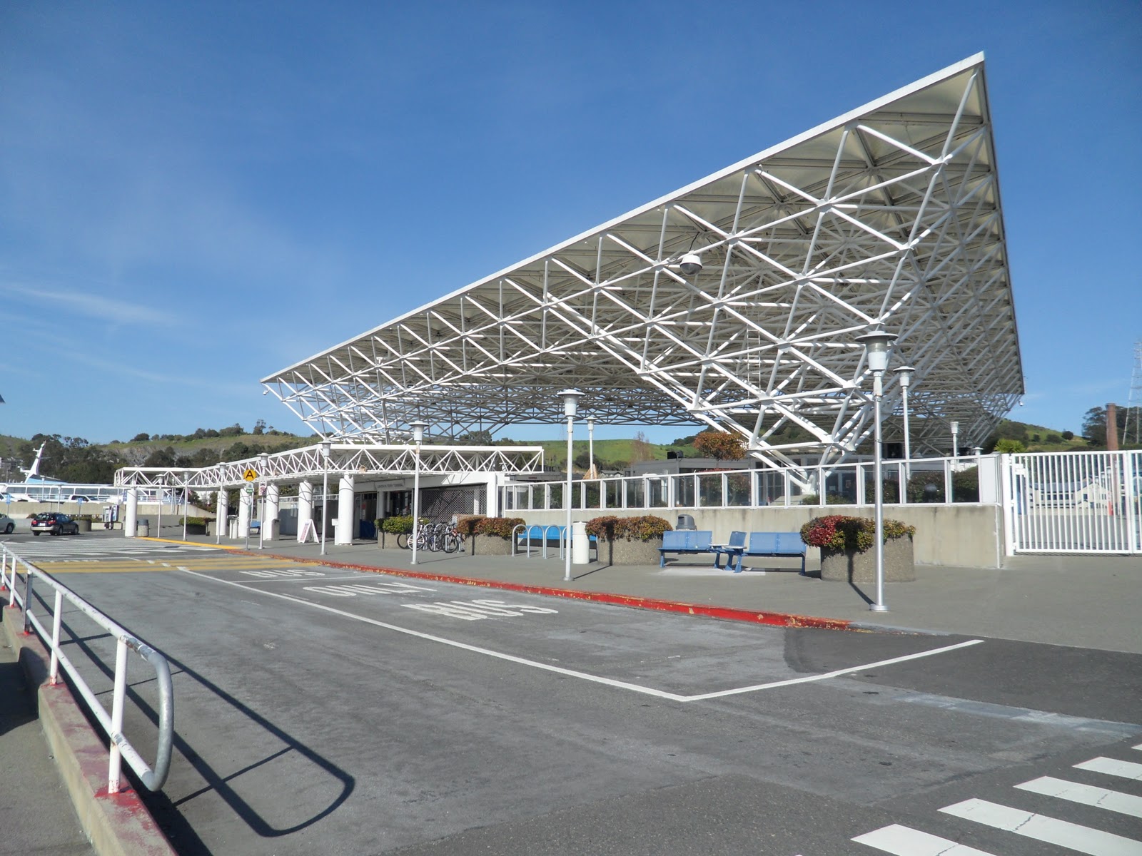
Make a left onto Route 20 and follow it to the Larkspur Ferry Terminal, but don’t turn in just yet. Keep going on the path to the stop light where we will meet with Option 2.

OPTION 2: The Dragon’s Belly

Back at the intersection of Irwin Street and Anderson Drive, to follow The Dragon’s Belly, make a left onto Anderson Drive.

Follow Andersen Drive through lower San Rafael until you reach the bike path entrance just before the intersection with Francisco Boulevard.

Turn onto the sidewalk at this point and follow the sidewalk to the path entrance a couple hundred feet (~70 meters) down the way.

Follow Route 5 onto the Cal Park Hill Path and follow it through the Cal Park Hill Tunnel.

The path will drop you off at the parking lot of the Century Theater at Larkspur Landing.

Turn right into the parking lot, then make another right onto Larkspur Landing Circle.

Follow Larkspur Landing Circle to the stoplight at Sir Frances Drake Boulevard.

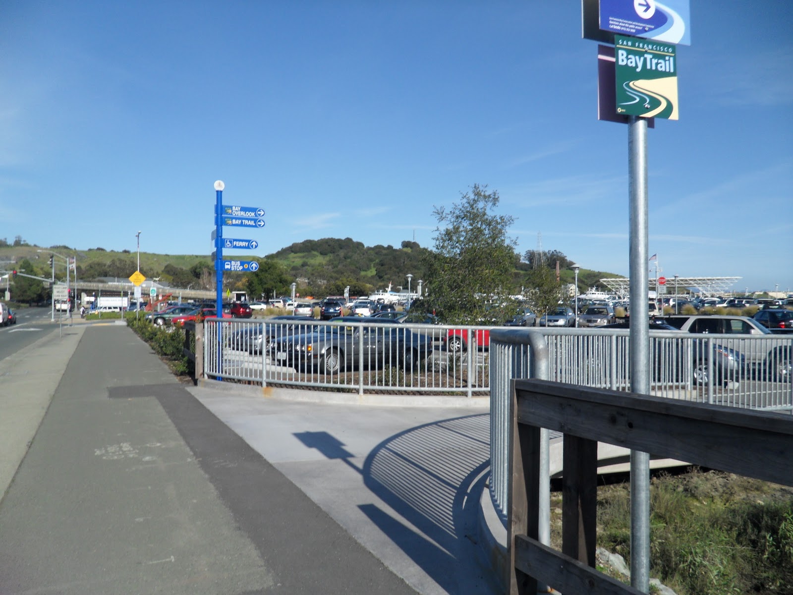
Cross Sir Frances Drake Boulevard towards the Larkspur Ferry Terminal entrance, but veer left onto the sidewalk and path.

This is where Option 1: The Dragon’s Spine and Option 2: The Dragon’s Belly merge.

FINAL LEG: Beer Here!

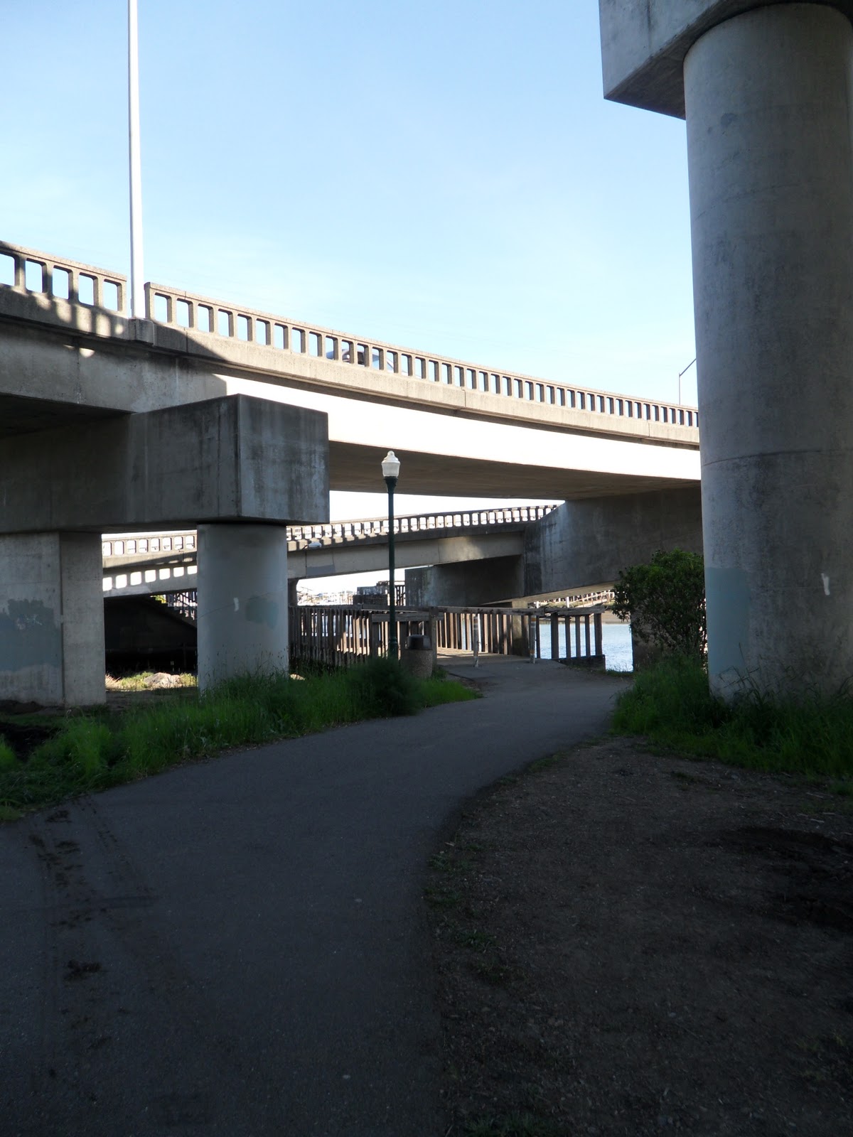
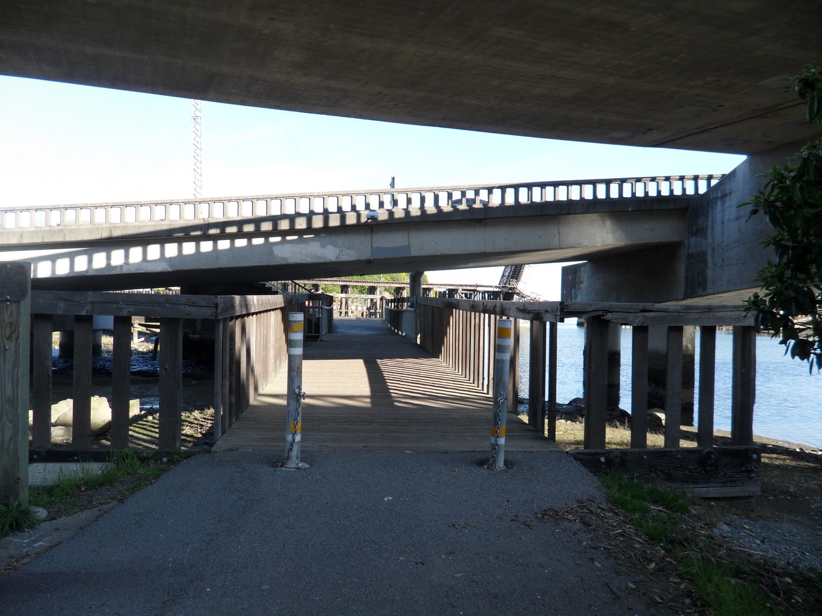
From the stoplight at the Ferry Terminal entrance, follow the path under the pedestrian bridge and then make a quick right.

Where the path meets the base of the pedestrian bridge, make a 180 onto the bridge and follow it over Sir Frances Drake Boulevard.

At the other end of the bridge, cross the road into the courtyard.

Just ahead of you is the Marin Brewing Company.

Stop in to have one of the Brewing Company’s microbrews before you catch the ferry back to San Francisco.

We always enjoy a Mt. Tam Pale Ale or a seasonal brew after a long ride. We also bring any of our friends that join us for a ride.

Being able to return to San Francisco via the Larkspur Ferry is a great way to extend a ride deeper into Marin County. Whether you are hungry for a post-ride meal, have time to kill before the next ferry or just feel like a beer, stopping in at Marin Brewing Company is a great way to meet all those needs. Make sure to say “Hi” if you see us there grabbing a beer!

Trail: THE SHARK’S FIN — Paradise Loop — Tiburon to Larkspur


At the end of The Jaws of Life you have a few choices, follow Paradise Drive to Corte Madera and the Larkspur Ferry Terminal, wait for the ferry in Tiburon or return to Sausalito.  “Get A Move On” is a glimpse of what you can expect to see on your ride along The Shark’s Fin – popularly known as ‘Paradise Loop’.

Distance from San Francisco Ferry Building (see Golden Gateway Trail) 33.76 miles; from the Marin Crossroads 19.33 miles; from Tiburon (see The Jaws of Life) 11.55 miles

Difficulty: Those comfort bikes are not longer so comfortable after the 20+ mile ride to Tiburon, so this route is typically only for Bay Area bikers and a good workout with the initial climb and the constant rolling hills.

Climbing on Route: 308 feet (94 meters)

Download your route sheet here: Directions – Shark’s Fin

FOR A MORE DETAILED LOOK click here for the full Geoped Map provided by g-map-pedometer.com.

Elevation Map for the Route provided by MapMyRide.com

It is just over eight miles from Tiburon to the Corte Madera Bike Path, but being able to gauge how far you’ve ridden along the Shark’s Fin and how far you have to go is key when attempting to catch the Larkspur Ferry on the weekends.  Below are the intersections along Paradise Drive as you ride from Tiburon to Larkspur.

Print out a copy to carry along for the ride.

At the intersection of Wornum Drive, cross Redwood Highway and under the US-101 overpass until you reach the intersection with Tamal Vista Boulevard.

Cross the street and you will be on Bike Route 16, the Larkspur-Corte Madera Bike Path.  You will recognize Mount Tamalpais in the background.

Follow the Route 16 over the bridge and make a right onto Route 18 at the path just over the bridge.

Follow the path to Lucky Drive, where Route 18 makes a right.


Follow Lucky Drive until you reach the “Bike Boneyard”.

If you deposit $0.05 with the Tin Man, he will let you know to keep going past the end of the culdesac and up the path to the bridge over the river.

Don’t worry, the pavement doesn’t end for bikes, it keeps going over along the bike path over the bridge. At the end of the bridge, make a hard, almost 180 degree, left-hand-turn and keep on Route 18.

At the end of the path, make a left on to Route 20 towards the Larkspur Ferry Terminal.

Follow Route 20 under the bridge.

Under the bridge, you’ll follow Route 20 over the wooden bridge.

At the end of the bridge, make a right towards the ferry terminal.

A little ways down the path you’ll see the bike turn in for the Larkspur Ferry Terminal, make a right and follow the path to the terminal ticket booth.

Once at the Larkspur Ferry Terminal, wait on the next ferry back to the San Francisco Ferry Building.  The 5:30p.m. ferry on weekends goes through Sausalito, so make sure you check out our article on the Hat Trick.

After completing the Shark’s Fin, relax and enjoy an adult beverage on the ferry ride back to San Francisco. Whether your decide to go back to San Francisco or keep going beyond Larkspur, have a great ride and a wonderful ride back to San Francisco.

Tips & Tricks: How To Ferry My Bike Back To San Francisco


When cycling across the Golden Gate Bridge and returning by ferry the difference between destination points in San Francisco for the Blue and Gold (Pier 41) and Golden Gate Ferries (Ferry Building) is a simple cycle along the Embarcadero. You will encounter traffic from cars, other cyclists and pedi-cabs, but as you can see the experience is a lot of fun and uniquely San Francisco.

LOTS of bikers wait in line at the ferry terminal in Tiburon

Crossing the Golden Gate Bridge and rolling down one of the “WEEE!” fast fun hills into the peninsula and magical world of Marin bike trails is like traveling down the rabbit hole – just assume there’s no way back, so get to your ferry in plenty of time! The departure time means just that: the ferry leaves . . .  and perhaps you behind. Plan ahead, be mindful of pace and have a later backup ferry in case of a “worst case scenario”, like a flat tire, injury or “Wow I’m pooped!” The awesome fun downhill after the bridge is back-breaking torture uphill. It’s not “impossible”, but the people who do it voluntarily are probably the same ones who enjoy Bikram yoga, fasting and walking over hot coals.

Winding your way down the Weee Fast Fun Hill is one thing, you wouldn’t want to have to walk your bike up it (its 0.75 miles long with an average gradient of 11%!), yes, we’ve done it, but the ferry is always so much more fun!

The DON’T MISS YOUR FERRY

The first thing to remember when taking the ferry back, or planning to, CHECK THE SCHEDULE! 

Find your Golden Gate Ferry schedule here.

And your Blue & Gold Fleet Sausalito schedule here.

Tickets available for sale onboard and at the Ferry Building and Pier 41.

Remember there is a WEEKEND ONLY schedule of the various Marin ferries. 

But BE WARNED. . . not all ferries are created equal! The most important factor in choosing your ferry may depend not just on time and convenience but on how much you cherish your $5000 bicycle, a.k.a. your carbon fiber Mistress of Pleasure.

Put simply, if you were a bicycle would you prefer to stand amongst the neatly stacked bike racks onboard GOLDEN GATE FERRY:

Easy, hands and bikes to yourself parking.

Easy, organized disembarking.

OR

Smashed together in a pandemonium bike massacre onboard BLUE AND GOLD FLEET:

View from the front . . .

On ferries from Larkspur you can hang your bike on hooks on commuter ferries or stack them gently against the inside door with minimal interference on larger boats.

You’ll be instructed on what to do by crew members once you are onboard any ferry, but be prepared AND able to carry the weight of your bike up stairs should this be required of you.

Once onboard it’s relax, unwind and enjoy the scenic ride back with an up close, intimate view of Alcatraz (without having to Escape), San Quentin (from Larkspur), Angel Island and the Golden Gate Bridge with a full bar at your disposal. Ahhhhhh . . .