Trail: CHINA CAMP: San Rafael to San Pablo Bay


China Camp State Park is a short ride from San Rafael and is home to some of the area’s best beginner mountain biking along with tons of wildlife and gorgeous views of the San Pablo Bay. If road biking is more your thing, then China Camp offers you a great ride around the coast of the San Pablo Bay that can be added on to a ride, or can just be a destination for the day.

Distance from The Short Cut: 8.4 miles (16.8 miles round-trip); Larkspur Ferry Terminal and Larkspur Connection: 10.70 miles; Marin Crossroads: 18.92 miles; Distance from Sausalito: 22.94 miles; Distance from San Francisco Ferry Building (see Golden Gateway Trail): 32.75 miles.

Elevation Gain on trail: 312 feet (624 feet round trip)

Difficulty: The ride features an urban ride through San Rafael which gives way to rolling hills and scenic views of San Pablo Bay, out far enough to make it a full day ride, but not so hard to get to a tourist couldn’t make it.
-Elevation Map for the Route provided by MapMyRide.com
Starting at the intersection of Lincoln Avenue and Second Street in San Rafael, the end of The Short Cut or partially through Let’s Grab a Beer, continue north along Lincoln Ave. Basically, follow Lincoln Ave. across Second St., or with the heavy traffic on Second St. if you are coming from downtown San Rafael (the faster route detailed in Let’s Grab a Beer), the safer option is to make a right onto Lincoln Ave. from Second St. and do a U-Turn on Lincoln Ave. and then cross Second St.
Follow Lincoln Ave. to Fourth Street (the route for the slower option detailed in Let’s Grab a Beer), then make a right onto Fourth Street, or continue to go straight if you are coming from Fourth St.
Follow Fourth St. as it crosses over the railroad tracks and under US-101.
Continue to follow Fourth St. until you reach Union St. Make a right at Union St.
Follow Union St. and make a left onto Third St. at the light.
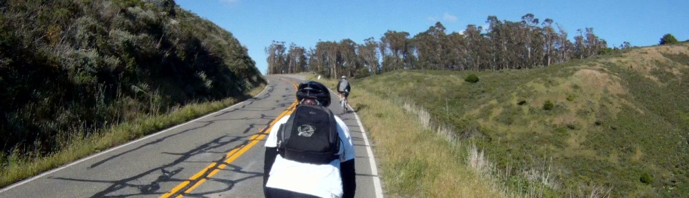
Follow Third St. through San Rafael as it leaves the city and climbs to the rolling hills toward San Rafael Bay. Third Street becomes Point San Pedro Rd. This is Bike Route 24.
Continue to follow Route 24 as it passes by San Rafael Bay with views of the McNear Brickyard along the way.
Just a bit further up the road is McNears Beach. McNears Beach has an outdoor pool, tennis courts, fishing and walking trails.
The hill leading up to and past McNears Beach is a tough climb ranging from 7 to 11%. Fortunately, it’s a short hill, so just power through it and you’ll almost be to China Camp.
After the climb, you get a nice descent to gain some speed as you enter China Camp.
At the entrance to China Camp Route 24 ends and Route 26 begins. Continue through the next 3.5 miles of rolling hills through China Camp. Click here for a map of China Camp.
The first section of China Camp is a bit of a climb as you go by the entrance to the Shoreline Trail and mountain bike paths on your left.
Your first descent takes you past China Camp Point as you round the sweeping left hand curve which leads to Five Pines Point.
Rounding Five Pines Point takes you on a descent with views of San Pablo Bay.
You’ll pass the Ranger Station on your right and then the road levels out for a short stint before climbing up to Weber Point where you can stop and take a short break.
The hills keep coming as you make another climb past Buckeye Point and descend through a couple of “S” curves to the next section of flats and the first section of marshlands.
Continue past Chicken Coop Hill and another entrance to the Skyline Trail will be on your left.
You’ll then pass by Bullet Hill with the Bullet Hill Trail entrance on your left and marshlands on your right.
Another quick rolling hill takes you past Turtle Back Hill with another trail entrance on either side of the road.
The flats after the descent from Turtle Back Hill takes you past the campground entrance on your left.
Once you past the campground entrance, you are just about out of the China Camp. Another mile and a half of flats brings you up to the boat launch area, which is where we typically turn around.
At this point, you have two options for returning back to San Rafael. The first is to turn around and take the same route back to San Rafael.
The second option is to continue along North San Pedro Rd. under US 101, make a left at Los Ranchitos Rd. and Los Ranchitos until it become Lincoln Ave. Continue along Lincoln Ave. until you cross Second St. in San Rafael and then make a right onto Irwin St. You will then meet up with Let’s Grab a Beer or The Short Cut and head back to Larkspur.
We typically turn around and take the scenic route through China Camp back to Larkspur. It’s a nice ride with a lot less traffic. If you decide to turn around as well, follow the road and once you get to San Rafael, continue on Third Street until you reach Lincoln Avenue, then make a left on Lincoln Ave. Follow Lincoln Ace. as described above and you’ll be back to Larkspur in no time.
No matter if you are looking to add some extra miles, or have just never been past San Rafael, China Camp is a great place to cycle.
Happy Thanksgiving!

Trail: ALPINE DAM — Fairfax to Mt. Tam, Hot Damn!


You’ve followed the Coffee Run and ended up in Fairfax, but aren’t ready to head home, what do you do? If you are up for a challenge, it’s time to head west! This route takes you toward Bolinas, up the Seven Sisters and drops you 2.9 miles from the summit of Mt. Tamalpais. If you still have the energy after conquering this much climbing, the route to the summit is detailed in Welcome to the Top of the World. Once you reach the summit with this route, you’ll be on your way to 5000 feet of climbing from the Ferry Building and just over a mile of climbing if you are brave enough and have the energy to make it back to the Ferry Building.
-Distance from San Francisco Ferry Building (see Golden Gateway Trail): 46.46 miles; Distance from Marin Crossroads: 33..05 miles; Distance from Sausalito: 37.07 miles; Distance from Coffee Run: 14.26 miles
-Climbing on Route: 2,329 feet (710 meters)
-Distance/Climbing remaining to Mt. Tamalias Summit: 2.9 mile/630 feet (192 meters)
-Difficulty: This is the more difficult way to ascend to the top of Mt. Tam with an initial climb 3.5 miles long that is just the beginning of a tough ride that will challenge any experienced cyclist.
-FOR A MORE DETAILED LOOK click here for the full route provided by MapMyRide.com.
-Elevation Map for the Route provided by MapMyRide.com
At the end of The Coffee Run you are left with a question, “Am I feeling up for climbing?”
From the Fairfax Coffee Roastery, make a left onto Bolinas Road.
At the stop sign with Cascade Drive and Frustuck Avenue, follow Bolinas Road toward the left and towards Mt. Tam and Alpine Dam.
Continue following Bolinas Road as it starts to climb just past Deer Park Villa.
The initial climb is quite steep at the beginning approaching grades of 8% and continues for 3.5 miles with an average grade of 4.5%.
Once you reach the Meadow Club Golf Course you then enter the Mt. Tam Watershed district and are only 0.75 miles from the top of the first climb.  The traffic along the road at this point starts to dissipate.
The top of the climb is a parking lot, but just beyond the views of the valley below and Alpine Lake are beautiful.
Follow the road as it descends around hairpin turns and then undulates all the way to Alpine Dam.
Alpine Damn is your last flat road until you return back to the Marin Crossroads.  This is the place to stretch and refill your water bottles before the next climb.
The next climb begins on just the other side of the dam. This second climb is 2.75 miles long and by far the hardest on your way to the summit of Mt. Tam.  It has an average grade of 5.7%, but hovers between 7-8% for most of the climb up to West Ridgecrest Road.
Don’t burn yourself out on this climb, because there is still another two mile climb once you reach the top. Take your time and take in the views.
Once you reach the top, take a left onto West Ridgecrest Road.
This is another good place to stop and stretch as the next climb, the climb up The Seven Sisters (aka The Seven Bitches), starts right away.
The climb up The Seven Sisters is not your normal climb. It is a 2 mile long series of upward undulations with an average grade of 3.4%.  There are sections with grades between 5 & 6% towards the last set of undulations.
Your legs will beg for relief as you make your way up this series climbs, but the views can’t be beat as you will overlook Bolians Lagoon and Stinson Beach below.
Just before the last climb, there is a great place to take a brake, take in the views and maybe even see some hang gliders as they glide over the ocean.
After a quick break to take in the views, you have one last climb until you reach the intersection of West Ridgecrest Road, East Ridgecrest Road and Pan Toll Road.
Once you reach Rock Springs point you’ve climbed over 2,300 feet from Fairfax alone, if you came from San Francisco you are at over 3,000 feet. Now its up to you to determine whether you have the legs to keep climbing up to the summit of Mt. Tam, or if you want to take a break from climbing and head back to Sausalito where you will meet up with the route from the Three Amigos at the intersection with CA-1.
If you decide to finish off the last 2.9 miles of climbing and summit Mt. Tam, follow East Ridgecrest Road to The Top of the World for the last 630 feet.  This is a challenge after such a tough climb, but the views are well worth it!

Trail: THE GOLDEN GATE LOOP — Golden Gate Bridge to Golden Gate Park and Back


Before you venture across the Golden Gate Bridge, San Francisco also has other beautiful sites like the Presidio, Legion of Honor, the Cliff House, Ocean Beach and Golden Gate Park some of which were featured in the 2012 Amgen Tour de California and the route from Lincoln Boulevard to Golden Gate Park are all part of the Escape From Alcatraz Triathlon. Golden Gate Park is the place to be on Sundays when two miles of John F. Kennedy Boulevard is closed to cars. On a nice day, this route is a great way to add some miles to your ride or just see more of the sites of San Francisco from you bike.

Distance: from San Francisco Ferry Building 16.75 miles, route is 11.98 miles long

–Trail Starts at mile 4.77 of The Golden Gateway

–Trail Ends at mile 5.37 of The Golden Gateway at the base of the Golden Gate Bridge

Climbing on Route: 686 feet (209 meters)

Difficulty: The route has a couple of long climbs and one that is very steep, but short. Overall, it’s a great ride, even on a rental bike.

-Elevation Map for the Route provided by MapMyRide.com
Download the Route Sheet here: Directions – Golden Gate Loop
Starting at mile 4.77 of the Golden Gateway Trail, make a left onto Lincoln Boulevard and follow it to Park Road. Make a right onto Park Road, then another right onto Kobbe Avenue. You’ll reach a peak along Kobbe Avenue as you cross Washington Boulevard that gives you a beautiful view of Sea Cliff and the Lands End trail.
Keep following Kobbe Avenue until it ends at Lincoln Boulevard, then make a left onto Lincoln Boulevard and enjoy the descent until you reach Sea Cliff at 25th Avenue and the road becomes El Camino del Mar.

Continue to follow El Camino del Mar as it goes through Sea Cliff and make a left when the road reaches an end.

Continue following El Camino del Mar as it climbs to the Legion of Honor, then make a left at 34th Avenue up the last bit of the climb.
You can either park your bike and take in an exhibit or continue along the descent down 34th Avenue to its intersection with Clement Street.
Make a right onto Clement Street and continue to climb through the Outer Richmond district. Clement Street ends and the street becomes Seal Rock Drive.
Seal Rock Drive is a short, but very steep hill with a stop sign at the end. Make a left at the stop sign onto El Camino del Mar, but be careful on this descent for any cars crossing your path who do not have stop signs.
El Camino del Mar quickly intersects with Point Lobos Avenue which becomes the Great Highway (CA-1). Make a right onto Point Lobos Avenue and continue descending past the Cliff House Restaurant.

Again, be very careful on this descent as you will pick up speeds of 30+ mph, but will have cars backing out from their perpendicular parking spots along the road and other cars stopping to spalk. Stay toward the dashed lane line for safety.
Continue to follow the Great Highway a few more lights until you get to John F. Kennedy Drive, just before the Beach Chalet. You will make a left onto JFK Drive, although the safest way is to enter the parking lot just before the light and use the crosswalk.
Follow JFK Drive past the windmills and through the park. This is a bit of a climb, but not much of a grade and the lanes also tend to be wide. Just stay vigilant for parked cars opening their doors.
JFK Drive turns left at the first stop sign with South Fork Road. Turn left and continue along JFK Drive.
Along the way, you will see the buffalo pasture, picnic areas, sports fields, Lindy in the Park and the de Young Museum. On Sundays, JFK Drive is closed to cars and is bike and pedestrians only from Transverse Drive to Kezar Drive. Once or twice a year they shut down the Great Highway from JFK Drive to the San Francisco Zoo, along with the entire length of JFK Drive from the Great Highway to Kezar Drive for Sunday Streets. Check the Sunday Streets website for the day(s).
Just after the de Young Museum, make a left onto Conservatory Drive West, and then another left onto Arguello Boulevard. There is a light on Arguello Boulevard just as you exit the park.
Continue along Arguello Boulevard as it crosses Geary Boulevard and California Street. Arguello Boulevard has a very steep climb at the end, just before it enters into the Presidio. Gear down to prepare for this 15% – 18% grade climb.
Continue along Arguello Boulevard in the Presidio as it winds its way past the Presidio Golf Course and Vista Point. Just past Vista Point, make a left onto Washington Boulevard just before Arguello Boulevard starts to descend.
Follow Washington Boulevard through the Presidio. After some rolling hills, you will pass by another lookout point and then cross Kobbe Avenue at the World War II Memorial. Washington Boulevard, then merges with Lincoln Boulevard.
The traffic at this point increases significantly. Follow Lincoln Boulevard until it intersects with Merchant Road at a stop sign. Make a left onto Merchant Road.
Follow Merchant Road, but be careful, this road merges directly onto US-101. DO NOT GET ON US-101! Make a left and follow Bike Route 95 just before the intersection with US-101.
Follow the bike path under the bridge and you be back at the path on the East Side of the Golden Gate Bridge. From here you can either cross on the pedestrian side of the bridge or go to the Bay Trail and cross to the bike side of the bridge. Either way, the route has met back up with The Golden Gateway.
This route through San Francisco allows you to add mileage to your route to Marin, or to jut enjoy more of the biking San Francisco has to offer on those days you don’t feel like crossing the bridge. Either way, this route has beautiful scenery, great riding and gives you alternate way to access some of San Francisco’s treasures.

UPDATE: Golden Gate Bridge West Side (Bike Side) Reopened — May 18, 2012! Woo Hoo!


On May 18, 2012 the West Side of the Golden Gate Bridge will finally reopened to bicyclists!  Just in time for the 75th Anniversary of the Golden Gate Bridge on May 27th, 2012. The Golden Gate Transit Authority has no further plans to close the west side of the bridge again. See release for further details.

Until the west side is reopened, there will be some changes to the way bikes enter the south side (San Francisco side) of the bridge.  Between May 7, 2012 and May 17, 2012 the ramp from the parking lot to the bridge (red line) will be closed as part of the renovation.  Bikers will need to either walk their bikes down the ramp used by pedestrians (purple line) or ride along the sidewalk around the toll plaza next to US-101 (green line).  See release for further details.

Pedestrians and those bicyclists who would rather go slow and enjoy the view will now be able to cross on the East Side of the bridge.  Those of us who would rather go a bit faster will be able to make our way across on the West Side allowing us to live in harmony once again with the pedestrians.  Just remember to be courteous to one another even on the West Side, the reopening doesn’t give you free rein to be a Bike Douche!  The day and hour regulations for the West Side go back into effect on May 18, 2012. See below for details.

Once you get to the north (Marin County) end of the West Side, you have a few options for what to do next.  You can go through the twistes down to Fort Baker, cross under the Bridge and head to Sausalito that way, ride up (and down) the Marin Headlands by making a left out of the parking lot entrance or make a right out the parking lot entrance and go to Sausalito that way.  See The Golden Gateway for details.

Once the West Side reopens, enjoy and maybe even stop and take a picture when it’s clear (aka look both ways before crossing).  Happy riding!